When the minerals run out, or it is no longer profitable to extract the resources, mines shut down. Prior to issuing a permit for the exploitation of a resource, most regulators require assurance that once the mine closes it, or the activities carried out at the site, will not present a risk to human health or the environment.
Ongoing monitoring of a mine once it is decommissioned is required to ensure this is the case.
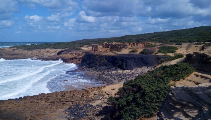
“The goal of my work is to study the environmental impact of mining waste in the north-east part of Algeria,” explains Issaad Mouloud, author of today’s featured image.
Algeria has a long history of mining. Since the antiquity and the time of the Berbers, many minerals and ores deposits were exploited. The northeast was the most productive region in the country. The geology of the study area is composed of magmatic and metamorphic rocks, sandstone and limestone.
Kef Oum Theboul mining district is located on the Eastern cost of Algeria, 4 km west of the Tunisian border. It is located 15 km from the town of El Kala. The Kef Oum Theboul site covers an area of 26.6 km2 and which contains copper lead and zinc ore
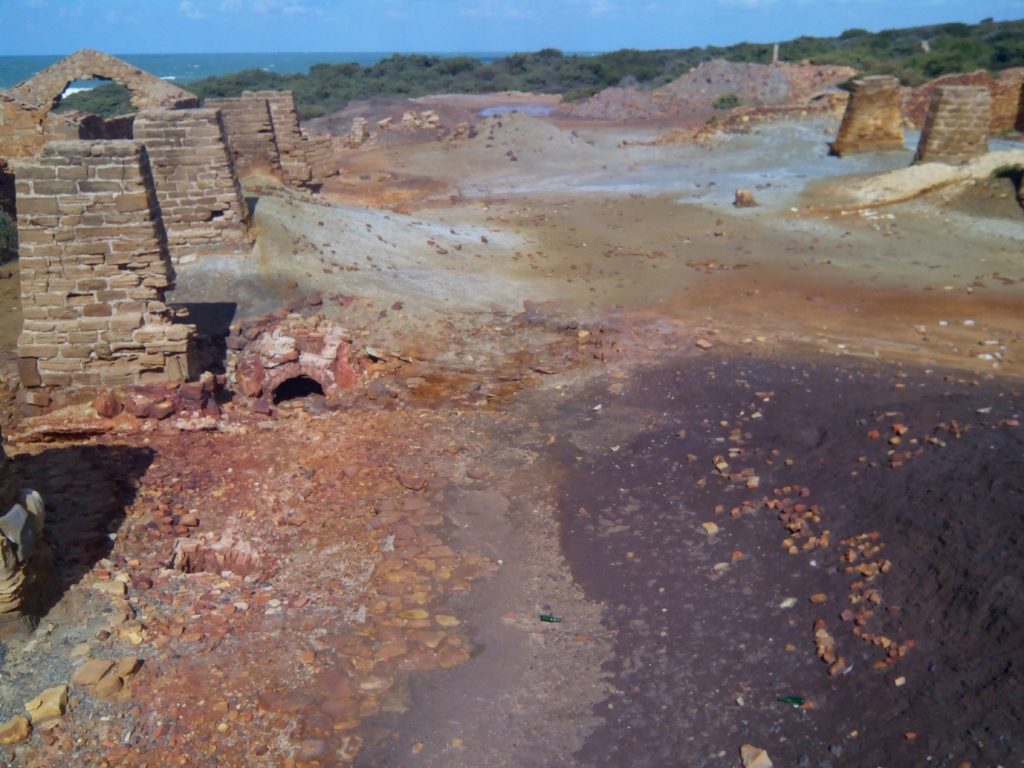
Discovered in 1845, the Kef Oum Teboul ore deposits were mined from 1849 to the 1970s. The Messida ore plant, pictured above and located not far from the Kef Oum Teboul deposit, is one of Issaad’s study sites.
The ore plant, situated in the Algerian Mediterranean coast, on Messida beach (located 6km from Kef Oum Teboul) processed copper, lead and zinc mineralizations. Processing at the plant started in 1899. It had three water jacket furnaces, with a capacity of 50 tons of ore per 24 hours. The obtained matte contained 20-22% copper, 200 grams of silver and 11-12 grams of gold per ton.
“The plant is now totally destroyed but mining waste, mainly sulphur ore and slag, is still stored in the Messida area,” explains Issaad, who goes on to say “the main pollution factor which I study is the acid mine drainage and heavy metals.”
Imaggeo is the EGU’s online open access geosciences image repository. All geoscientists (and others) can submit their photographs and videos to this repository and, since it is open access, these images can be used for free by scientists for their presentations or publications, by educators and the general public, and some images can even be used freely for commercial purposes. Photographers also retain full rights of use, as Imaggeo images are licensed and distributed by the EGU under a Creative Commons licence. Submit your photos at http://imaggeo.egu.eu/upload/.


lyle
Of course you should say modern mines, consider the Gold King spill in Colorado in 2015. Mine was started in 1887 and was operated off and on until the 1980s. When drainage from lower tunnels was blocked the mine filled up with water full of minerals and an attempt to fix it resulted in the spill. Other mines in the area produce a lot of acid drainage, and in most cases the mining companies have gone bankrupt several times over the years.
Or if you want to talk Europe consider for example the Rio Tinto mines which have been mining since Roman times.