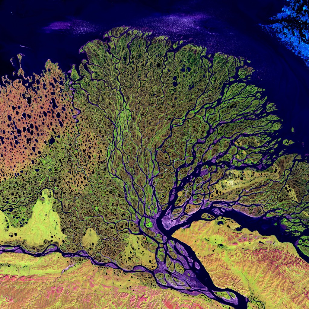
The Lena River flows throughout Russia from its source in the Baikal Mountains out into the Arctic Ocean, where the delta’s landscape is dominated by ice-rich Yedoma and thermokarst lakes. Thermokarst lakes have been identified as a source of carbon release to the atmosphere and Yedoma-like lake sediments are known to release more methane than any other sediment due to their incredibly high carbon content. So what is a thermokarst lake?

The Lena River Delta, dominated by Yedoma uplands and thermokarst lakes. Image taken by LANDSAT (source: NASA).
Thermokarst is a landscape that results from the thawing of both icy permafrost and larger ice masses. In northern Siberia, thermokarst starts to develop at the surface: once the ground subsidises, water accumulates in a series of small basins known as alasses. They continue to grow in size to form thermokarst lakes, which can either drain or coalesce with neighbouring lakes to form even larger ones that can reach several kilometres in diameter. When thermokarst lakes drain, they leave behind much smaller lake remnants that lie with a flat basin with steeply sloping sides. Multiple cycles of thermokarst development can occur within a single thermokarst basin to create a complex thermokarst landscape peppered with lakes and islands.
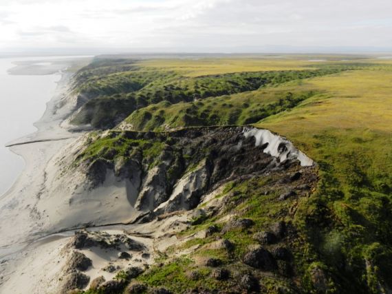
Kurungnakh Island, which lies within the Lena River Delta, formed during the Pleistocene and is part of the region’s thermokarst landscape. The cliff below exposes the Yedoma, a series of silty permafrost deposits with high ice and carbon contents. Permafrost is soil that is either at or below the freezing point of water and forms in regions where the mean annual temperature is below this. Permafrost soils are very rich in carbon, which is stored as peat and methane. The release of this carbon into the atmosphere has the potential to accelerate climate warming through a positive feedback system. That is, where a small change (the release of methane due to permafrost melt) has the capacity to cause a change of even greater magnitude (the presence of more methane in the atmosphere increases the temperature and accelerates the rate of permafrost degradation, releasing even more methane…).
The most immediately recognisable form of permafrost degradation is the presence of thermokarst – you can get a feel for this in the photo below:

“Kurungnakh Island” by Sebastian Zubrzycki. Distributed by the EGU under a Creative Commons licence.
The pale lower unit is comprised of fluvial sand, overlain by ice-rich permafrost (light grey) and capped with a thin covering of Holocene peat. Fluvial sands in this region are relatively ice-poor, which limits the capacity for further thermokarst development. While there is relatively little capacity for further thermokarst development, it is important to consider other processes associated with permafrost degradation and the rates at which they occur. In doing so, we can better quantify future carbon fluxes from permafrost soils in as the climate warms.
Reference:
Morgenstern, A., Grosse, G., Günther, F., Fedorova, I., and Schirrmeister, L.: Spatial analyses of thermokarst lakes and basins in Yedoma landscapes of the Lena Delta, The Cryosphere, 5, 849-867, doi:10.5194/tc-5-849-2011
Imaggeo is the EGU’s online open access geosciences image repository. All geoscientists (and others) can submit their images to this repository and since it is open access, these photos can be used by scientists for their presentations or publications as well as by the press and public for educational purposes and otherwise. If you submit your images to Imaggeo, you retain full rights of use, since they are licensed and distributed by the EGU under a Creative Commons licence.
