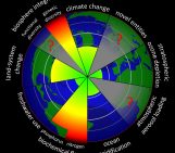
Ocean thermal expansion, that is, the increase in water volume due to temperature alone, is relatively well understood – as is the retreat of both mountain glaciers and ice caps. While most models simulate these effectively, there is little understanding of how both the Greenland and Antarctic ice sheets will respond to climate change. This is because the full extent of ice-ocean interactions is not included in climate models – it’s no wonder when there are so many factors to consider: melting of mountain glaciers, ice caps and polar ice sheets, glacial isostatic adjustment and ocean thermal expansion to name just a few!
Mahé Perrette and his colleagues have developed a novel approach for sussing out sea level rise (SLR); combining simple models with general circulation models (GCMs) to use the benefits of both in predicting future change. To get an idea of the uncertainties associated with SLR, take a look at this graph, in which red is a highly uncertain prediction (up to 70 cm variation) and dark blue is an estimate we can be quite confident of (only 5 cm variation):

The first of the three panels combines the uncertainty for all components of SLR considered by Dr Perrette and his team – there’s really not much blue there is there?! [Source: Perrette et al., 2013].
Both the magnitude of SLR and the timescales over which it occurs varies wildly between models, but it remains clear that the effects of SLR will be felt most in the low-lying coastal regions of the world: from small island nations such as Tuvalu, which at only marginally above sea level, is a country only too aware of this threat; to the densely populated, and agriculturally important, coastal plains of Bangladesh.
Each of the contributions to SLR (meltwater from the Antarctic and Greenland Ice Sheets, and melting of mountain glaciers and icecaps) vary locally, which means that SLR will also vary from region to region. This interactive map by Perrette and his team is a great demonstration of how SLR varies throughout the world under different emissions scenarios.

Predicted sea level rise for coastal regions. The key indicates the different components contributing to SLR: MGIC = Mountain Glaciers and Ice Caps, AIS = Antarctic Ice Sheet, GIS = Greenland Ice Sheet and GIA = Glacial Isostatic Adjustment [Source: Perrette et al., 2013].

Rates of relative sea-level change [Souce: Riva et al., 2010].
Gravitational forces influence global, as well as local, water distribution. The declining mass of ice caps at the poles means there will be weaker gravitational forces acting on Arctic and Antarctic waters. The weakening of these poleward-pulling forces will cause water to be redistributed throughout the globe, resulting in greater SLR at the equator than at the poles. So, despite the large local variations in SLR, its effects will be felt most in the tropics and at the equator.
By Sara Mynott
References:
Perrette, M., Landerer, F., Riva, R., Frieler, K., and Meinshausen, M. (2013), A scaling approach to project regional sea level rise and its uncertainties, Earth Syst. Dynam., 4, 11-29, doi:10.5194/esd-4-11-2013.
Riva, R. E. M., J. L. Bamber, D. A. Lavallée, and B. Wouters (2010), Sea-level fingerprint of continental water and ice mass change from GRACE, Geophys. Res. Lett., 37, L19605, doi:10.1029/2010GL044770.