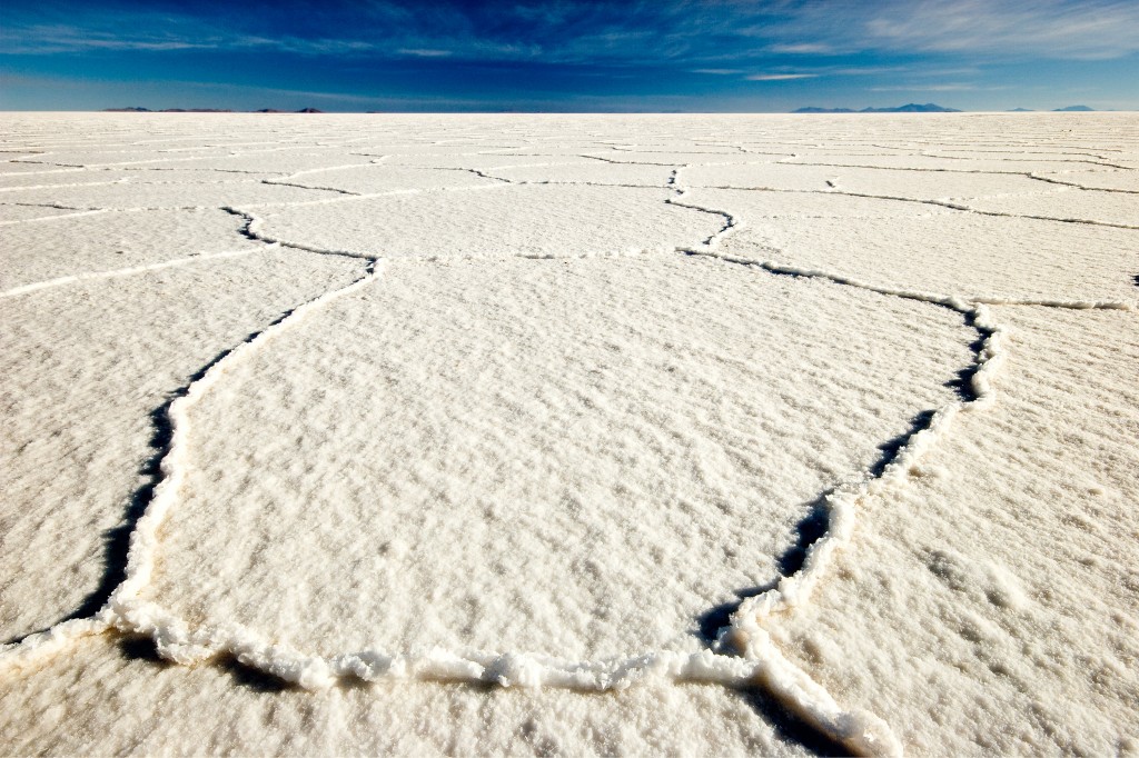
“Flat in the mountains” by Olivier Galland, distributed by the European Geosciences Union under a Creative Commons license.
Electric cars require roughly 1,000 times more lithium than a standard laptop. It is therefore understandable that Bolivia’s Salar de Uyuni, a unique environment shown here under deep-blue skies, is widely regarded as the ‘Saudi Arabia of lithium’, because it contains over 40% of the planet’s lithium chloride (LiCl) reserves, or more than 5.4 million tons.
The Salar is part of the Altiplano plateau, which formed during the uplift of the Andes mountains roughly 14 million years ago. Tourists from around the world flock to see the parched, white landscape, located at 3,656 m above sea level and lacking in almost any life form. Its salt surface crust ranges in thickness, from tens of centimetres to a few metres, and sits atop mud interbedded with salt and saturated with brine. It is the brine that mining companies are lining up to extract, as it contains a saturated solution of sodium chloride, lithium chloride, and magnesium chloride in water.
Olivier Galland, a senior researcher at the University of Oslo, took this photo during an outreach project called the Andean Geotrail. He describes the salar’s environment, “It is the lowest point of an endorheic basin, meaning that all the rivers of the basin flow toward it and are not connected to the sea. Instead, the water from the rivers accumulates in the salar, which transforms to a lake during Austral Summers, before evaporating, leaving behind the salt, which precipitates and forms this continuous crust. I took this picture during an outreach project, which was based on a cycling adventure through the Andes, from Ushuaia in southern Argentina to Lima, Peru. The aim of this adventure was to visit spectacular geological localities, and share our observations with 600 pupils who followed us through a blog. You can find more information on the Andean Geotrail webpage, and on the blog.”
Galland sees the next few years as vital in shaping the future of the salar. He explains, “The Salar de Uyuni typically represents a fantastic geotouristic locality, as thousands of tourists visit it every year. Unfortunately, none of these tourist have any idea of how it formed. The aim of our outreach project was to give the relevant information to explain the origin of such a scenery, and give another dimension to this lunar landscape. In addition, the Salar de Uyuni has become an economical issue, as it hosts the largest lithium deposit on Earth. Since its discovery, the touristic and mining industry are fighting to decide the future of this unique geological environment.”
Imaggeo is the EGU’s online open access geosciences image repository. All geoscientists (and others) can submit their images to this repository and since it is open access, these photos can be used by scientists for their presentations or publications as well as by the press and public for educational purposes and otherwise. If you submit your images to Imaggeo, you retain full rights of use, since they are licensed and distributed by the EGU under a Creative Commons licence.
