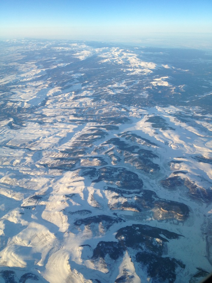
Jointed Colorado Rockies by Will Gosnold, distributed by the EGU under a Creative Commons license
The Rocky Mountains, or Rockies, are a North American mountain system stretching around 5,000 km from northern British Columbia, Canada, to New Mexico in the southwestern United States. They are made up of a discontinuous series of mountain ranges with distinct geological origins, the last of which was formed during the Laramide orogeny (mountain formation event) 80–55 million years ago.
With a population of 568,158 (2011 estimate), Wyoming has the lowest population and second lowest population density of any US state, yet it has the 10th largest area. Its environment is defined by its geological history, lying at the intersection of the Rockies to the west and, to the east, the Great Plains, a broad expanse of flat land running north to south across North America.
The sheer size and distance covered by the Rockies, even through just the one state of Wyoming, is hard to imagine by European standards. At 253,348 sq km, Wyoming itself has a greater area, for example, than the UK, Romania, Belarus, Greece, or Bulgaria, just to name a few. Perhaps the best way to understand the scale of the Rockies is by experiencing them from above, an experience captured here by Will Gosnold through an aircraft window. Gosnold, a professor within the Department of Geology and Geological Engineering at the University of North Dakota, describes this photo opportunity, “I took the photo from the window of a Delta Airlines plane, over what is likely Wyoming, during a flight from San Francisco to Minneapolis while returning from the Fall Meeting of the American Geophysical Union on 9 December 2011.”
Apart from boasting the Rockies and its vast expanse of publicly owned land, including a section of Yellowstone National Park, Wyoming produces a broad array of mineral commodities. Apart from being the largest and second largest producer of coal and natural gas respectively in the US, it also produces coalbed methane, crude oil, uranium, and trona, an evaporite mineral used for the production of washing soda (sodium carbonate). Diamond and uranium mines have also recently operated in the state.
Imaggeo is the online open access geosciences image repository of the European Geosciences Union. Every geoscientist who is an amateur photographer (but also other people) can submit their images to this repository. Being open access, it can be used by scientists for their presentations or publications as well as by the press. If you submit your images to imaggeo, you retain full rights of use, since they are licenced and distributed by EGU under a Creative Commons licence.
