Fresh from leading a team of UK geophysicists on a two-week campaign of seismic investigations in northern Sweden, Dr Adam Booth of Swansea University provides for us his second report from the 2012 General Assembly floor. His first post explored subglacial environments of ice sheets and glaciers.
Hi again from Vienna, and Day 3 of the EGU’s General Assembly. Hope you’re enjoying reading the blogs!
My previous post focussed on the deep, damp world of the subglacial environment; today, I’m gaining considerable altitude and talking to Dr Lindsey Nicholson (University of Innsbruck) about her growing interest in debris-covered mountain glaciers, and learning from some of the researchers in her debris-dedicated session.
In my own experiences of Arctic geophysics, glaciers are usually pristine: covered by fresh snow, and easily traversed by snowshoe, ski or snowmobile. As ever, though, variety is the spice of life and there are some glaciers that are altogether…rockier. In fact, many mountain glaciers lurk beneath a mantle of fallen rocks and this provides them with a uniquely complex set of characteristics. A geophysical survey on a glacier that’s strewn with rocks strikes me as a particularly taxing problem – it’s difficult to tow a radar system across a boulder field, or to install a seismic line in solid rock – so I was interested to learn more about alternate methods of studying debris-covered glaciers.
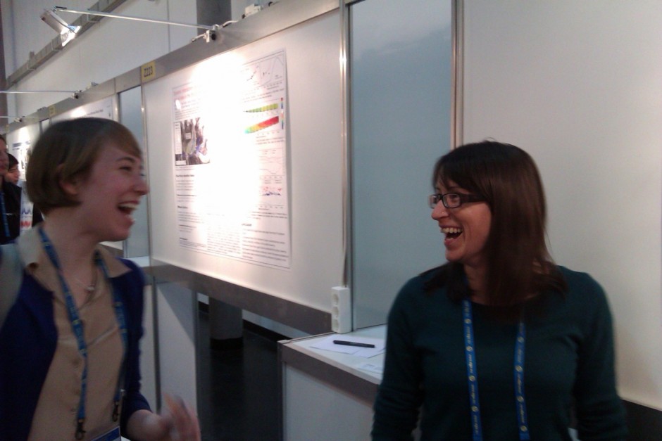
Dr Lindsey Nicholson (right) shares a joke with a colleague at Wednesday evening’s “Debris-covered glaciers session”.
“There’s a growing interest in debris-covered glaciers,” Lindsey tells me. “In the last few years, they have really come to the fore since we’ve realised how little we know about them.” The more I talk to Lindsey, the more I realise that debris-covered glaciers really are a law unto themselves. In general, physical descriptions of ‘clean-ice’ glaciers, of their motion and the energy that is supplied to them, often work pretty well. Unfortunately, give a glacier a debris-cover and it’s a whole different beast. For example, an initial dusting of debris exacerbates glacier melt – the debris absorbs more solar radiation, warms up, and ends up delivering more heat to the glacier. However, when that debris exceeds a certain critical thickness (e.g., after piling-up successive rockfalls), it acts as a sunscreen and glacier melting is reduced (the talk of Martin Juen of the Bavarian Academy of Sciences, Germany, was dedicated to understanding the controls on this). Lindsey’s experience suggests that there might be a veritable mountain to climb: “Our current understanding doesn’t capture the full complexity of the system. The old processes need to be modified, adapted, or reinvented.”
A major boost in our understanding is provided by Pierre-Marie Lefeuvre, formerly an MSc student at the University of Sheffield (UK), now a PhD student at the University of Oslo (Norway). In collaboration with Dr Felix Ng, Pierre-Marie has developed a computational method that offers new understandings of the coupling between debris-cover and glacier-flow model. The model predicts that, as a debris-covered glacier starts to melt, the relative area of its debris cover becomes larger; as the glacier wastes away, previously-buried rockfalls become exposed and linger on the surface. Differences in debris cover can even cause a glacier to split, with a lower section stranded from its higher-altitude counterpart. Future predictive models will undoubtedly be indebted to the pioneering steps of Pierre-Marie’s work, and he advises that we keep an eye out for an imminent publication.
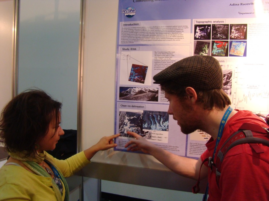
Adina Racoviteanu discusses her poster with Pierre-Marie Lefeuvre. (I promise it’s an unposed photo!)
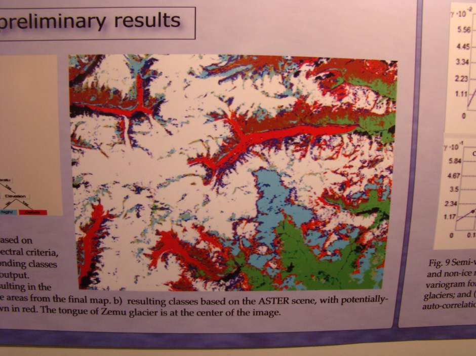
But even seeing a debris-covered glacier can be problematic. Normally, glaciologists would delineate clean-glacier ice using remotely-sensed satellite images: however, distinguishing a debris-covered glacier from – say – a debris-covered mountainside is understandably tricky. Fortunately, Dr Adina Racoviteanu (post-doc, LGGE Grenoble, funded by CNES France) is something of a remote-sensing revolutionary. In recent research she has developed algorithms that are able to predict whether surface debris cover is underlain by ice…or just more debris. The image below shows the results of this method (recently published in the journal Sensors), in which the red areas clearly demarcate the extent of the debris-covered glacier.
Defining debris-cover… Adina Racoviteanu’s work allows debris-covered glaciers to be identified from satellite data. Ice is most-likely located beneath the bright-red areas.
Even more inspiring is that the next step in this research – classification of features based on their surface texture – is inspired by processes developed in medical science! Textural data, derived from ASTER and Quickbird satellite images, are combined with surface topography and temperature records to define the edges of the debris-covered glacier. This work, Adina tells me, will be a big step towards quantifying how much melt is occurring beneath a glacier’s debris cover.
My conversation with Lindsey now moves specifically towards Himalayan glaciers. In addition to their current contribution to sea-level rise, changes to Himalayan glaciers are associated with other significant humanitarian effects. On one hand, the glacier is a valuable resource, often representing the only resource of fresh water for an isolated Himalayan community. On the other, pooled meltwater can catastrophically break out of confining debris layers, flooding villages and destroying valuable agricultural land – and such unstable terrain also deters investment in economic, local-scale hydraulic power plants. However, a key difficulty in predicting the behaviour of Himalayan glaciers is the natural variability over an enormous geographical scale: “East-west, north-south,” Lindsey says, “the Himalayas are completely different. Accurately extrapolating observations across such wide areas is clearly problematic.”
During the session’s poster presentations, I happened across UNIS’s Professor Doug Benn. “Five years ago,” he told me, “we had no idea of how mountain glaciers were changing. Since then, we’ve really come on leaps and bounds.” The vibrancy in the community really echoes his words. I’m by no means a specialist in high-altitude glaciology, but I left the session enthused with the feeling that many more key breakthroughs are just around the corner. There might be a mountain to climb, but I really think I’ve just met the people to climb it.
By Adam Booth, post-doc at Swansea University


