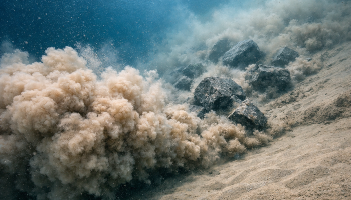
SSP
Stratigraphy, Sedimentology and Palaeontology

Ramon Lopez

Ramon is a senior geologist with 15 years of research (PhD) and industry experience in sedimentology, ore deposits and hydrogeology. He is currently providing consultancy and training for the oil industry (running field trips, teaching online courses). He has expertise in collecting field data on a wide range of environments and converting it into multiple formats depending on the client and purpose: from just text and images to 3D models and videos filmed with drones. He is also senior consultant for R&D military projects at Inspiralia USA. More info: www.channelsgeo.com / LinkedIn (www.linkedin.com/in/ramon-lopez-jimenez) / Twitter (@Montxolopez)

Fossilized Tree Trunks: Preservation in Continental and Marine Ancient Outcrops of Baja California

Fossilized Tree Trunks: Preservation in Continental and Marine Ancient Outcrops of Baja California

While working on the exceptional, but remote outcrops of Baja California, I have encountered an extraordinary quantity of fossilized tree fragments in Cretaceous deposits. These fossils were preserved in both subaerial, fluvial, and marine environments. Does this mean that preservation of tree trunks is easy? How can wood be preserved for more than 70 million years? What kind of information can we ...[Read More]

Offshore Gaza: gas in deep-water sedimentary reservoir rocks as another element in the conflict

Offshore Gaza: gas in deep-water sedimentary reservoir rocks as another element in the conflict

The conflict between the Israeli state and the Palestinian people revolves not only around the control of land but also extends to the ocean, particularly the sedimentary rocks beneath the seafloor (see oil and natural gas fields in the region in Figure 1). This article aims to analyse the geological aspect, specifically sedimentary rocks with hydrocarbon reservoir potential offshore the Gaza Stri ...[Read More]

The study of sedimentary architecture and topography to reduce Earthquake damages: a sedimentological perspective on the Kahramanmaraş earthquakes

The study of sedimentary architecture and topography to reduce Earthquake damages: a sedimentological perspective on the Kahramanmaraş earthquakes

The area were most collapses occurred is a former alluvial outlet for the drainage of water and sediment from the upper parts of the Ahir Mountain When it comes to earthquakes, the nature of the Earth surface geology and its geometry is critical to understand the intensity and type of motion of the ground where we live. Of course, other factors matter when assessing the risk of damage in human-mad ...[Read More]

The digitalization of sedimentary outcrops

The digitalization of sedimentary outcrops

From sketches to first photos Knowledge of geology and, in particular of sedimentology, has successfully been transferred and shared for hundreds of years through sketches. Like a botanist or zoologist, a geologist is able to record data from the field with just a paper and a pencil in the form of drawings (see one of the earliest published sketches of an outcrop in Figure 1). Geological maps and ...[Read More]