From sketches to first photos
Knowledge of geology and, in particular of sedimentology, has successfully been transferred and shared for hundreds of years through sketches. Like a botanist or zoologist, a geologist is able to record data from the field with just a paper and a pencil in the form of drawings (see one of the earliest published sketches of an outcrop in Figure 1). Geological maps and sketches of outcrops are the two basic elements of field data for a geologist. For a sedimentologist a major goal may be to show the spatial distribution and geometry of sedimentary ‘units’ (i.e., bed, member, formation, group and supergroup).
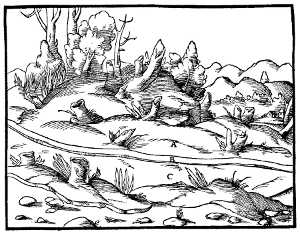
Figure 1. This sketch is considered one of the earliest geological sketches published. Georgious Agricola aimed to show an ore deposit in the form of a vein in a mountain. From “De re metallica” (1556), Page 45.
The advent of photography could be set as a first breakthrough in the collection and sharing of data from outcrops (Figure 2 shows one of the oldest photographs taken with a geological purpose). Any drawing is an artistic representation of ‘reality’ while a photograph is an almost perfect 2D representation of it. The more realistic its representation is, the better anyone could observe qualitative and quantitative features of an outcrop. In short, ideally, data from an outcrop should be shared exactly as if one would be physically there to be able to measure and observe features of the sedimentary rock. But there are issues that impede the representation of an outcrop in such a way; for example: the wide range of scales of all the features, the potential infinite amount of data that one can record, or the fact that some data is qualitative (e.g., colour, texture determined in the field) so the instrument used to record images from the outcrop could render an image significantly different from what our eyes and brain processes. Let’s move on with the technological innovations in recent history that have made possible to record data from outcrops in a wider range of scales and features.
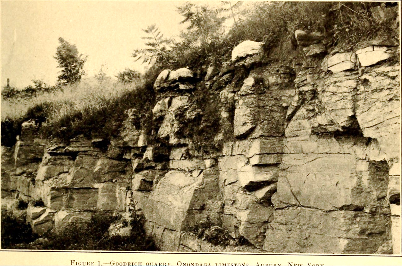
Figure 2. Image from page 128 of “Bulletin of the Geological Society of America” (1890) Title: Bulletin of the Geological Society of America. Year: 1890 (1890s)
Aerial imagery: aircrafts and satellites
Very soon, the military realised the benefit of taking pictures of any territory from the air: The perspective and scale of visualization would provide information about the enemies’ position and routes for ground vehicles. Geologists also immediately realized the value of aerial photography for mapping. USA geologists were pioneers in the late ’20’s[1] using aerial photographs to differentiate soil and lithology types from shading in black and white photographs. However, the real breakthrough was the deployment of satellites, which incorporate high-resolution lenses and a wide range of sensors. The big leap forward was the multispectral satellite imagery, which enabled high-precision predictive mapping for large territories around the Earth. In 1972, the NASA launched the first multispectral satellite of with the Landsat Mission. Multispectral sensors measure electromagnetic signal in specific ranges of solar light spectrum, making the identification of a variety of minerals possible. In 2022, the WorldView-3 satellite is at the cutting-edge of satellite imagery. This satellite uses 16 bands positioned in the near and short-wave infrared windows, which enables the identification of a wider and more precise range of minerals as well as a spatial resolution of 1.25 to 3.7 meters for mineral analysis (Figure 3). Satellites help mapping relatively large spatial scale geological features and identifying general lithologies in wide regions, but, what about collecting data from outcrops in a smaller spatial scale?

Figure 3. Mineral map derived from the spectral analysis on the WorldView-3 images (50-cm resolution). Cuprite Hills area, Nevada[2]
The advent of drones: democratization of outcrop data collection
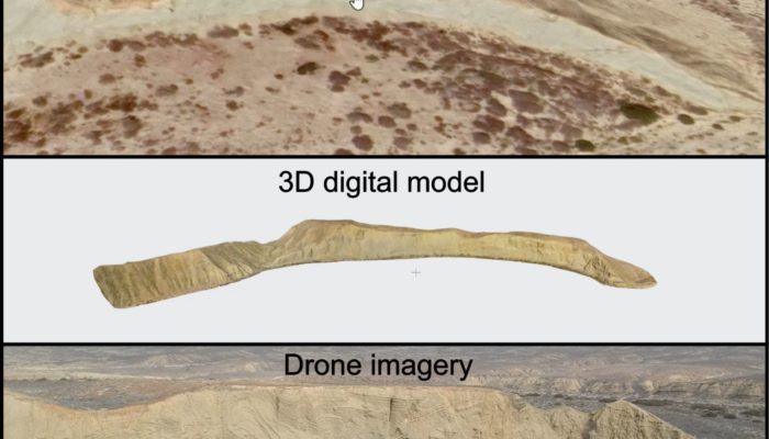
Today, it is not necessary to pay, at least, hundreds of Euros for renting a private plane or helicopter to collect photos from the air. We can buy a drone for a few hundred Euros and collect photos for years (unless one crashes it!). The availability of relatively cheap drones with good optics (i.e., the camera lens) allows any geologist to collect images from any distance and angle of a given outcrop. More importantly, it enables the collection of imagery of, once before, inaccessible outcrops. Drones have also facilitated the operation of surveying techniques like LIDAR and photogrammetry[3]. These techniques are meant to provide relatively high-resolution topography models of the terrain and, now, these are easier and cheaper to perform thanks to off-the-shelf drones. In the case of LIDAR, one will need to spend more money than photogrammetry because it is necessary to buy a Lidar sensor that will be mounted on the drone.
Virtual and augmented reality: the next advanced experience?
Current innovations in data storage and management plus technical advances in hardware aim the development of virtual class or training tools[4]. Can these tools effectively transfer knowledge with the same quality compared to a live experience in the field? Definitely, no. As instructor of online and field courses, I have tested students and trainees to first analyse outcrop data from 3D models, photos and videos created from drones and then, I have taken them to the field to the same outcrop. The result: they always show a poorer observation of key sedimentary features compared to the live visit in the field (see an example of this issue here: Comparison of outcrop data). A poor observation of data will inevitably take to a poorer transfer of knowledge and skills. No photo or 3D model can today equal a live visit to an outcrop, but we should not forget that we could not show many inaccessible and excellent outcrops to other students and professionals without the aid of drones. There are lots of advances, but today the best way to learn geology is combining live visits to outcrops with satellite, drone and other remote sensing data.
[1] www.asprs.org/wp-content/uploads/pers/1947journal/dec/1947_dec_557-565.pdf
[2] https://effigis.com/en/new-era-geological-mapping-multispectral-satellites-advanced-data-processing
[3] www.propelleraero.com/blog/drone-surveying-misconceptions-lidar-vs-photogrammetry/#:~:text=Lidar%20is%20a%20direct%20measurement,overlap%20and%20sufficient%20ground%20control
[4] www.earthmagazine.org/article/fieldwork-among-pixels-virtual-and-augmented-reality-diversify-geoscience-education/