The contribution from Sergio León-Ríos, Associate Researcher at the Advanced Mining Technology Center (AMTC) at the University of Chile, where he does seismology research. Post edited by Adam Ciesielski prior to publication.
Introduction
Hydrogen sits at the heart of today’s energy transition. From policy documents to industry roadmaps, it is widely promoted as a clean alternative to fossil fuels. But while most discussions focus on how to produce hydrogen, geoscientists are increasingly asking a different question: what if some hydrogen does not need to be produced at all?
In recent years, unexpected discoveries in places as diverse as the United States and Mali have revealed the presence of natural hydrogen—sometimes called white hydrogen—generated by geological processes deep within the Earth. These findings overturned long-standing assumptions that hydrogen, being a small and highly reactive molecule, could neither accumulate nor persist underground. Instead, they suggest that the Earth may continuously generate hydrogen, potentially offering a low-carbon energy resource that has remained largely overlooked.
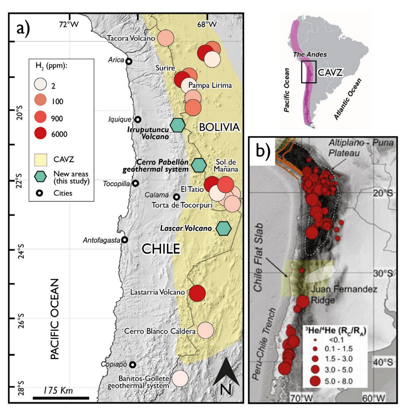
Figure 1. Altiplano region in the Chile – Bolivia border. a) Colored circles show ppm concentration of H2 from samplings obtained in Bolivian territory. Green polygons indicate the study site of this project in northern Chile.
One region that is recently growing attention is the Andean subduction zone (Figure 1), where active tectonics, volcanoes, and geothermal systems intersect. In Northern Chile, these processes converge beneath the high plateau of the Altiplano, raising a compelling possibility: could natural hydrogen be forming and accumulating beneath one of the most tectonically active regions on the planet?
From industrial hydrogen to hydrogen made by the Earth
Today, most hydrogen used worldwide is produced industrially, classified as green, blue, or grey depending on the associated carbon emissions (IEA, 2019). In contrast, natural hydrogen forms through geological reactions, without industrial intervention or CO₂ emissions.
The most efficient of these reactions is serpentinization, a process in which water reacts with iron-rich mantle rocks (peridotites), generating hydrogen as a by-product. This process occurs in several tectonic environments, including mid-ocean ridges, ophiolites, transform faults, intraplate settings, and—crucially—subduction zones (Zgonnik et al., 2020; Jackson et al., 2024).
Although the mechanisms that generate natural hydrogen are increasingly well understood, the conditions that allow it to migrate, accumulate, and remain trapped in the subsurface are still poorly constrained (Lévy et al., 2023). This uncertainty represents both a scientific challenge and an opportunity.
Why subduction zones matter
Subduction zones represent one of the most effective natural laboratories for hydrogen generation (Figure 2). As an oceanic plate sinks into the mantle, it releases water, which then reacts with the overlying mantle wedge. This interaction creates ideal conditions for serpentinization and hydrogen production.
In the Central Andean Volcanic Zone (18–28°S), however, natural hydrogen has only recently been investigated. A key study by Moretti et al. (2023) reported hydrogen emissions in the Bolivian Altiplano, detected through soil-gas measurements and gases released from hot springs. As ³He is predominantly primordial and abundant in the mantle, whereas ⁴He is mainly produced by radioactive decay in the crust, by having elevated ³He/⁴He values reflect a greater input of mantle-derived fluids relative to crustal sources, indicating that deep fluids are efficiently migrating toward the surface above the subduction zone.These findings strongly suggest that similar processes may be active in the Chilean Altiplano, where geological conditions are comparable but remain far less explored.
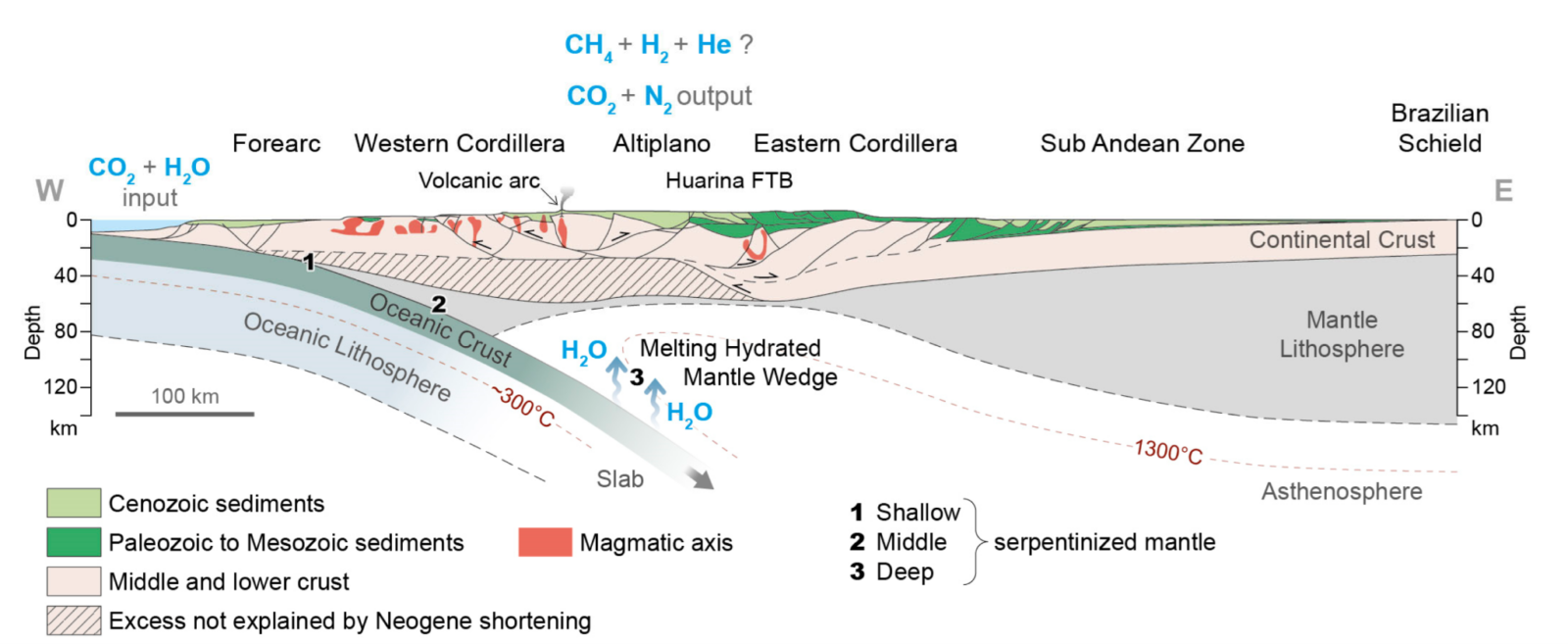
Figure 2. Schematic view of the Pacific subduction below the Andes at about 20° S and of its gas and water budget. (1) At a deeper level, the mantle lithosphere of the overriding plate is also hydrated (2) and (3) The serpentinites remain stable for a while, but when the temperatures surpass 1000 °C, the water is released and hydrates the hot asthenospheric mantle wedge that melts.
Looking for an invisible gas: a multi-proxy approach
Detecting natural hydrogen is fundamentally different from exploring conventional hydrocarbons. Hydrogen leaves few direct traces, and no single method can identify it on its own. For this reason, our project adopts a multi-proxy approach, integrating structural, geochemical, isotopic, seismological, and geophysical observations.
Our objective is to characterize—for the first time in Chile—the origin, circulation pathways, accumulation mechanisms, and spatial distribution of natural hydrogen in the Altiplano. Achieving this goal requires a genuinely interdisciplinary effort.
The project brings together seismologists, geologists, applied geophysicists, geochemists, and geothermal geologists, all experienced in fieldwork, laboratory analysis, and numerical modelling. This diversity is essential to link deep Earth processes to near-surface observations.
From faults to fluids
Our integrated methodology combines field and laboratory studies and includes:
- Structural characterization and strain-field analysis to identify faults and fracture networks that may act as pathways or traps for hydrogen-bearing fluids, enabling the assessment of their geometry, connectivity, and kinematic history, and thereby constraining fluid migration pathways, potential accumulation zones, and the temporal evolution of permeability within the system.
- Seismological imaging, using Local Earthquake Tomography (LET) to resolve fine-scale velocity variations related to fluids and altered rocks, and Ambient Noise Tomography (ANT) to image broader crustal structures independent of earthquake distribution.
- Geophysical methods, including Magnetotellurics (MT) and Transient Electromagnetics (TEM), to detect electrically conductive zones associated with fluids, alteration, or geothermal reservoirs.
- Geochemical and isotopic analyses of gas samples from soils, springs, and fumaroles, including hydrogen concentrations and noble gas isotopes (e.g. ³He/⁴He) to trace mantle versus crustal sources.
Because these techniques require dense spatial coverage and high-quality data, fieldwork is a central component of the project. Study areas are selected not only for their geological relevance but also for accessibility (roads availability), safety (a relevant issue in this area is the robbery of pickups, so the idea is to lodging in safe areas such as border police stations, Figure 3), and optimal seismic station geometry (ideally study sites that allow a full azimuthal coverage for seismic stations). Data collection follows a cascade strategy over the first three years, allowing each dataset to guide subsequent deployments and ensuring robust interpretation using national and international analytical facilities.
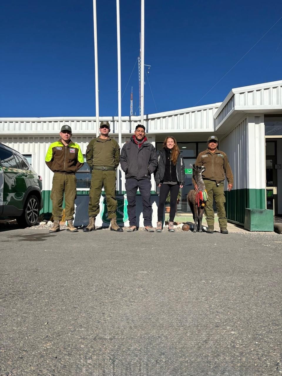
Figure 3. Researches together with Carabineros de Chile border police from the Ujina station that hosted us during the four field campaigns at the Irruputuncu volcano.
Why three study sites?
Geothermal systems in the Central Andes are not randomly distributed. Instead, they cluster into three distinct tectono-geothermal environments (Figure 1), defined by characteristic fault geometries, stress fields, and fluid signatures (Veloso et al., 2020).
Our three study sites—Irruputuncu, Láscar, and Cerro Pabellón—each represent one of these environments, allowing us to systematically test how tectonics controls hydrogen generation, migration, and storage.
- T1 (Irruputuncu) is dominated by major strike-slip faults that provide direct pathways for deep, mantle-derived fluids, as evidenced by high ³He/⁴He ratios
- T2 (Láscar) features intersecting strike-slip and thrust faults, promoting fluid storage at depth and more complex circulation patterns, with stronger crustal influence.
- T3 (Cerro Pabellón) is controlled by normal faulting linked to crustal extension, where fluids circulate through highly differentiated volcanic rocks.
By comparing these contrasting environments, we can evaluate where natural hydrogen is most likely to form, move, and accumulate within the Andean crust.
Why this matters for society
Understanding natural hydrogen is not only a scientific question—it is also a societal one.
If exploitable natural hydrogen systems exist, they could complement existing energy strategies by providing a low-carbon resource that does not require industrial production. At the same time, exploring hydrogen without understanding its geological context could pose environmental and economic risks.
By integrating geoscience at the earliest stages of hydrogen exploration, this project aims to support responsible, evidence-based decision-making, contributing scientific knowledge that can inform Chile’s National Green Hydrogen Strategy. It also builds national capacity by training graduate students across multiple geoscience disciplines and fostering collaboration between academia, laboratories, and applied research.
Ultimately, this work aims to support a more knowledge-informed approach to the exploration of emerging energy resources, grounded in an improved understanding of the Earth systems that govern their formation,
Key questions driving the research
- What is the geological origin of natural hydrogen in the Chilean Altiplano, and what concentrations can be expected?
- How are natural hydrogen systems distributed, and what role do faults, volcanic structures, and regional stress fields play in their formation and storage?
- How can integrated geochemical, structural, and geophysical approaches improve future hydrogen exploration strategies?
Current status
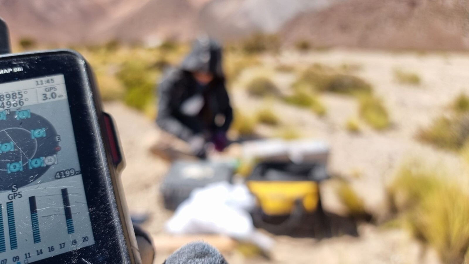
Figure 4a. The average elevation for the deployment was 4000 m.a.s.l. This photo shows in the background one of the seismic stations being installed to image the Irruputuncu volcano and the Salar de Coposa.
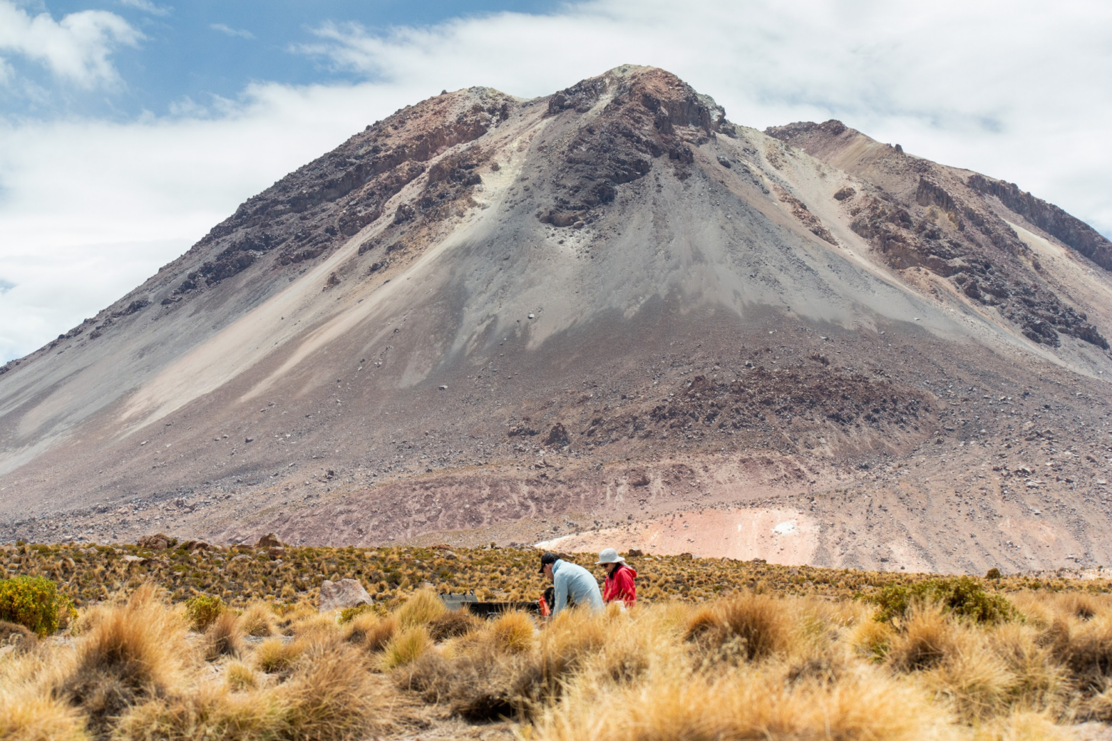
Figure 4b. Magnetotellurics measurements were also registered covering the west flank of the Irruputuncu volcano.
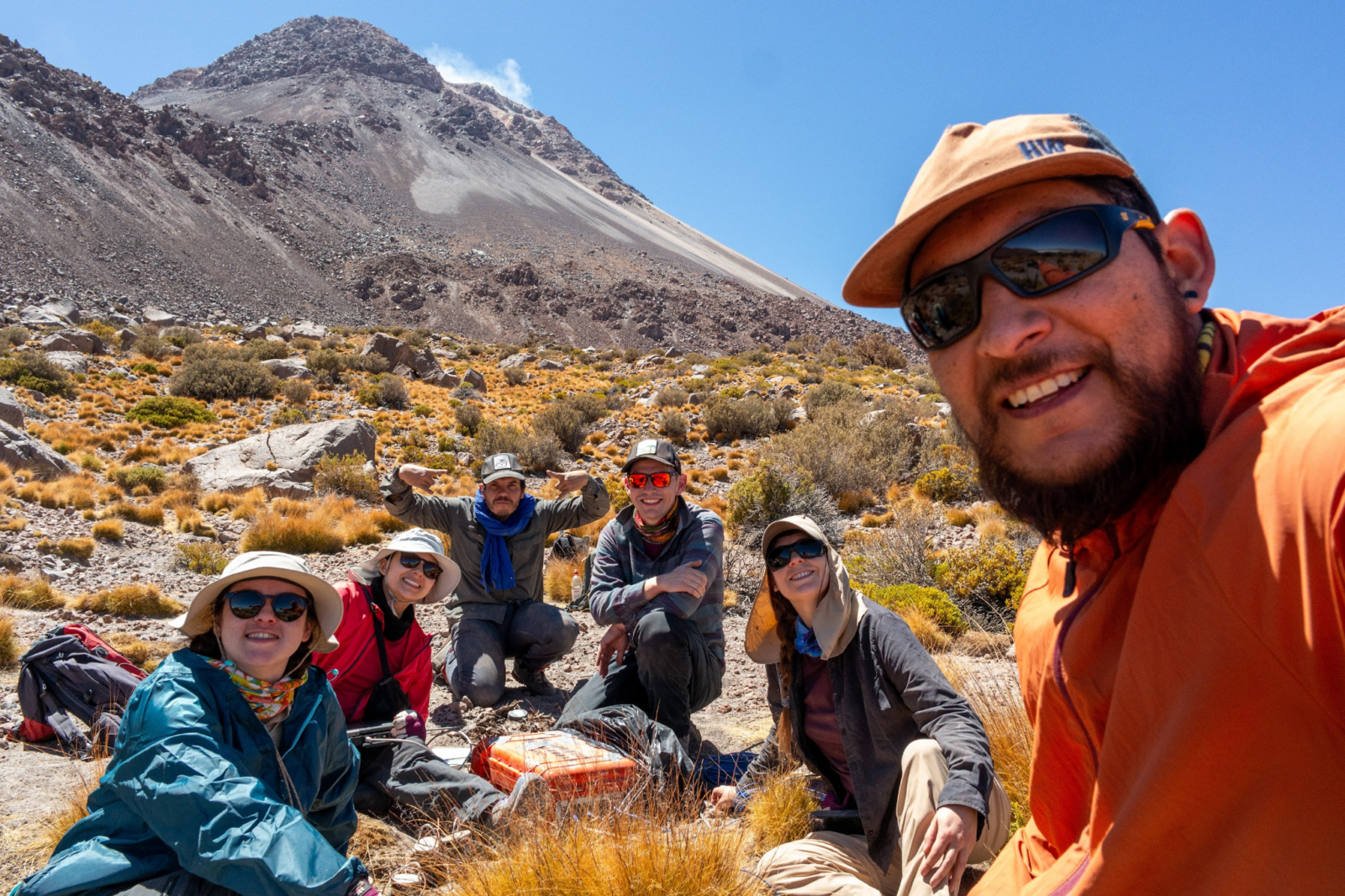
Figure 4c. Deployment crew from the Advanced Mining Technology Center and the Geophysics Department of the Universidad de Chile.
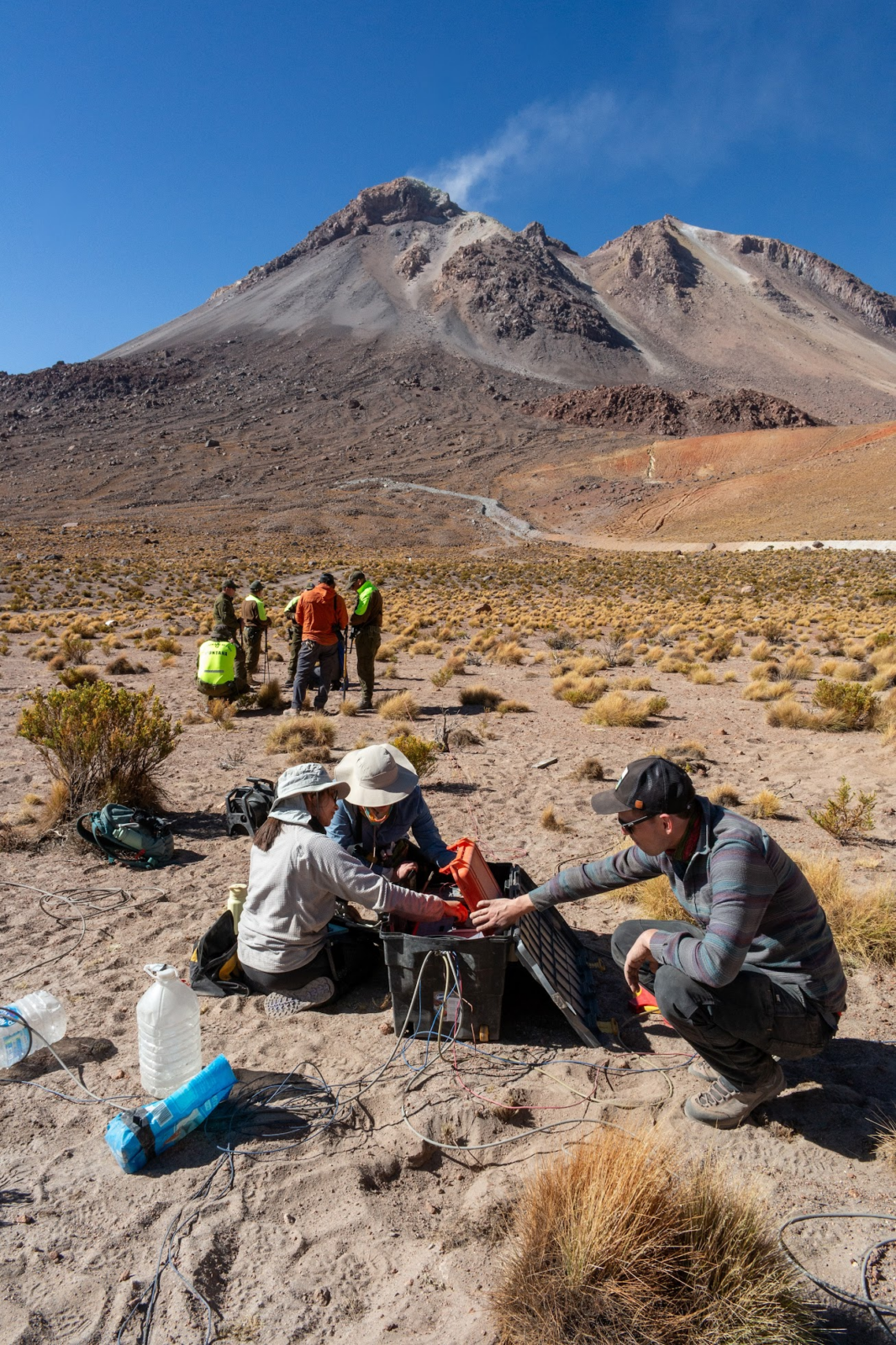
Figure 4d. Carabineros de Chile – in the background – supported the fieldwork and the installation in areas close to the Bolivia border.
Our multidisciplinary group has already finished most of the measurements at site 1, Irruputuncu volcano. We deployed a dense temporary seismological network of 40 3C-geophones (4.5 Hz) that continuously recorded the activity along the area. Additionally, 14 magnetotellurics stations were installed around the volcano to model the resistivity field. The geochemistry of the region was also studied by probing for isotope analysis and in-situ H2 measurements.
By today, the instrumentation was moved to the site 2, close to the Salar de Atacama, where we deployed a similar experiment in April, with a service visit planned for next August and the complementary experiments scheduled for October.
References in order of appearance:
- Zgonnik, V. (2020). The occurrence and geoscience of natural hydrogen: A comprehensive review. Earth-Science Reviews, 203, 103140. https://doi.org/10.1016/j.earscirev.2020.103140
- Jackson, O., Lawrense, S.R., Hutchinson, I.P., Stocks, A.E., Barnicoat, A.C., Powney, M. (2024). Natural hydrogen: sources, systems and exploration play. Geoenergy2024-002, vol. 2. https//doi.org/10.1144/geoenergy2024.002
- Lévy, D., Roche, V., Pasquet, G., Combaudon, V., Geymond, U., Loiseau, K., & Moretti, I. (2023). Natural H2 exploration: tools and workflows to characterize a play. Science and Technology for Energy Transition, 78, 27. http://doi.org/10.2516/stet/2023021
- Moretti, I., Baby, P., Alvarez Zapata, P., & Mendoza, R. V. (2023). Subduction and hydrogen release: The case of Bolivian Altiplano. Geosciences, 13(4), 109. https://doi.org/10.3390/geosciences13040109
- Veloso, E.E., Tardani, D., Elizalde, D., Godoy, B.E., Sánchez-Alfaro, P.A., Aron, F., Reich, M., & Morata, D. (2020). A review of the geodynamic constraints on the development and evolution of geothermal systems in the Central Andean Volcanic Zone (18–28 Lat. S). International Geology Review, 62(10), 1294-1318. https://doi.org/10.1080/00206814.2019.1644678
Use of figures and credits:
The figures shown in this entry were prepared as part of the proposal submitted for the ANID Exploracion grant, call 2024. Credits to Valentina Reyes-Wagner for the photographies during fieldwork.
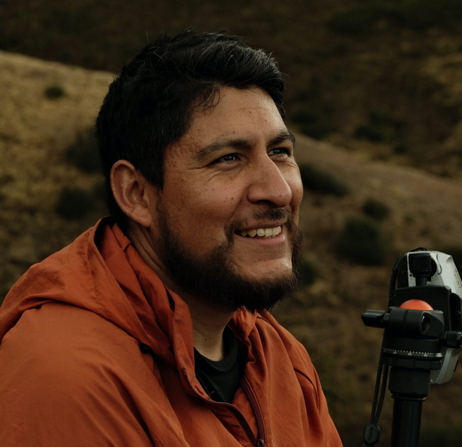
Sergio Leon-Rios
About the author
Sergio León-Ríos is Associate Researcher at the Advanced Mining Technology Center (AMTC) at the University of Chile, working on seismology and its applications to mineral exploration. He holds a PhD in Natural Sciences from the Karlsruhe Institute of Technology (KIT), Germany. His research focuses on understanding the physical behavior of active margins, including megathrust earthquakes, crustal fault systems, magmatic fields, and their relationship with the emplacement of natural resources.