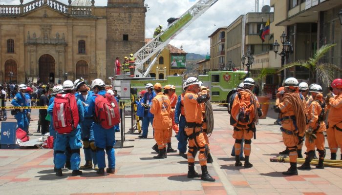
Today I have the honour to introduce Prof. David Alexander as our guest. David is Professor of Risk and Disaster Reduction at University College London (UK). His expertise comprises holistic aspects of disaster risk reduction and practical matters in emergency planning and management. He has also worked as Scientific Director of the Advanced School of Civil Protection of the regional governmen ...[Read More]
Cryospheric Sciences
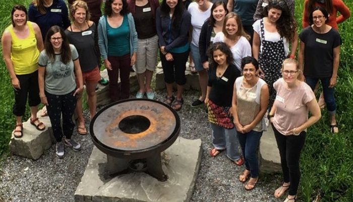
Image of the Week – Inspiring Girls!
What, you may ask, are this group of 22 women doing standing around a fire-pit and what does this have to do with the EGU Cryosphere blog? This group of scientists, artists, teachers, and coaches gathered 2 weeks ago in Switzerland to learn how to become instructors on an Inspiring Girls Expedition. But what, you may ask again, is an Inspiring Girls Expedition? Well read on to find out more… ...[Read More]
Geodynamics
Happy blog birthday!
If the title and image didn’t tip you off: the EGU Geodynamics blog is celebrating its first anniversary! Almost exactly 1 year ago (okay, so it’s one year and one day, because I wanted to stick to the Wednesday upload schedule), the EGU GD blog was launched! Yay! Applause! Good thing we’re not insanely vain about or proud of this and going to milk this event with a blog post. Oh ...[Read More]
Geodynamics
Magma oceans
The Geodynamics 101 series serves to showcase the diversity of research topics and methods in the geodynamics community in an understandable manner. We welcome all researchers – PhD students to professors – to introduce their area of expertise in a lighthearted, entertaining manner and touch upon some of the outstanding questions and problems related to their fields. For our latest ‘Geodynamics 10 ...[Read More]
Cryospheric Sciences
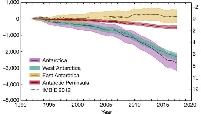
Image of the Week — Quantifying Antarctica’s ice loss
It is this time of the year, where any news outlet is full of tips on how to lose weight rapidly to become beach-body ready. According to the media avalanche following the publication of the ice sheet mass balance inter-comparison exercise (IMBIE) team’s Nature paper, Antarctica is the biggest loser out there. In this Image of the Week, we explain how the international team managed to weight Anta ...[Read More]
Tectonics and Structural Geology
Mind your head #2: The importance of time management in academia
Mind Your Head is a blog series dedicated towards addressing mental health in the academic environment and highlighting solutions relieving stress in daily academic life. An important struggle of people working in academia is how to complete all the different tasks in the limited time available. Even though time management is important for almost any type of career, the degree of freedom in academ ...[Read More]
Natural Hazards
Volcanic tourism, in between fascination and hazard awareness. Episode 1: the volcanologist prospective.
Volcanoes are often located in stunning and fascinating places of the world. Some volcanoes are in areas already heavily populated, like Popocatépetl in Mexico or that thanks to tourism become highly or more populated during certain times of the year, like Agung in Indonesia. In addition to the charm, volcanoes can be and have been harmful to both lives and properties. The hazards posed by ...[Read More]
Stratigraphy, Sedimentology and Palaeontology
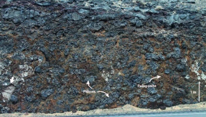
When lava meets water…
Pillow-palagonite complex forming as a result of hot lava entering a former river channel or lake in the Columbia River Flood Basalt Province, Washington State, USA (c. 15 My). Individual sediment packages were picked up from the bottom of the water body and trapped within the lava complex (see white arrow). Orange-brown palagonite is a type of clay which forms through the break-down of volcanic g ...[Read More]
Cryospheric Sciences
Image of the Week — Orange is the new white
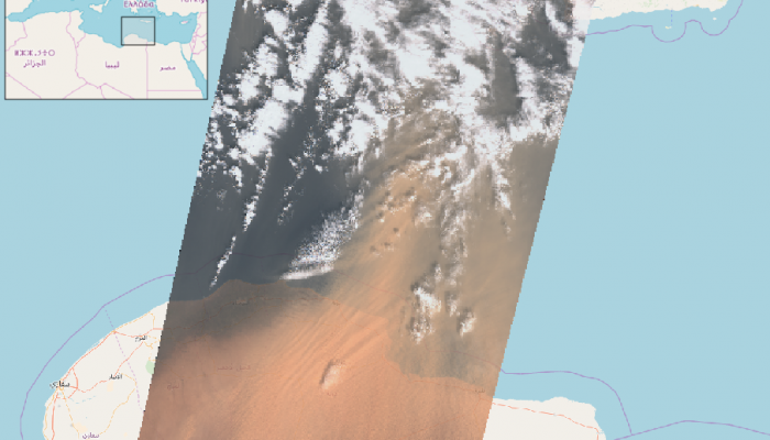
On 22 March 2018, large amounts of Saharan dust were blown off the Libyan coast to be further deposited in the Mediterranean, turning the usually white snow-capped Mountains of Turkey, Romania and even Caucasus into Martian landscapes. As many people were struck by this peculiar color of the snow, they started documenting this event on social media using the “#orangesnow hashtag”. Instagram and t ...[Read More]
Solar-Terrestrial Sciences
The average magnetic field and polar current system (AMPS) model
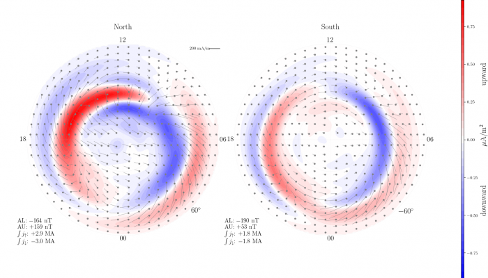
In this month’s post, Karl Magnus Laundal explains a newly developed empirical model for the full high latitude current system of the Earth’s ionosphere, AMPS (Average Magnetic field and Polar Current System). The model is available and documented in python code, published under the acronym pyAMPS. The community is invited to download and explore the electric currents and magentic fiel ...[Read More]

