Tinted detail of a photo: Fast-flowing white water rushing over mossy boulders in a rocky stream through a tall green conifer forest.
HS
Hydrological Sciences

Roland Hohensinn

Educated in geodesy and geophysics, Roland Hohensinn works at the interfaces of space geodesy, hydrology, and Earth observation. His research uses satellite gravimetry, Global Navigation Satellite System observations, and other remote sensing measurements to study natural hazards, and changes in water storage, surface deformation, and the Earth system.

The groundwater we lose – and the groundwater we gain
The groundwater we lose – and the groundwater we gain

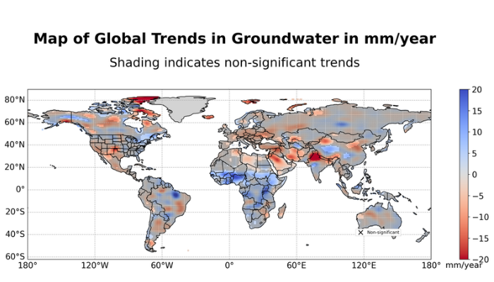
Groundwater is easy to use but difficult to observe. Wells can measure local changes very precisely, but they are unevenly distributed, and long groundwater records are missing across large parts of the world. Satellite gravimetry offers another view. Instead of measuring water levels in individual aquifers, satellites detect small changes in Earth’s gravity field caused …[Read More]