Stories from the field – how exactly are those GPS data collected? The geodesy community at large benefits from the many science projects with open data policies. A user simply has to navigate to a data portal, download the data, and within a matter of moments a world of possibilities opens up for potential research. But where exactly do these data come from? While scientific results get ...[Read More]
Geodesists on Tour: GPS measurements on Antarctica
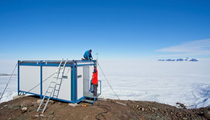
ANET GPS site at Lepley Nunatak. Photo credit: Jeremy Miner