Geodesy is the science of measuring the Earth’s shape, gravity field, and rotation. What if we could make it exciting, fun, and easy for everyone to understand? That’s exactly why the International Association of Geodesy (IAG) and its Global Geodetic Observing System (GGOS) launched the Geodesy Cartoons initiative: to bring geodesy closer to the public through visually engaging and humorous illustrations.
The first Geodesy Cartoons were born from the creative mind of Riccardo Barzaghi, a geodesist and professor at the Politecnico di Milano (Italy), who pursues drawing as a hobby. To date, he has created three captivating cartoons on geodetic themes.
To build on this success, IAG and GGOS invite scientists, students, educators, and artists from all backgrounds to participate in the Geodesy Cartoon Competition. Whether you’re a researcher or simply someone with a creative idea and a love for drawing, this is your chance to inspire others and showcase the fascinating world of geodesy in a fun and accessible way.
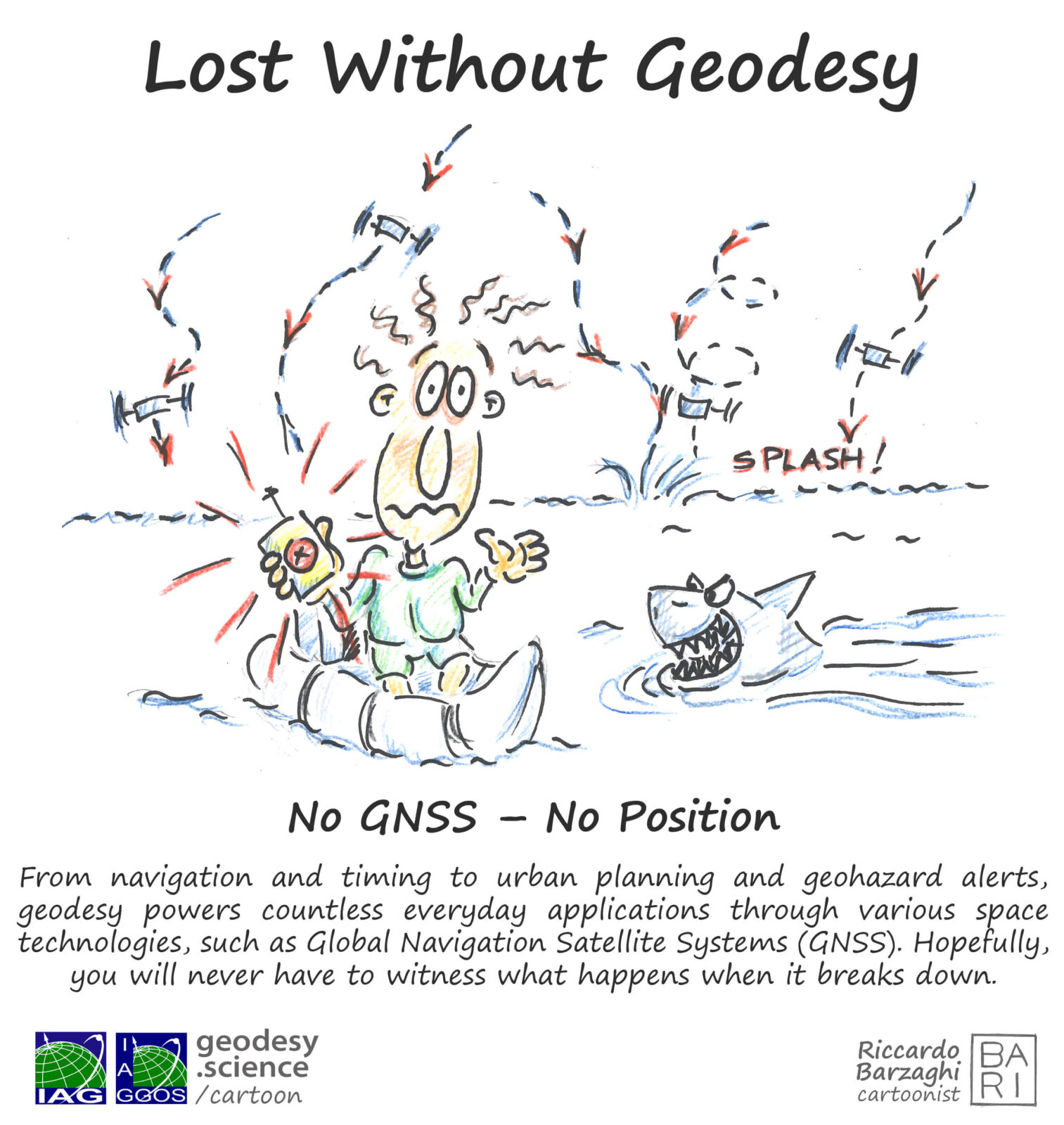
Cartoon drawn by Riccardo Barzaghi.
Why share your vision through a cartoon?
Because science communication matters. With your Geodesy Cartoon, you can help people everywhere understand why geodesy is essential – from climate monitoring and navigation to disaster management and beyond.
What’s in it for you?
Winners can receive up to 900€ in prizes and additional benefits (e.g. free IAG Membership) and gain visibility across the global geodesy community. Every participant will also get a reserved spot at the IAG Geodesy Reception 2026 during the EGU General Assembly 2026 in Vienna.
Let your creativity lead the way.
No matter your style, all you need is a great idea, a simple and engaging message, and a Geodesy Cartoon that makes geodesy both fun and meaningful. Are you ready to create your Geodesy Cartoon? Visit the competition homepage for full details and how to join. Let’s make geodesy visible, understandable, and unforgettable.
Links:
Geodesy Cartoon Competition: https://geodesy.science/cartoon/competition
Other Geodesy Cartoons: https://geodesy.science/cartoon
– Edited by Rebekka Steffen