A geodetic reference frame provides the foundation for determining positions on Earth and in space, as well as for reliably quantifying our planet’s changes due to geodynamic processes and ongoing climate change. The ITRF ensures a uniform basis to tackle current and future challenges, including a wide range of location-based applications (navigation, traffic and fleet management, transport logistics, control of industrial and agriculture machinery, autonomous driving, …) that now deeply pervade our daily life. A uniform global and long-term stable reference frame is also required for understanding the dynamics of our planet, for monitoring climate change phenomena and for operating early-warning systems to protect against natural hazards. The standard reference frame recommended by a number of international scientific organizations, including the International Union of Geodesy and Geophysics (IUGG) and the International Association of Geodesy (IAG) for Earth science, satellite navigation and positioning applications is the International Terrestrial Reference Frame (ITRF).
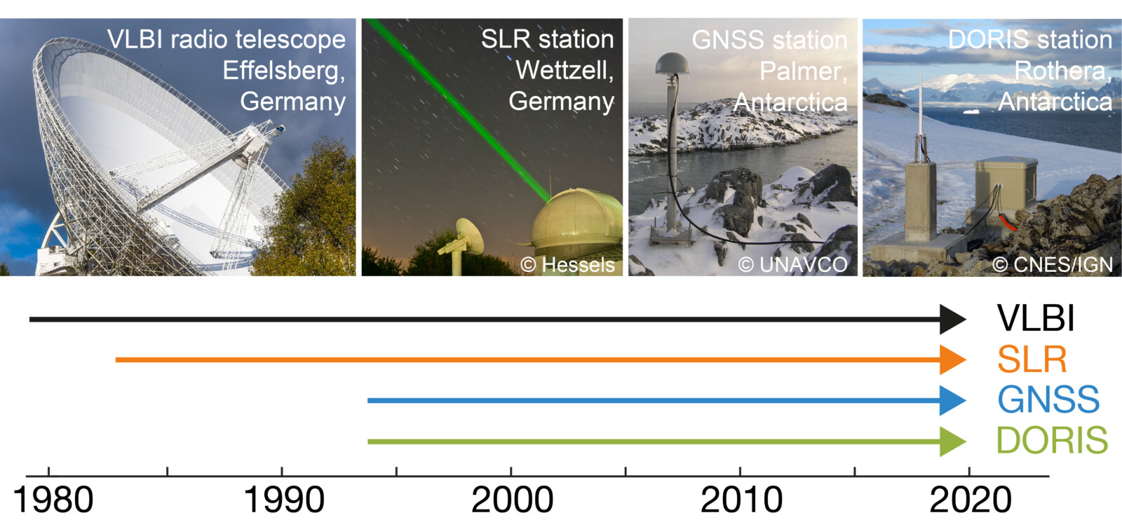
Four space geodetic techniques are currently used for the ITRF computation: Very Long Baseline Interferometry (VLBI), Satellite Laser Ranging (SLR), Global Navigation Satellite Systems (GNSS), and Doppler Orbitography and Radiopositioning Integrated by Satellite (DORIS). These four observation techniques now provide observations over 25 to 40 years. The analysis of the VLBI, SLR, GNSS and DORIS observations over this long-time span is a tremendous international effort, which is done by four scientific services (IVS, ILRS, IGS and IDS) of the IAG. The three ITRS Combination Centers of the IERS, namely the Institute national de l’information géographique et forestière (IGN) in Paris, the Deutsches Geodätisches Forschungsinstitut of the Technical University of Munich (DGFI-TUM), and the Jet Propulsion Laboratory (JPL) of NASA in Pasadena, are responsible for the combination of the data provided by the four technique-specific IAG Services. The most recent realization of the International Terrestrial Reference System (ITRS), the ITRF2020, was published on 15 April 2022 (https://itrf.ign.fr/en/solutions/ITRF2020).

Space geodetic techniques VLBI, SLR, GNSS and DORIS and their observation time span used for the realization of the geodetic reference system (Source: DGFI-TUM)
Recently the IAG’s Global Geodetic Observing System (GGOS) produced a short film “Terrestrial Reference Frames – Connecting the World through Geodesy”. This video illustrates the importance of geodetic terrestrial reference frames for science and society. It shows how a terrestrial reference frame is defined and realized, and how the ITRF helps us understand our dynamic planet.
More information:
- GIM International highlights the importance of geodetic reference frames in two articles (see latest issue 7/2023, pp. 43-45 and pp. 77) (https://www.gim-international.com/magazines/gim-issue-7-2023)
- Journal of Geodesy article “ITRF2020: an augmented reference frame refining the modeling of nonlinear station motions” https://doi.org/10.1007/s00190-023-01738-w

Felix Perosanz
Very nice and useful video! Thanks so much
Kyamulesire Bruno
Much needed video, we need to keep posting in brief like this one. The topic of reference frames is still challenging to many especially the dynamic versions.