Measuring ice surface elevation changes with satellite laser altimeters flying hundreds of kilometres above Earth tells us where the Antarctic and Greenland ice sheets are thinning or thickening and how much they contribute to sea level rise. Beyond that though, it can also reveal hidden activity of subglacial lakes filling and draining beneath the ice and meltwater rivers flowing ou ...[Read More]
Uncovering Antarctica’s hidden subglacial lake network with satellite altimetry

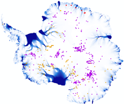
Figure 1: Current inventory of known subglacial lakes beneath the Antarctic Ice Sheet. Each dot represents an individual lake. Active subglacial lakes from previous lake inventories are shown in orange (Livingstone et al., 2022; Neckel et al, 2021) and red (from our new study). Stable subglacial lakes are shown in purple (Livingstone et al., 2022). Ice flow speed in blue (from Gardner et al., 2018) highlights the fast-flowing ice streams. Figure credit: Jenny Arthur.
