CR
Cryospheric Sciences

Remote sensing

Image of the Week – Monitoring icy rivers from space!
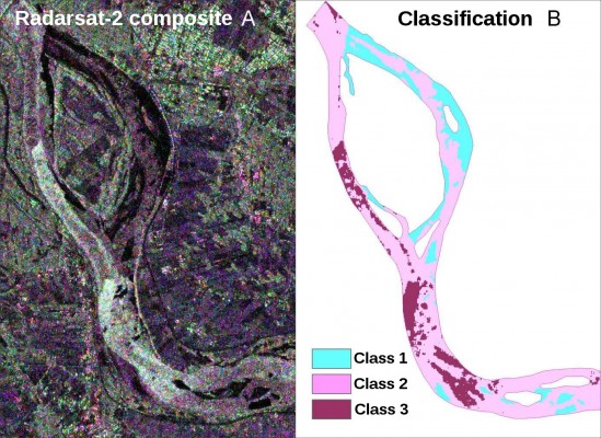
Image of the Week – Monitoring icy rivers from space!

Why? When a river freezes over, it changes the amount of water that flows through the river system. River ice affects many of the world’s largest rivers, and in the Northern Hemisphere, approximately 60% of rivers experience significant seasonal effects. The formation and evolution of river ice changes river discharge and is not only of interest to local ice skating enthusiasts. The variations in ...[Read More]

Image of the Week – Changes in the Greenland Ice Sheet Documented by Satellite

Image of the Week – Changes in the Greenland Ice Sheet Documented by Satellite

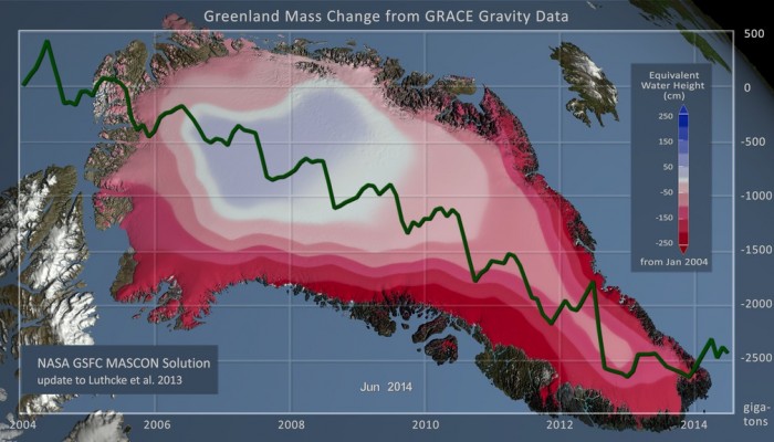
Monitoring the changing ice mass of the Greenland Ice Sheet provides valuable information about how the ice sheet is responding to changing climate, but how do we make these measurements over such a large area of ice? Using NASA’s GRACE satellites (twin-satellites flying in formation) it is possible to make detailed measurements of the Earth’s gravitational field. As ice is gained/lost from ...[Read More]

Image of the Week — What’s up with the sea-ice leads?

Image of the Week — What’s up with the sea-ice leads?

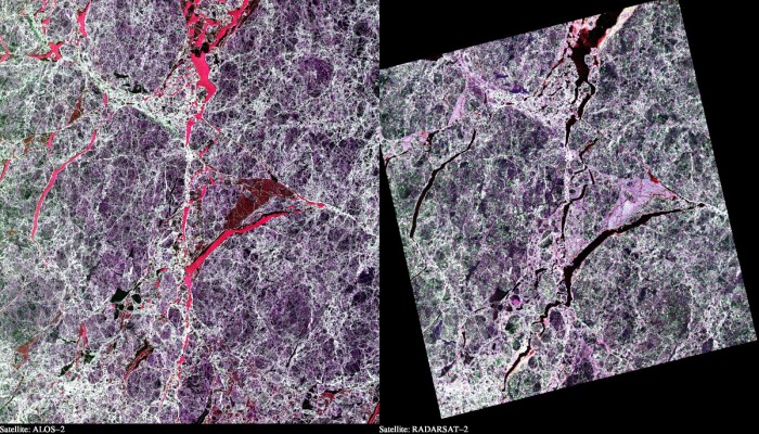
This illustration shows two Synthetic Aperture Radar (SAR) images taken over sea ice in the Arctic Ocean. Both images are polarimetric and the different colours reflect the different polarimetric channels of the SAR (red = VV, green = HV and blue = HH). The two images are from the two satellites “ALOS-2” and “RADARSAT-2”. These are equipped with radars that operate at wavel ...[Read More]

Image of the Week: Greenland Ice Streams

Image of the Week: Greenland Ice Streams

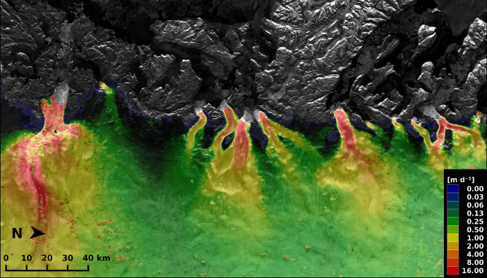
This image is from the west coast of Greenland and it shows several glaciers flowing towards the sea (upper part of the image), transporting ice into the ocean. The colours show the velocity of the ice. As the ice gets nearer to the coast it speeds up reaching speeds over 15m/day. The velocities were calculated using two Sentinel-1A radar scans from 3 and 15 January 2015. You can download a high r ...[Read More]

­Around the Poles in approx. 100 minutes: Earth Observation for Climate Science and the Cryosphere – Anna Maria Trofaier and Anne Stefaniak

­Around the Poles in approx. 100 minutes: Earth Observation for Climate Science and the Cryosphere – Anna Maria Trofaier and Anne Stefaniak

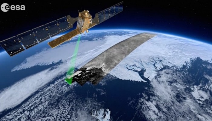
Everyday we come into contact with technology that has changed the way we work, live and even think. Yet it is still easy to forget how integral satellite technology is to our daily lives; over two thousand artificial satellites currently orbit our planet – satellites for navigation, for telecommunication, for meteorology, and for environmental and climate monitoring. The latter two categori ...[Read More]