Does measuring the surface of the ice sheets provide more than superficial knowledge of their current status? Read further to find out why the answer is definitely yes! Measuring surface elevation changes actually tells us where Greenland and Antarctica are thinning or thickening and how much they contribute to sea level rise. Scientists have been doing this for the past three decades, so keep on ...[Read More]
For Dummies: Radar altimetry for measuring ice sheet elevation changes
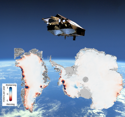
Greenland and Antarctica surface elevation changes from CryoSat-2. Credit: ESA, Inès Otosaka.