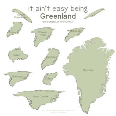
As a reader of the Cryosphere blog, you may have spent a lot of time looking at the Greenland Ice Sheet, but do you really know what Greenland looks like? This “It Ain’t Easy Being Greenland” map is something I made for fun during the #30DayMapChallenge (an international project to complete one map a day during the month of November) and highlights how different the island country appears dependin ...[Read More]
Image of the Week – The true size of Greenland
Greenland is a critical part of the world, which is regularly covered on this blog, because it hosts the second largest ice body on Earth – the Greenland Ice Sheet. This ice sheet, along with its small peripheral ice caps, contributes by 43% to current sea-level rise. However, despite being the world’s largest island Greenland, appears disproportionately large on the most common world maps (Fig. 2 ...[Read More]

