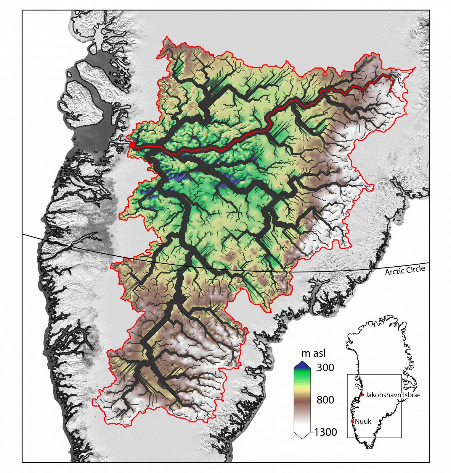
The Greenland Ice Sheet contains enough water to raise sea level by 7.36 meters (Bamber, et. al. 2013) and much of this moves from the interior of the continent into the oceans via Jakobshavn Isbræ – Greenland’s fastest flowing outlet glacier. An ancient river basin hidden beneath the Greenland Ice Sheet, discovered by researchers at the University of Bristol, may help explain the loca ...[Read More]
Image of the Week – Canyons Under The Greenland Ice Sheet!

Figure 1: The calculated drainage network for southern Greenland (interpreted from airbourne ice penetrating radar data). It shows an extensive flow network of channels beneath the ice. Which can be interpreted as a possible configuration for water flow pre-glacially, as well as in an ice-free future. The main channel within the catchment area of Jakobshavn Isbræ is marked by the red line. Bed elevation (between 300 and 1300 m above sea level (asl)) is also shown. Inset: location of study area within Greenland.
