REMARK: If you’ve enjoyed reading this post, please make sure you’ve voted for it in EGU blog competition (2nd choice in the list)! During both the austral winters of 2016 and 2017, a famous feature of the Antarctic sea-ice cover was observed once again, 40 years after its first observed occurrence: the Weddell Polynya! The sea-ice cover exhibited a huge hole (of around 2600 km2 up to ...[Read More]
Image of the Week – A Hole-y Occurrence, the reappearance of the Weddell Polynya
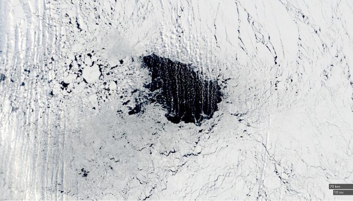
Fig. 1: The Weddell polynya as seen in the 7th September 2017. The size is around 2500 km2. Black areas are sea-ice free (open water) [Credit: NASA].