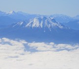
Image of the ash plume from Kelut, drifting across the Indian Ocean on 14th Feb, 2014.
NASA Earth Observatory image by Jesse Allen, using data from the Land Atmosphere Near real-time Capability for EOS (LANCE).
I have used storify.com to put together a synopsis of the February eruption of Kelut, Java, Indonesia. There are some additional links to more detailed posts and related information below.
Related posts
- Fascinating technical analysis of the satellite data from Nicarnica Aviation
- Erik Klemetti on Wired
- Volcano Discovery updates on Kelud
- Satellite imagery collated by Imageo on Discover Magazine
- Collection of satellite observations on The Watchers
- Aftermath of Gunung Kelud on VolcanoCafe
- International Charter, Space and Major Disasters – Datasets (Radarsat, TerraSAR-X, Landsat, SPOT, MTSAT, Suomi NPP)
Collections on Storify
- David Pyle – The eruption of Kelut (Gunung Kelud)
- Raymond Klaasen – Vulkaan Kelut, 13 februari (in dutch)
- Iswimaar – Volcano erupts in Indonesia
- Voice of America – Indonesia’s Mt Kelud erupts
- NSW North Coast – Volcano eruption leaves travellers stranded
Links for further information on activity and monitoring
- The Volcanological Survey of Indonesia (Pusat Vulkanologi dan Mitigasi Bencana Geologi, or CVGHM )
- Smithsonian Global Volcanism Programme – Kelut
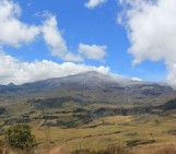
The eruption of Kelut, Gunung Kelud, Java, February 2014
The dramatic eruption of Gunung Kelud (Kelut volcano, Java, Indonesia) provides excellent examples both of how quickly information can spread around the world during unfolding volcanic crises; and of the capacity that we now have for tracking and analysing volcanic eruption plumes in near real time.
-
Kelut is a dangerous volcano with a volatile history, and the lead in to the latest eruption was short. The first images of the eruption from @hilmi_dzi caught the rapid lofting of the plume.
-

-
And, about 90 minutes later, also from @hilmi_dzi, the spectacular lightning show that often accompanies ash-rich plumes. In this image, there is also a clear glow from the core of the plume, where the hot volcanic mixture of ash and gas is emerging from the vent.
-
 Earth pic of the day. Indonesia’s Mount #Kelud volcano erupts with static discharge lightning. Credit: @hilmi_dzi pic.twitter.com/ymG2ItUfEq
 -
Indonesia is well prepared for volcanic emergencies, with over 130 active volcanoes, and major recent eruptions at both Sinabung (on Sumatra) and Merapi (on Java); a theme picked up both by the Indonesian press, and in social media posts.
-
 Front Page, Feb. 15: Mt. Kelud’s eruption displaces thousands, halts flights, spews ash pic.twitter.com/zQXyaF3b9H
 -
Volcanic ash in Yogyakarta in 2010 (eruption of Merapi) and 2014 (eruption of Kelut)
-
 #jogja Foto Perbandingan dampak hujan Abu Vulkanik di tugu ,Merapi 2010 Kelud 2014 pic.twitter.com/jnUkmMJypa via @JogjaMedia| @LensaJogja
 -
Explosive volcanic eruptions pose a significant threat not only to communities living around the volcano, but also to air traffic. In this case, the Volcanic Ash Advisory Centre in Darwin, Australia, were quick to respond with forecasts of the likely spread of the ash in the atmosphere.
-
 Estimated extent and prediciton of the ash plume (VAAC Darwin). pic.twitter.com/XPchidd6Bt
 -
In the early stages of an eruption it can be quite hard to gauge how high the ash has been lofted in the atmosphere; and this is also something that can change quickly depending on the strength of the eruption.
-
 Kelut #volcano in Java is erupting – Darwin VAAC reports ash cloud to 15 km altitude http://www.bom.gov.au/products/IDD65295.shtml …
 -
 #Darwin VAAC says volcanic ash plume observed to FL550 500NM WSW of Mt Kalud, Java. Some flts in region cnld/diverted pic.twitter.com/VLXd4i8XCB
 -
For an explosive eruption of this scale, remote-sensing measurements from satellites can very quickly provide the cofirmation needed on the ground in terms of the scale of the eruption, and the location of the ash cloud. As explained on the NASA Earth website, satellites first detected the eruption at 11.09 pm local time (20 minutes before @hilmi_dzi‘s first photo, above); and at 12.30 am (local) the Visible Infrared Imaging Radiometer Suite (VIIRS) on the Suomi NPP satellite captured an image of the top of the plume rising above the clouds.Shortly after, a laser-ranging instrument (Cloud-Aerosol Lidar, CALIOP) flew over on board the CALIPSO satellite, providing the first direct evidence that the plume top had reached between about 20 km and 26 km height.
-
 A satellite recorded ash from Mt. Kelut at an altitude of 20 kilometers (12 miles). http://1.usa.gov/1gFqkY5 pic.twitter.com/J1Q7OPvhV9
 -
Peter Webley expands on this in a blog post, showing a reconstruction of the plume in cross section.
-
 Volcanic Activity in the North Pacific and beyond: Visualizing the Kelut Volcano eruption cloud in Go… http://volcanodetect.blogspot.com/2014/02/visualizing-kelut-volcano-eruption.html?spref=tw …
 -
Volcanologists and atmospheric scientists are quite interested to know how high eruption plumes reach because that information tells them both about the strength of an eruption (the stronger the eruption, the higher the plume); and also about the potential of an eruption to have an influence globally, which is usually thought to require an eruption to loft material into the stratosphere. In this case, it appears that some of the plume did intrude into the stratosphere; but in fact the first look at the potential gas emissions (in particular sulphur dioxide) suggests that these are actually rather small.
-
 SO2 from #Kelud drifts over Indian Ocean.
SO2 mass is modest – no measurable climate impact expected #climatechange pic.twitter.com/CSaxanK1sH -
Perhaps of more (academic) interest to scientists is the structure of the expanding ash cloud itself – notice the ripples visible in the infra-red image above.
-
 Kelut’s giant mushroom cloud, with gravity waves and perhaps a temp inversion due to tropopause piercing? http://cimss.ssec.wisc.edu/goes/blog/wp-content/uploads/2014/02/140213_mtsat-1r_ir_kelud_east_java_anim.gif …
 -
 CALIPSO lidar data for #Kelud eruption show nice gravity waves in the umbrella cloud at ~19 km altitude pic.twitter.com/V3yqFGb4YP
 -
The eruption also literally sent soundwaves around the globe, with an infrasound signal detected by the global Comprehensive Test-ban Treaty Organisation array, as well as other infrasound networks – a promising tool in monitoring activity at the world’s active volcanoes.
-
 Global infrasound from the 13 February 2014 Kelut Volcano eruption in Java! http://newsroom.ctbto.org/
 -
Across Java, of course, the eruption has caused substantial disruption with reports of over 100,000 people being evacuated, a number of fatalities, and disruption to transport networks due to the fallout of ash across a wide portion of Java. The tweets and images below capture just a little of the scale of the misery caused by this event.
-
 Ash covers this airplane from the eruption of Mount Kelud near Java in Indonesia. #737 #Boeing pic.twitter.com/5HSDGN8dmm
 -
 Volcanic ash covers a plane at Yogyakarta airport, about 200 km west of the Mount Kelud volcano on Java pic.twitter.com/TvDw7H9l8H
 -
 Juanda Airport in Surabaya after eruption of Mt. Kelud, 1 of 4 airports on Java reportedly closed pic.twitter.com/4AxxVk8Kox via @madhannnn
 -
 @AP Sat, Feb 15th. Volcanic ashes of Mt. Kelud, at Adisucipto Int’l Airport in Yogyakarta, Java, Indonesia. pic.twitter.com/NizhwiHyh6
 -
 Mount Kelud erupts in #Indonesia, prompts mass evacuation, kills 3. Photos: http://buff.ly/1f2WPzy pic.twitter.com/qMCPmuUIiW
 -
Everyting is grey.. I can’t see the way..
Volcano ash because of Mt.Kelud eruption
#grey #Yogyakarta… http://instagram.com/p/kd9QFsCW9e/ -
Like a dead city.. taken from upstairs.. the trees and houses are covered by the ash of Mt. Kelud… http://instagram.com/p/keDmSiCBaa/
-
Slamet Riyadi street today! Still in vulcano ash fr. Mount Kelud #instatoday #instainsta #instaweekend… http://instagram.com/p/ka3omNo5PR/
-
Suasana Puri Timoho Asri Baru II pasca hujan abu vulkanik Gunung Kelud . Hujan salju man 😀 #nofilter http://instagram.com/p/keK63PyzXb/
-
 More ash, this time from Mount Kelud in Indonesia, in today’s #bikepic from Getty Images. pic.twitter.com/tBrQldxhkP
 -
 The eruption of Mount Kelud in Malang, on the island of Java in Indonesia
A duck walks through the mud and ash. pic.twitter.com/bP6vYFekzA -
 Bags of volcanic ash ready to be sold. Not everyone suffers because of a #volcano #eruption. #kelud #makelemonade pic.twitter.com/Cr2UV1dWST
 -


Read next page
Did you find this story interesting? Be the first to
like or comment.