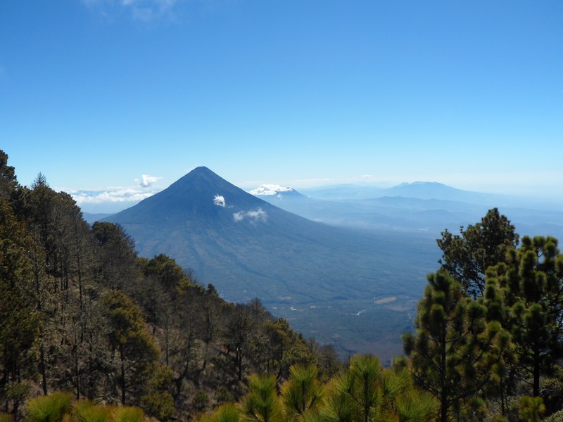
Volcan Agua, Guatemala
Taken from the side of the Acatenango, another volcano, this image shows the stratovolcano Agua towering over the landscape. Agua was the location of a catastrophic debris flow/lahar in the mid 16th Century, destroying the then capital city of Guatemala.
(Credit: Joel Gill, 2014)
(This image, and others taken in Guatemala, is available for free use (subject to terms and conditions) from the EGU Image Repository)

Joel is the Founder/Director of
Geology for Global Development (
@Geo_Dev) an organisation working to support geologists to make a sustainable contribution to the fight against global poverty. He is an
interdisciplinary researcher, with a PhD in geography (natural hazards), and research interests in multi-hazard frameworks, disaster risk reduction, rural water projects, and sustainable development. This work has taken him to Chile, China, Guatemala, India, South Africa, Tanzania and Uganda. Joel is currently based at the British Geological Survey, and tweets at
@JoelCGill.
Pingback: Field Research in Guatemala (4) – Reflections from Fuego | Geology for Global Development