
This photo was taken by Jack Williams from the University of Otago during mapping of the surface rupture from the recent Kaikoura earthquake. It shows pressure ridges in road from subsidiary strand of Hundalee Fault. You can read more about his field work on yesterday’s blog.
Photos
Guest Blog: Scarcity-Waste – The Syngenta Photography Award 2015
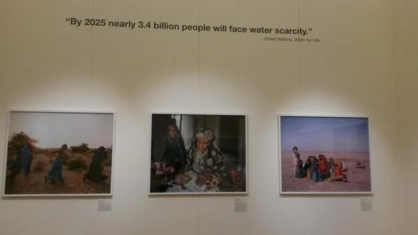
Luke Maxfield is an undergraduate student and GfGD Ambassador at Oxford University. Today he writes about a recent visit to a photography exhibition at Somerset House (London, UK) on the theme of Scarcity-Waste: Upon entering the Syngenta Photography Award exhibition visitors are greeted with one of those worrying statistics: “In the past 50 years, the world’s …[Read More]
Images of Guatemala (9) – Conflict and Disasters
Until 1996, Guatemala was in the midst of a brutal Civil War. This sculpture in the Presidential Palace of Guatemala City is a reminder of that troubled past and symbolic of a hopeful peaceful future. In the same way that conflict/disasters can hamper and set-back development efforts, conflict can also set-back disaster risk reduction and management. …[Read More]
Images of Guatemala (8) – Volcanic Observatories
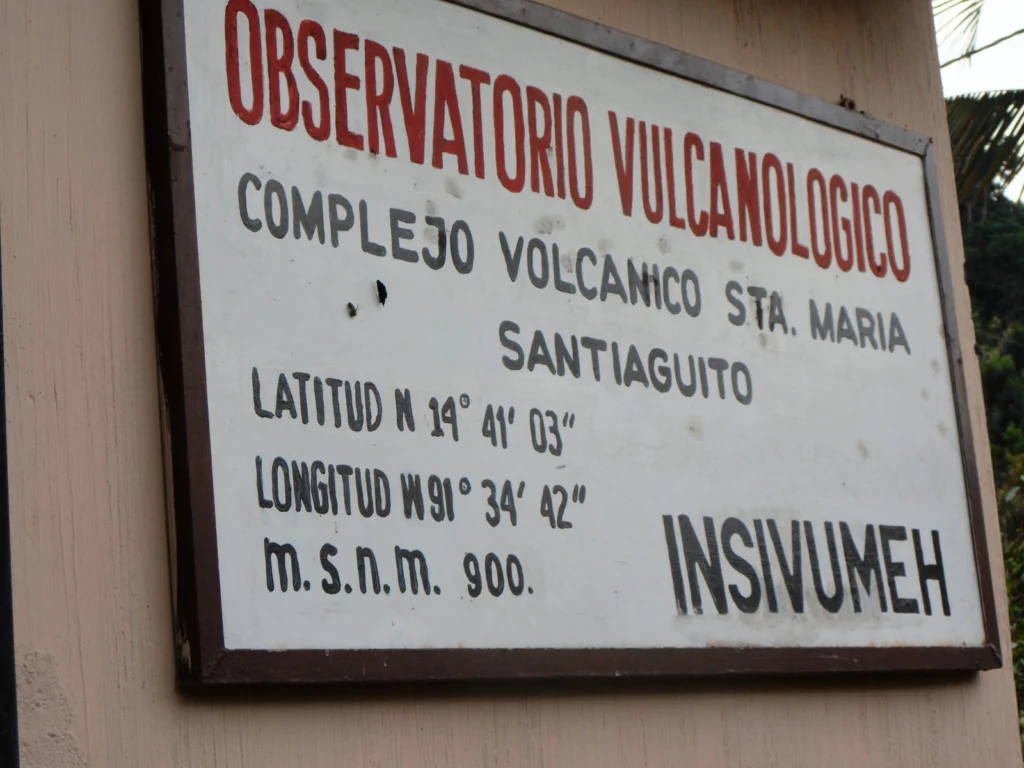
The volcanic observatories, run by the National Institute for Seismology, Volcanology, Meteorology and Hydrology (INSIVUMEH), are based close to Guatemala’s active volcanoes, including Fuego and Santiaguito. Observers, located at each observatory, make observations and work with those in the local community to share information about the volcano. Our fundraising project will be working to strengthen …[Read More]
Images of Guatemala (7) – Volcano Art
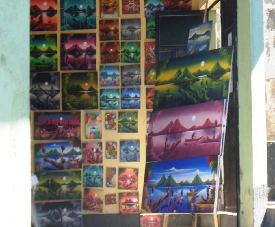
The dramatic landscapes of Guatemala are an important source of inspiration for some of the creative arts being produced in Guatemala. The images above (from top to bottom) a shop selling paintings aimed at the tourist market, a wall painting as part of a commercial advertisement, and my own purchased collection of three hand painted ‘volcano’ …[Read More]
Images of Guatemala (6) – Some Impacts of Agriculture
(Credit: Geology for Global Development, 2014) This truck load of sugar cane was one of many observed on this stretch of road from Antigua leading to a volcanic observatory around the volcano Fuego. Agriculture – notably sugar and coffee – in Guatemala is highly significant in many respects, bringing benefits such as exports and jobs. There …[Read More]
Images of Guatemala (5) – Lake Atitlan
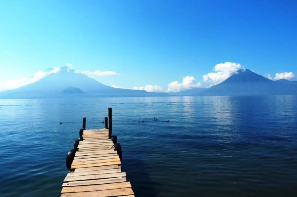
Lake Atitlan, Guatemala. A picture we’ve shared on this blog before – but well worth including in our Images from Guatemala series. Taken from Panajachel, and looking across to the volcanoes of Atitlan (right) and Toliman (left). The small mound in front of Toliman is known as Cerro de Oro. The lake fills a significant …[Read More]
Images of Guatemala (4) – Fiesta at Lake Atitlan
Fiesta at Lake Atitlan, Guatemala. Guatemala is a country with many volcanic hazards, as shown in some of the previous images in this series, but also a country rich in culture and traditions. The image above was taken at the annual fiesta in San Pablo, a small town on the edge of Lake Atitlan. During the …[Read More]
Images of Guatemala (3) – Lahar Deposits at Fuego
Lahars at Volcan de Fuego, Guatemala. This image captures a lahar [mudflow] deposit close to Volcan de Fuego. These deposits are formed when rain mobilises ash and pyroclastic material on the volcano to form a fast moving, powerful mudflow with the ability to transport material including large boulders. As the energy dissipates, the sediment is deposited as …[Read More]
Images of Guatemala (2) – Pyroclastic Flow Deposits
Pyroclastic Flow Deposits close to Volcan de Fuego, Guatemala. The scale of these deposits, formed in 2012, can be seen against the scale of the person standing in the background [dark line, just above the red shrub]. Pyroclastic flows, alongside lahars, are two of the most significant and destructive volcanic hazards associated with Volcan de Fuego. …[Read More]