 Over the next couple of months, Joel Gill (GfGD Founding Director) will be reporting live from Guatemala, whilst undertaking interdisciplinary field research relating to natural hazards and disaster risk reduction. This fieldwork forms part of a NERC/ESRC funded PhD, supervised at King’s College London. Today Joel gives an introduction to his research and why he is focusing on the Central American country of Guatemala…
Many assessments of natural hazard potential treat natural hazards as discrete or independent events. An examination of multiple case studies and a broad range of hazards literature suggests that this is not always appropriate. Initial results of research that I have conducted at King’s College London (KCL) with Professor Bruce Malamud, identify a broad range of natural hazard interactions (more than 90 interactions, across 21 different natural hazards, paper in review). This discrepancy between observed reality and the modelling of hazard potential could result in an underestimation of risk or a distortion of management priorities.
Research Aims
My interdisciplinary PhD research therefore, aims to develop and improve multi-hazard approaches to assessing hazard potential, through increasing our understanding and characterisation of natural hazard interactions (e.g., an earthquake triggering landslides) and networks of interactions (e.g., an earthquake triggering landslides, which trigger flooding, which trigger further landslides) at global and local scales.
The fieldwork component of this work aims to explore, quantify and contrast hazard interaction networks developed from understandings and data populating contrasting knowledge worlds. In other words, what differences are there in the understanding of hazard interactions between hazard professionals and local community groups? What implications do these contrasts have on hazard monitoring, policy and research priorities? Feedback will also be gathered to enhance a series of visualisations developed in earlier stages of this work, and designed for end-user stakeholders.
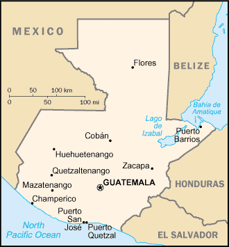
Guatemala (Public Domain)
Why Guatemala?
Guatemala is a country prone to multiple natural and environmental hazards, including earthquakes, tsunamis, volcanic eruptions, landslides, floods, droughts, ground collapse, tropical storms and hurricanes, significant temperature variations, wildfires and impact events. Furthermore, development places a number of stresses on the natural environment (including deforestation and urbanisation). These stresses have been documented to exacerbate a range of natural hazards in the area (e.g., deforestation exacerbating landslides during Hurricane Mitch, or road cuttings increasing landslides after an earthquake in 2012).
The existence of a broad range of natural hazards alone is not sufficient for this study. In addition to this, we are interested in the spatial overlap of natural hazards and the interactions between them. Multiple case studies have been recorded of hazard interaction networks in Guatemala, with triggering, increased probability and synergistic hazard relationships all featured.
This combination of factors make Guatemala an ideal country to examine the existence of hazard interactions and the understanding of such processes by key stakeholders. I will be travelling there from January 16th until March 17th.
What kind of work will you be doing?
Over the two months I will be in Guatemala, I will be undertaking:
- A ground reconnaissance of the hazardscape (observing both natural and anthropogenic environments at multiple scales, and having discussions/semi-structured interviews with relevant stakeholders.
- A series of interviews and workshops with hazard professionals and local communities to assess their understanding of hazard interactions and how these understandings are developed.
- Personal training and development (including language training, joining MSc Volcanology students from the University of Bristol for a field course, and learning lots more about social science field methodologies).
Over the next couple of months I will try and write regularly, covering my fieldwork experiences and lessons learnt throughout different stages of the work. I’m sure I will be touching on aspects of traditional geology, hazard processes and impacts, the integration of social science techniques into field research and issues of cross-cultural communication.
You can leave questions about Joel’s preparations and experiences in the comments section below, or via Twitter (@Geo_Dev//@GillJoel).