David Litchfield completed a second undergraduate degree in Geosciences with the Open University and is currently studying part-time for an MSc in Geophysical Hazards at UCL. He has a broad interest in hazard monitoring methods and how geoscientists communicate their findings with those who need it, and retains a strong connection with the Andean highlands of Ecuador. This summer, David is volunteering at a volcanic observation centre in Ecuador. This is the fifth post in a popular series that we have been running throughout the summer, and here David writes here about risk perception studies at Cotopaxi volcano. If you have any comments or questions about David’s work in Ecuador you can email him or find him on twitter: @litchfieldD.
My last blog referred to volcanoes in unrest, those showing signs of activity but not actually in a phase of eruption. An important Ecuadorian example of this is Cotopaxi about 60 km south of Quito in the eastern Cordillera mountain range. At 5897 m it is the second highest peak in Ecuador although the highest active volcano, and if you like your volcanoes steep, pointy and with an icy cap, she’s certainly a beauty! It’s very popular on the tourist trail, where agencies take visitors around the national park, on downhill bike rides and sometimes irresponsibly up to the crater before they’ve properly acclimatised to the altitude.
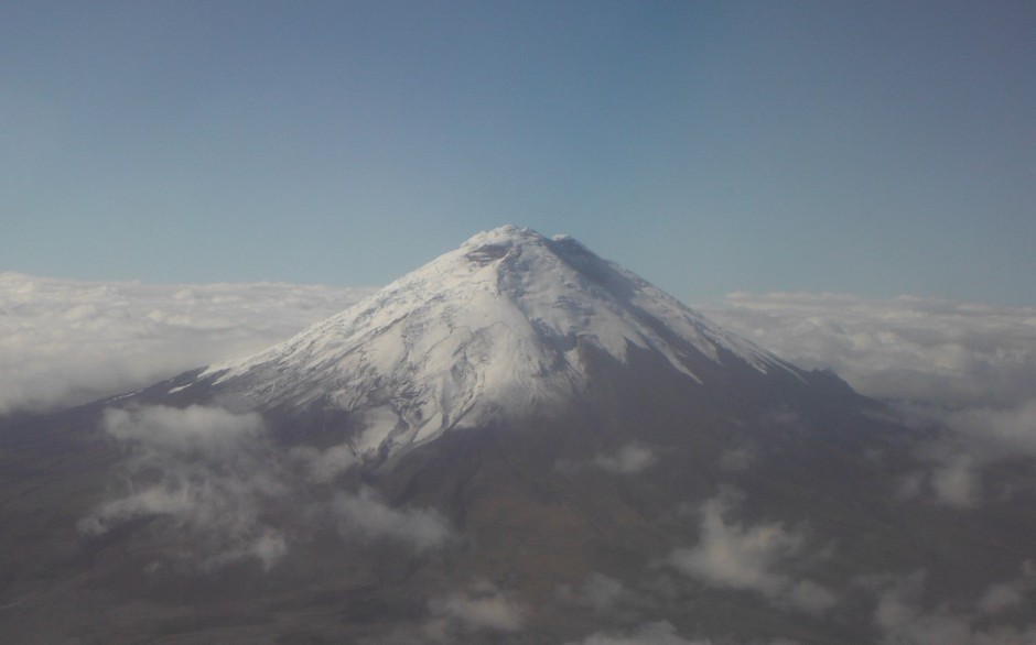
Cotopaxi photographed from an aeroplane
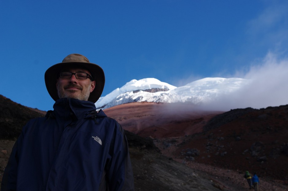
David and Cotopaxi from the refuge at 4864 m. Photo: Ryerson Christie
The current cone is the product of andesitic volcanism over the last 4100 years, and historically eruptions have occurred around once per century, producing pyroclastic flows, air fall deposits and lahars (volcanic mudflows). This latter threatens about 300,000 people living close to the volcano or its drainage routes and are produced by material mixing with glacial melt water or intense rainfall onto pyroclastic deposits. For more information see Instituto Geofísico (IG) guides here. Past lahar deposits help identify hazard zones, but the exact extent affected in the future must be modelled and depends on uncertain factors, such as the degree of explosivity and volume of material ejected. However, it is reasonable to expect that one day Cotopaxi will again produce lahars that travel down populated routes. With the deaths of 23,000 people from a lahar flow on Nevado de Ruiz, Colombia in 1985, and no significant eruption from Cotopaxi since 1904, it is vital we understand and reduce the risks it presents.
I had a fantastic opportunity to contribute in a small way to the VUELCO (Volcanic unrest in Europe and Latin America) project. This European Commission funded international research project concerns 6 volcanoes around the world including Cotopaxi. It takes a multi-disciplinary approach to improve our understanding of unrest signals and so make better forecasts of their outcomes. In addition to more mechanistic and statistical elements, its objectives include aspects of communication, decision-making and management. Focussed this time on the Latacunga valley south-west of the volcano, I joined in with a risk perception survey managed by Dr. Ryerson Christie, an academic from the School of Sociology, Politics and International Studies at Bristol University with the assistance of the IG. It included a range of questions on people’s views around volcanic hazards, their likelihood of evacuation, and their knowledge of and involvement in emergency planning. Also crucially we asked what other risks they experienced in their daily lives, as there may be a tendency for volcanologists to over simplify the way they expect a person to respond to hazard information. Ryerson recounted how a previous interviewee pointed out that with even a couple of days warning of an adverse volcanic event, that’s far more generous than they could hope for from other risks like injury or robbery!
We wandered around villages and towns in the risk zones which were often easy to recognise being dominantly agricultural land strewn with the boulders of past lahars. We approached homes, businesses or just people in the street and asked for a few moments of their time, while I hypocritically tried to forget my personal strategy at home of racing past anyone with a clipboard in hand! At first I observed, but later I was able to undertake my own interviews which was a very special experience. Despite considerable time spent in Ecuador over the last few years, I’ve never had so much exposure to the lives of people outside of the cities and I loved it. I heard about their daily struggles, but also their passion for nature and the tranquillity of their surroundings. I particularly enjoyed hearing legends about the volcano, one being that of the giant Chilintosa stone, claimed to have landed on and squashed a home and its occupants as punishment for their wealthy but ungenerous ways!
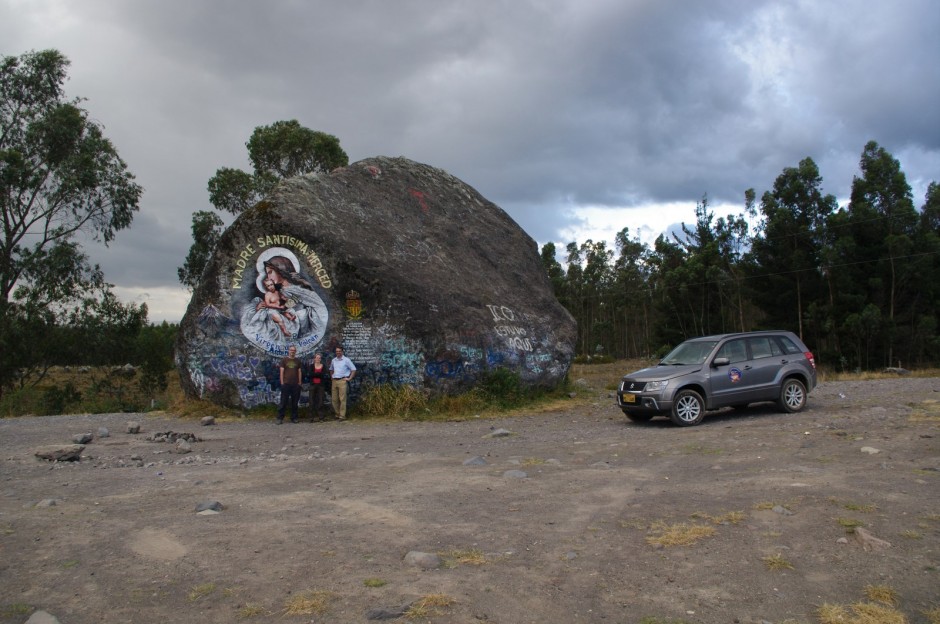
David, Maria (field assistant) and Ryerson with the Chilintosa stone, deposited during a previous lahar event. Photo: Pedro Espin
The settings for the interviews were unforgettable. Sipping canelazo (Ecuadorian hot toddy) in a beautiful old hacienda built into an ancient Incan palace, watched over by the owner’s portrait by the famous painter Guayasamín was definitely a highlight. But equally memorable were sitting in gardens fighting off overly enthusiastic dogs, crouching among the cowpats while my interviewee did the milking or the simple pleasures of relaxing on the grassy bank of a stream talking to an older woman as she got on with her laundry. I was also pleased to disprove a mother and daughter’s assumption that we would not be able to help them move a boulder in their field. Although I think initially bemused by the arrival of a tall foreigner to their village with his odd questions, the villagers were without exception warm and welcoming, often sending us off with gifts of sweets and fruit. However, I’m also left with a profound sense of the challenges still remaining. The designated places of safety for many people in the wide flat valley was as much as 10 km away, leaving them highly vulnerable, especially if they lack transport, as travel time for a lahar from the peak is perhaps only half an hour. Maybe better understanding of precursors would enable precautionary evacuation before an eruption, but would the political and social appetite be there after the challenging experiences when this was done for Baños and Tungurahua? I was also frustrated to find one evacuation route could not even be followed safely, where a left-turn was prevented by the later addition of a central fence in the highway. Although I’m sure this was miscommunication between agencies, I guess this also comes back to competing risks and priorities – was the daily hazard for cars crossing the highway perhaps just more important than a once-a-century mudflow?
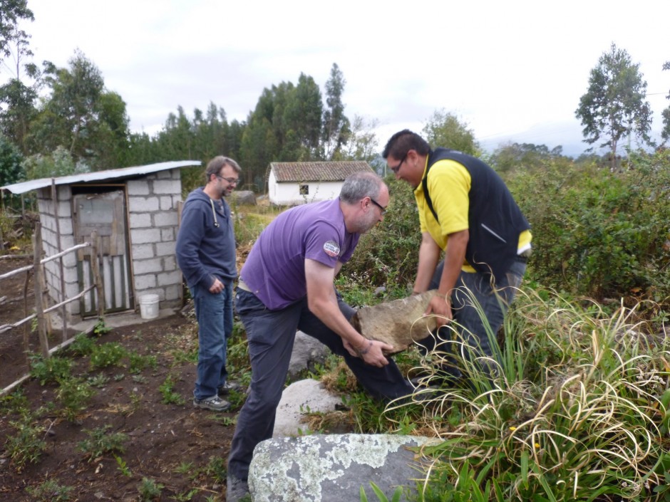
Ryerson, David and Pedro (IG worker) moving rocks. Photo: María Balén
I would like to express my gratitude to the Instituto Geofísico for this opportunity and to the Open University Ian Gass Bursary for providing financial support. Any opinions, omissions or errors in this blog are entirely my own. Please get in touch if you have any comments or questions.
Neil Buckland
I was in Banos in 2011 and interested to see road signs indicating which way to run in the event of an eruption. One road in and another out didn’t give a lot of confidence in the chances of a mass evacuation, especially given the high population of the town, car ownership and inter town coach volumes. Higher up the mountain, a village school did have a tin roofed shelter connected to a new high speed road down and away from Banos, as I recall.