Earlier this year my PhD supervisors and I (Daniel) had a paper accepted for publication in Earth-Science Reviews entitled ‘Flood stratigraphies in lake sediments: A review’ (Schillereff et al., 2014). It’s been fairly popular in terms of downloads but it occurred to me the other day that many of those prospective readers may be put off somewhat by its hefty word count. Thus, putting together a shortened version outlining the main points and conclusions seemed wise!
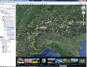
The review stems from my PhD research investigating whether sediment cores extracted from UK lakes contain distinct layers deposited by severe floods that occurred in past decades or centuries. It follows many neat papers illustrating similar case studies from every continent bar Antarctica. (We’ve included a KML GoogleEarth file in the Supplementary Info enabling users to fly to the sites of each published palaeoflood record mentioned in the text).

Screen capture of the GoogleEarth KML file included as Supplementary Information. The high number of published lake palaeoflood records from the European Alps is evident!
The major point we wanted to make is that because lakes are found in so many different environmental settings, and the processes influencing the volume and characteristics of sediment reaching the lake bed are so complex, distinguishing flood layers from ‘day-to-day’ sedimentation is challenging. As a result, there are a host of considerations to ponder before undertaking palaeoflood research and a range of methods have been employed.
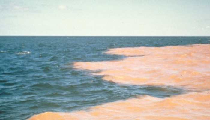
The paper is split into three major sections. In Section 1, the mechanisms controlling the rate of deposition in a lake are examined as one critical requirement is that sufficient sediment is delivered during a flood to leave a characteristic imprint. Thus a catchment and lake configuration is required where ample sediment is eroded from the watershed and transported through a river to the lake of interest. One important consideration is that the sediment available in the catchment may vary through time; the conversion of forested hillslopes to pasture, for example. Once the river delivers its sediment plume to the lake, many interacting processes influence where individual particles are deposited. While there is relationship between particle size and the velocity grains descend through the water column (i.e., Stokes’ Law), horizontal forces such as wind and waves, temperature or water density variations with depth and even the Coriolis Effect (in larger lakes) can influence the pattern of deposited sediments. Having a comprehensive understanding of the lakes’ physical characteristics prior to seeking a palaeoflood record is clearly very important and this section ends with a conceptual model that highlights those features most advantageous or disadvantageous to the archiving of a palaeoflood sequence.
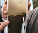
So, a sediment core has been extracted (ideally several from different parts of the lake) and some distinctive layers are visible, perhaps deposited by historical floods. We aimed to describe all the sediment analysis techniques used by palaeoflood researchers in Section 2, and there are many! The first step is usually a thorough visual assessment, perhaps using thin sections under a microscope, coupled with X-ray or CT scans that will hopefully pick up these flood layers. Many sediment parameters can be measured in the lab, such as isotopic composition, particle size, magnetic or geochemical signals, as well as palaeoecological indicators such as pollen counts. The working hypothesis is usually that peaks or troughs in these proxies will correspond to flood layers, as different material is delivered to the lake under these much higher flow conditions. The thickness of these layers is often measured too, although examples where thickness and flood magnitude do not correlate have been published.
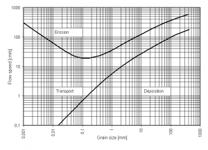
We paid particular attention to particle size indicators. I’ve run countless particle size measurements during my PhD, working on the premise outlined by Hjulstrum’s famous work suggesting a relationship between grain size and river discharge, so coarser sediment layers may indicate deposition during a flood. Sadly lake sediments are often mixtures of material from multiple different sources, interpretation of particle size data can be challenging! Furthermore, as rapid and non-destructive automated core scanners become increasingly popular, indirect particle size data are published using ratios between certain elements. While several palaeoflood studies have successfully demonstrated their use, our review emphasises some possible issues with elemental ratios that should be considered. Ultimately, researchers want to count how many of these distinctive flood units are found within a sediment sequence and assign an age, or at least a time window, to each one. This will enable flood return periods to be estimated from long-term data, potentially an improvement on those produced from shorter datasets. Developing a suitable chronology is therefore critical, and a number of useful dating methods that are appropriate over different timescales (e.g., the 20th century, the last few centuries or many millennia) are described.
The final section includes an idealised protocol to follow depending on the nature of the sediments under investigation and the methods available to the researcher. It also presents six case studies of lakes in the UK, the European Alps, Scandinavia and the Canadian High Arctic where palaeoflood records have been successfully extracted, hopefully illustrating how different methods were adapted to suit the characteristics of specific lakes.
Hopefully this has been a useful overview of the paper – if you are still keen, the paper itself contains many thousands of words on the subject and the GoogleEarth file also guides users to the appropriate literature. Alternatively, feel free to get in touch!
Schillereff, D., Chiverrell, R., Macdonald, N. and Hooke, J. (2014) Flood stratigraphies in lake sediments: A review. Earth-Science Reviews 135, 17-37. DOI: 10.1016/j.earscirev.2014.03.011


