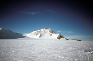
Brand Peak , Antarctica. Source: euphro, Wikimedia Commons.
The Earth’s surface temperatures can have a profound effect on the Earth’s ice sheets, the huge layers of ice thousands of metres thick that cover Greenland and Antarctica. Over the past few decades, satellites have monitored the changes of these icy landscapes, revealing that parts of Greenland and West Antarctica are melting. This is important as it contributes to sea level rise, which can have significant impacts on vulnerable coastal lands.
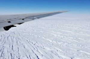
Pine Island Glacier in West Antarctica, seen from NASA’s DC-8 research aircraft, 2009. Source: NASA/Jane Peterson.
So far, however, East Antarctica’s ice sheet, the largest on the planet, has been seemingly stable. One big question Earth scientists have busied themselves with is just how stable this ice sheet is, and whether or not it will be affected by the continuing CO2 emissions and rising temperatures that are projected for the coming century.
To try and get some answers, scientists can turn to the past. By looking at rocks or sediments that covered the Earth thousands or millions of years ago, at times when the Earth’s climate was either similar or different to today, they can study how the environment responded to these changing climates.
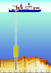
Sketch of a core being sampled from the seafloor. Source: Hannes Grobe/AWI, WIkimedia Commons.
Between about 5 and 2.5 millions of years ago, during a time we call the Pliocene epoch, the Earth’s climate was very similar to that which scientists predict for the end of this century. Temperatures were about 3°C warmer than they are today, and CO2 levels were similar to those that are found in the atmosphere at present. By going to the bottom of the ocean and studying ancient Antarctic sediments from this time, Earth scientists can try to paint a picture of what Antarctica looked like under these conditions, which scientists suggest we may be facing in a few decades.
The chemical composition of buried sediment grains, dust and tiny algae can reveal information about the temperature of the water, its salinity, and also where the buried material physically came from before it found its way to the bottom of the ocean. By using very sensitive geochemical fingerprinting tools, scientists have for example found that sediments taken from the seafloor 350km off the coast of East Antarctica had originally come from a region of Antarctica called the Wilkes Basin, today buried deep under the ice sheet. For material from the Wilkes Basin to have been eroded and transported to the bottom of the sea, this region must have been out in the open and ice-free.
This could suggest that during warmer periods of the Pliocene, part of Antarctica’s giant East ice sheet did melt, and scientists think that such an amount of melting would have contributed to between 3 and 10 m of sea level rise. Today, such a rise, if it were to happen, could have important consequences.
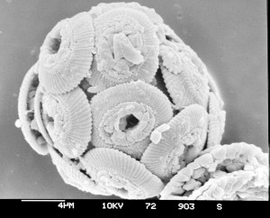
Microfossils from a sediment core. Source: Hannes Grove/AWI, Wikimedia Commons.
Geological results such as these, not only from Antarctica, but from across the world’s oceans and seas, can provide important new constraints to help scientists understand what sort of environmental changes we may be facing tomorrow.
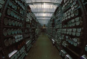
Geological core repository for sediment samples. Source: Hannes Grobe/AWI, WIkimedia Commons.
