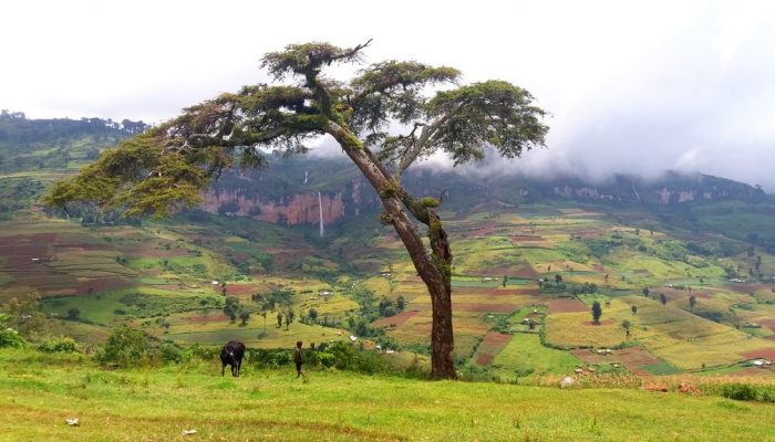
This colourful cropland patchwork is located on the fertile flanks of Mount Elgon, Uganda at an elevation of 2,400 metres above sea level. The extinct shield volcano, the oldest in East Africa, is mostly covered in clouds and provides an infinite flow of wonderful waterfalls. Due to the climate at this elevation, the cultivated crops experience more temperate weather conditions compared to crops m ...[Read More]
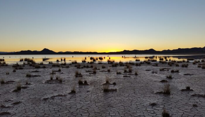
Imaggeo on Mondays: The Crossroads of Flood and Drought
This picture was taken on the way back from collecting field measurements at the Lordsburg Playa in southwestern New Mexico, USA. The setting sun highlights the contrast between the dry, cracked soil and the standing water from antecedent rainfall. A playa is a flat topographic depression in arid or semi-arid regions that contains a large amount of deposited sediment. When the surface of the playa ...[Read More]
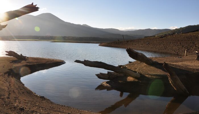
Imaggeo on Mondays: Chilean relics of Earth’s past
As Earth’s environment changes, it leaves behind clues used by scientists to paint portraits of the past: scorched timber, water-weathered shores, hardened lava flows. Chile’s Conguillío National Park is teeming with these kind of geologic artifacts; some are only a few years old while others have existed for more than 30 million years. The photographer Anita Di Chiara, a researcher at Lancaster U ...[Read More]
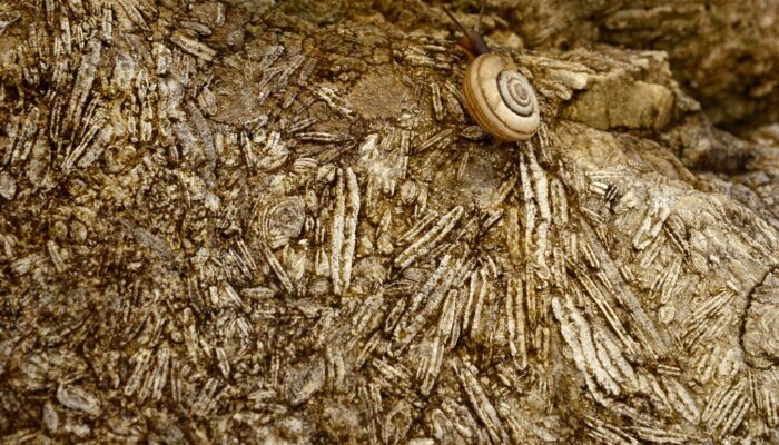
Imaggeo on Mondays: Nummulites, the living lentils
This photograph depicts a close-up of Eocene limestones from the Sardinero Formation in Cantabria (Northern Spain). The limestone is rich with foraminifera shells, most of them from the Nummulitidae family. These organisms once lived in a very shallow sea that separated Europe from Iberia in the late Mesozoic and early Cenozoic era. Later the sea basin’s closure led to the formation of the Pyrene ...[Read More]