GeoLog

earthquake

The day the Earth trembled: A first-hand account of the 25 April Nepal earthquake

The day the Earth trembled: A first-hand account of the 25 April Nepal earthquake

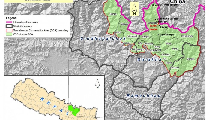
On the 25th April 2015, Viktor Bruckman, a researcher at the Austrian Academy of Sciences, and a team of his colleagues were a few hours into a hike between the settlements of Lamabagar, in a remote area of northeastern Nepal, and the Lapchi Monastery when a magnitude 7.8 earthquake struck Nepal. Their journey cut short by the trembling Earth, stranded in the heights of the Himalayas, this is thei ...[Read More]

GeoEd: A risky business

In this month’s GeoEd post, Sam Illingworth explores the pitfalls of being a scientist in the public eye. Following the recent acquittal of 6 geoscientists on manslaughter charges after ‘failing’ to predict the 2009 L’Aquila earthquake, is it time we thought about improving how risk is communicated to the wider public? At the beginning of November of this year, six Italian scientists were acquitte ...[Read More]

GeoTalk: Matthew Agius on how online communication can help identify earthquake impact

In this edition of GeoTalk, we’re talking to Matthew Agius, a seismologist from the University of Malta and the Young Scientist Representative for the EGU’s Seismology Division. Matthew gave an enlightening talk during the EGU General Assembly on how communication on online platforms such as Facebook can help scientists assess the effect of earthquakes. Here he shares his findings and what wonders ...[Read More]

It’s not my fault

A line on a map is important. In the Beverly Hills region of Los Angeles a series of mapped fault lines are now the cause of a major controversy. Communities have been alarmed, money has been lost and legal proceedings are ongoing. It started in 1992. James Dolan and Kerry Sieh, two earthquake geologists at the California Institute of Technology, published a map in a field trip guidebook about the ...[Read More]