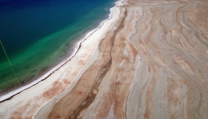
This is an aerial image taken from a balloon at around 150m height, at the eastern shoreline of the Dead Sea. Such “selfies” are scientifically valuable, providing important data that help researchers to analyze the morphology of the retreating lake and investigate associated hazards like sinkholes, subsidence and landslides. The older shorelines, visible as lines on the shore stand fo ...[Read More]
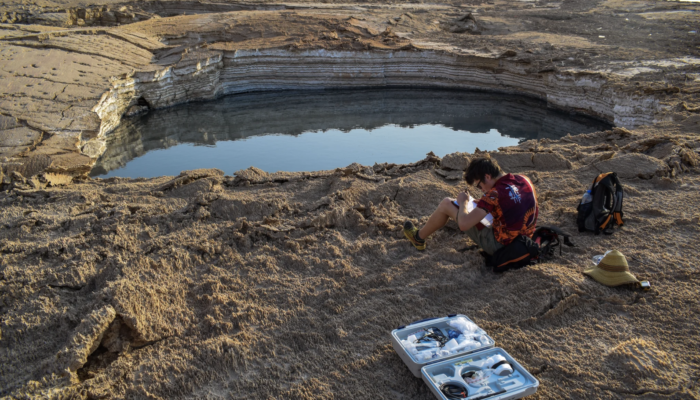
Imaggeo on Mondays: Sampling sulfurous sinkhole water
Sampling of water present in sinkhole formed in superficial salt-rich lacustrine deposits at Ghor Al-Haditha, Dead Sea eastern shore, Jordan, during a field campaign in October 2018. The water in this sinkhole flows into the Dead Sea in a surface stream channel formed in 2012. The water was highly acidic and extremely conductive, with a strong sulfurous odour. Understanding the chemistry of the wa ...[Read More]
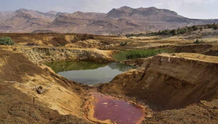
Imaggeo on Mondays: The colourful sinkhole clusters at Ghor Al-Haditha
Sinkholes that form on the Dead Sea shore at Ghor Al-Haditha, Jordan, often occur in clusters, with many holes packed into a small area. However the visual appearance of neighbouring sinkholes can vary significantly. Mineral precipitation in the foremost sinkhole in this picture, which has no fresh water supply, gives it a garish pink-orange colouration. The larger hole behind has a groundwater-de ...[Read More]
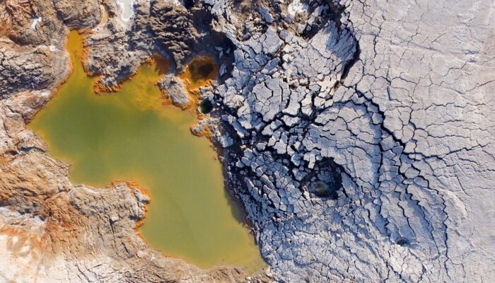
Imaggeo on Mondays: Hole in a hole in a hole…
This photo, captured by drone about 80 metres above the ground, shows a nested sinkhole system in the Dead Sea. Such systems typically take form in karst areas, landscapes where soluble rock, such as limestone, dolomite or gypsum, are sculpted and perforated by dissolution and erosion. Over time, these deteriorating processes can cause the surface to crack and collapse. The olive-green hued sinkho ...[Read More]