If you are a scientist you probably know the value of a good, well designed image. The right graph or diagram can help the reader to really grasp the meaning of a complicated theory or process, help to illuminate a critical piece of data, or highlight a key finding. But whilst much advice exists about how to create effective, accessible images, what about photographs? In our early training, ...[Read More]
Imaggeo On Monday: Geoscientific selfie at the Dead Sea

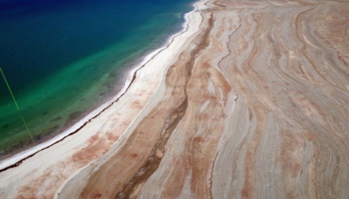
Geoscientific selfie at the Dead Sea. Credit: Djamil Al-Halbouni (distributed via imaggeo.egu.eu)
This is an aerial image taken from a balloon at around 150m height, at the eastern shoreline of the Dead Sea. Such “selfies” are scientifically valuable, providing important data that help researchers to analyze the morphology of the retreating lake and investigate associated hazards like sinkholes, subsidence and landslides. The older shorelines, visible as lines on the shore stand fo ...[Read More]

