Blue Olivine set in a matrix of pyroxene, magnetite and plagioclase in a basalt collected by the photographer, Bernardo Cesare, on the shore of the Sea of Galilee, Israel. Polarized light photomicrograph. Crossed polarizers and red tint plate. Width c. 2.7 mm. Who may have been throwing this stone a couple millennia ago? Description by Bernardo Cesare, after the description on imaggeo.egu.e ...[Read More]
Imaggeo On Monday: Blue Olivine in an unusual basalt
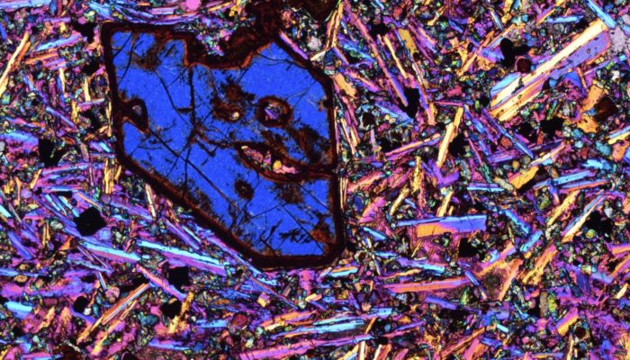
Blue Olivine in an unusual basalt. Credit: Bernardo Cesare (distributed via imaggeo.egu.eu)