This is a photograph of Uluru, in the Northern Territory of Australia, on a hot and humid summer afternoon. As lightning flashed about, torrential rains swept across the landscape and silver rivulets of water began to rush down the sides of the mountain. Uluru is made of red-coloured Proterozoic arkosic sandstones, a coarse grained lithology rich in quartz and feldspars. However, on rare days such ...[Read More]
Imaggeo on Mondays: Storm on the Rock
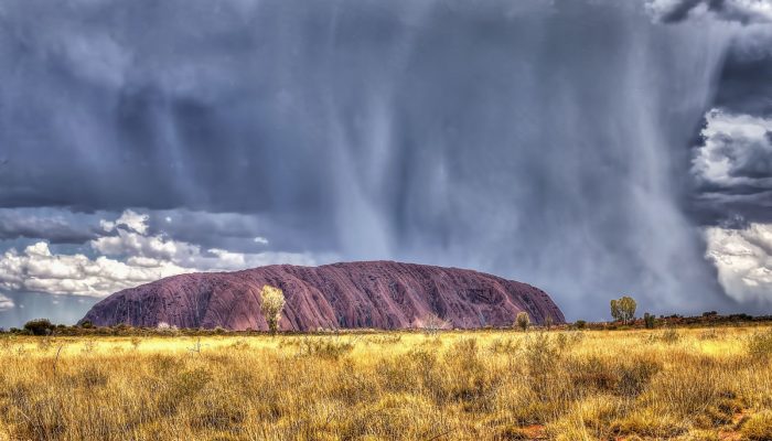
Storm on the rock. Credit: John Clemens (distributed via imaggeo.egu.eu)