Today’s post takes us to the far northern reaches of our planet, to a desert like nothing you’ve seen before. This picture is a view to the north across Alexandra Fjord, on the east coast of Ellesmere Island, in the Canadian High Arctic, with Sphynx island in the middle of the fjord. The south shore of Alexandra Fjord includes a polar oasis, an area of tundra vegetation and relatively mild climati ...[Read More]
Imaggeo on Mondays: Low tide at Alexandra Fjord
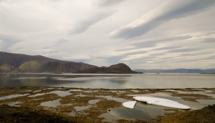
Low tide at Alexandra Fjord . Credit: Martin Brummell (distributed via imaggeo.egu.eu).