This photo, captured by drone about 80 metres above the ground, shows a nested sinkhole system in the Dead Sea. Such systems typically take form in karst areas, landscapes where soluble rock, such as limestone, dolomite or gypsum, are sculpted and perforated by dissolution and erosion. Over time, these deteriorating processes can cause the surface to crack and collapse. The olive-green hued sinkho ...[Read More]
Imaggeo on Mondays: Hole in a hole in a hole…
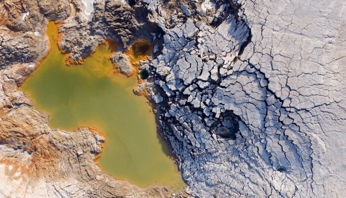
Hole in a hole in a hole.. Credit: Djamil Al-Halbouni (distributed via imaggeo.egu.eu)

