One of the world’s most volcanically active regions is the Kamchatka Peninsula in eastern Russia. It is the subduction of the Pacific Plate under the Okhotsk microplate (belonging to the large North America Plate) which drives the volcanic and seismic hazard in this remote area. The surface expression of the subduction zone is the 2100 km long Kuril-Kamchatka volcanic arc: a chain of volcanic isla ...[Read More]
Imaggeo on Mondays: An explosive cloud
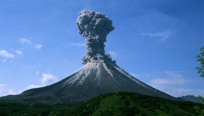
Karymsky volcano, 2004. Credit: Alexander Belousov (distributed via imaggeo.egu.eu)
