Our climate is constantly changing, and with the help of simulation modelling, scientists are working hard to better understand just how these conditions will change and how it will affect society. Science journalist Conor Paul Purcell has worked on Earth System Models during his time as a PhD student and postdoctoral researcher; today he explains how scientists use these models as tools to foreca ...[Read More]
How to forecast the future with climate models
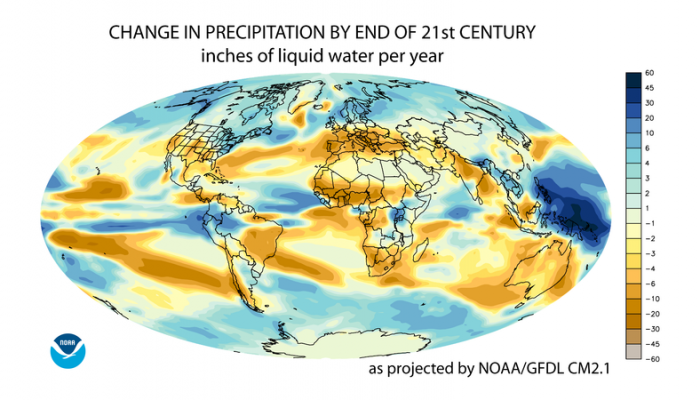
This world map shows the change in annual average precipitation projected by the GFDL CM2.1 model for the 21st century (Credit: NOAA Geophysical Fluid Dynamics Laboratory, via Wikimedia Commons)