That soils are vital to secure our future supplies of water, food, as well as aiding adaptation to climate change and sustaining the planet’s biosphere is a subject we’ve featured on the blog as recently as the summer. That’s because never have humans been more out of touch with the vital importance of this natural resource. Inhabiting among soil particles thrives an even less familiar, but equall ...[Read More]
Imaggeo on Mondays: The invaluable role of soil dwellers
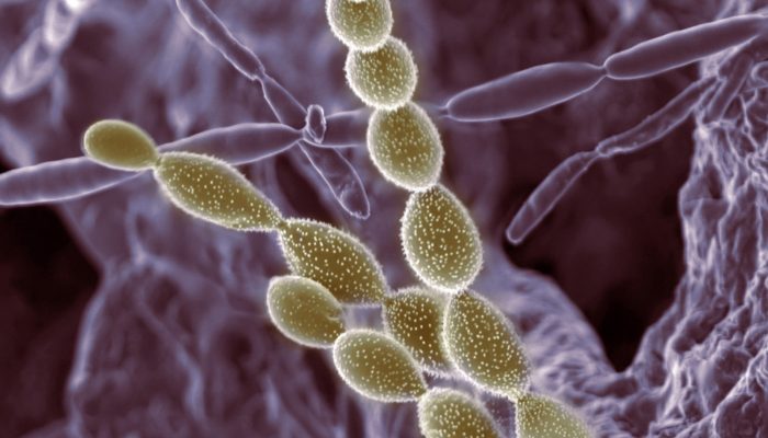
Find a new way . Credit: Alice Dohnalkova (distributed via imaggeo.egu.eu)