
The Svalbard archipelago is considered to be one of the best places to study the geological history of the Earth because its rocks represent every geological period. This image shows a view from the peak of Fugleberget (569 m a. s. l.; 77º 00’ N, 15º 30’ E) on the south-western coast of the island of Spitsbergen. Glaciation of this geologically diverse area gave rise to a variety of geomorphic fea ...[Read More]
Imaggeo on Mondays: A Patagonia landscape dominated by volcanoes
Imagine a torrent of hot and cold water, laden with rock fragments, ash and other debris hurtling down a river valley: this is a lahar. A by-product of eruptions of tall, steep-sided stratovolcanoes, lahars, are often triggered by the quick melting of snow caps and glaciers atop high volcanic peaks. The history of the Ibañes River and its valley, in southern Chile, are dominated by their proximity ...[Read More]
Imaggeo on Mondays: A solitary floating island
With 2014 officially named the hottest year on record, there is evidence of the effects of rising global temperatures across the globe. The solitary, shimmering iceberg in today’s Imaggeo on Mondays photograph is a reminder that one of the best places to look for evidence of change is in glaciers. Daniela Domeisen tells the story of this lonely frozen block of ancient ice. The picture shows an ice ...[Read More]
Geosciences Column: Do roads mean landslides are more likely?
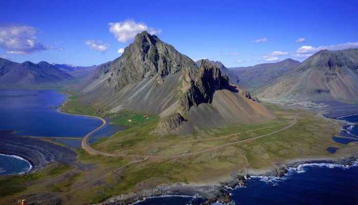
The Hvalsnes landslide, Eastern Iceland. Credit: Ragnar Sigurdsson (arctic-images.com; distributed via imaggeo.egu.eu)
Landslides have been in the news frequently over the past 12 months or so. It’s not surprising considering their devastating consequences and potential impact on nearby communities. Data collected by Dave Petley in his Landslide Blog shows that from January to July 2014 alone, there were 222 landslides that caused loss of life, resulting in 1466 deaths. A recent paper, in the journal Natural Hazar ...[Read More]