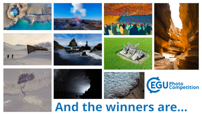
For this year’s Photo Contest, EGU received a number of amazing images capturing a broad spectrum of the geosciences. Since the selection committee whittled the field down to 10 finalists, you have been voting for your favourites throughout EGU24’s week-long conference, both on-site in Vienna at the EGU booth, and online. After an enthusiastic response from voters, we are now ready -and very excited- to announce the winners!
Congratulations to these superb photographers!
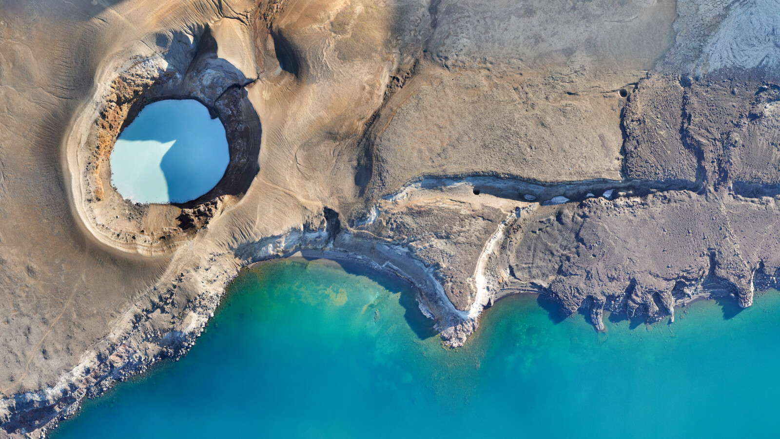
Volcano-tectonic interaction by Nicolas Oestreicher
The early morning sun highlights the topography at the Viti crater, situated next to the Öskjuvatn Lake, Iceland. Geologists measured ground displacement by flying a drone over the lake shores every few years and comparing the changes between successive 3D surface models. We see here a detail of the 2023 orthophoto, generated with >11’000 photos of a Wingtra One GenII drone. While the Viti crater was formed in 1875 and contains acidic (pH 2) and warm (28°C) water, the Öskjuvatn Lake is neutral and cold, explaining the colour change. The Viti crater is about 190 m in diameter for scale.
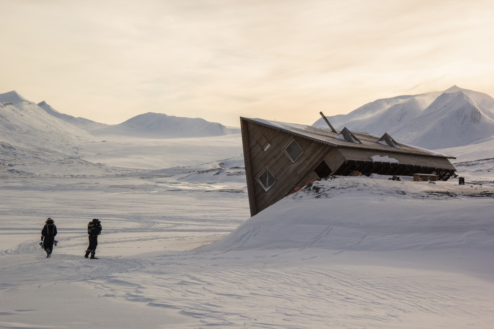
Permafrost melt and glacial retreat outpacing human expectations by Stan Schouten
This symbolic small cabin stood precariously on a relic of the Gronfjordbreen glacier, Svalbard. As with many other glaciers the Gronfjordbreen, is melting quickly in our changing world. With rising waters in its proglacial lake the moraine underneath the cabin collapsed soon after the cabins’ completion.
The tale of the fallen cabin is not one of despair, but a stark message etched in the relentless landscape. Nature’s timetable is not ours to dictate, and the consequences of underestimating the speed at which our climate is changing can be swift and unforgiving. It is a comic reminder of humanity’s struggle to grasp the true pace of a changing planet. This picture was taken during a geology fieldwork course at UNIS, Svalbard.
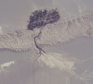
Satellite image of the tree-like village by Mohammad Goudarzi
Keshit village in Kerman province, Iran, which looks a lot like a tree in satellite images.
Imaggeo is the EGU’s online open access geosciences image repository. All geoscientists (and others) can submit their photographs and videos to this repository and, since it is open access, these images can be used for free by scientists for their presentations or publications, by educators and the general public, and some images can even be used freely for commercial purposes. Photographers also retain full rights of use, as Imaggeo images are licensed and distributed by the EGU under a Creative Commons licence. Submit your photos at http://imaggeo.egu.eu/upload/.

