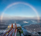
Some humans are racing to map the moon, Mars, and the stars, yet the very ground beneath our oceans remains largely unknown. What does it say about us, that we can chart the craters of distant planets before we bother to understand the seafloor that feeds us, cools us, and regulates our climate?
In an age of climate breakdown, ecological collapse, and blue economy buzzwords, the seabed has become a paradox: out of sight, but increasingly in demand. Governments and corporations are scrambling to map it; with agendas beyond protection: to mine, claim and control it.
But what if we flipped the script?
What if seabed mapping became an act of care rather than conquest? A tool not for extraction, but for regeneration? As we mark World Hydrography Day tomorrow, it’s time to ask: can mapping the ocean floor help restore (not ravage) our planet? Can we reimagine hydrography not as a neutral science, but as a political and ecological practice that centers justice, transparency, and healing?
I recently came across a research paper that has inspired me to write this blog. The paper is titled “A Pause or Moratorium for Deep Seabed Mining in the Area? The Legal Basis, Potential Pathways, and Possible Policy Implications” which was written by researchers at the Research Institute for Sustainability (RIFS), led by Pradeep Singh. The paper argues for a “precautionary pause” or moratorium on deep-sea mining until robust regulations are in place. Pressure is mounting on the International Seabed Authority (ISA) to finalise a mining code after the island nation of Nauru triggered the “two-year rule” in 2021. However, the ISA missed the deadline, which raised concerns that mining could begin without sufficient environmental safeguards. While a moratorium carries more legal weight, a precautionary pause is a more flexible and politically feasible step that still aligns with international law and anticipatory principles. Both options would delay mining and allow time to address major knowledge, regulatory, and governance gaps.
The paper also warns of potential geopolitical consequences and interest in mining within national waters if activities are postponed. Still, the authors argue that delaying exploitation is the most responsible choice, especially given the limited scientific understanding of deep-sea ecosystems and the complexity of ongoing ISA negotiations.
This tension between extraction and preservation sits at the heart of a deeper question: what kind of future are we mapping toward?
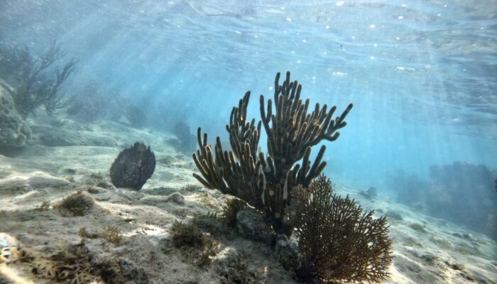
The ocean floor: Earth’s underexplored treasure
Hydrography is the science of measuring and describing the physical features of oceans, seas, coastal areas, lakes, and rivers. It is the foundation of all marine knowledge and within that vast field, seabed mapping has become one of the most vital tools of the 21st century. Using sonar, satellites, autonomous underwater vehicles (AUVs), and deep-sea submersibles, scientists can now create detailed maps of underwater landscapes that were, until recently, invisible.
Yet, even today, only circa 26.1% of the global seafloor has been mapped to modern standards. This statistic is as startling as it is revealing. We know more about the surface of Mars than we do about the bottom of our own oceans.
Why is this significant? Because the seabed holds the keys to understanding marine biodiversity, the dynamics of climate change, tectonic activity, and even the ancient history of our planet. From undersea volcanoes to sprawling coral reefs and deep-sea canyons, the bathymetry (underwater topography) of the seafloor determines where life can thrive and where ecosystems are at risk.
Mapping is not just a scientific endeavor; it is a form of environmental justice. Without knowing what’s beneath the waves, how can we protect it? How can coastal communities advocate for their rights when offshore industries dredge, drill, or dump in areas with little or no oversight or accountability?
Climate, carbon, and cartography
Our oceans absorb roughly 30% of the carbon dioxide released into the atmosphere and over 90% of the excess heat trapped by greenhouse gases. Much of this carbon is stored in seabed sediments, which are a form of natural climate regulation scientists call blue carbon.
Yet without accurate seabed data, we remain largely in the dark about where this carbon is stored, how much exists, and how susceptible it is to disruption by human activity. Practices like bottom trawling, for example, churn up seafloor sediments and risk releasing massive amounts of carbon back into the water column, which could reverse some hard-won climate gains. By identifying carbon-rich zones through detailed seabed mapping, we can better protect these areas and potentially designating them as off-limits to trawling, dredging, or mining. Mapping also helps us track the impacts of sea level rise, changing ocean currents, and warming waters on fragile ecosystems like seagrass beds, coral reefs, and mangrove forests, which are critical habitats that not only sequester carbon but also shield coastlines from erosion. In this way, ocean cartography, when guided by equity and science, has the power to become a tool for climate justice.
Restoration through revelation
Restoration is a term that, in my opinion, conjures up images of planting trees or rewilding forests. But the ocean needs restoring too, and it begins with knowing what we’re working with.
Marine restoration projects, whether focused on coral reefs, kelp forests, or shellfish beds, all depend on accurate baseline data. Where is the damaged habitat? What species once thrived there? What are the physical conditions (depth, temperature, substrate) that support regrowth?
Seabed mapping can answer these questions. For instance:
-
In the Mediterranean, researchers are using high-resolution mapping to identify lost seagrass meadows, which can then be replanted to sequester carbon and protect fish nurseries.
-
In the Caribbean, bathymetric surveys are helping locate coral rubble fields left by hurricanes and bleaching events, allowing conservationists to anchor coral fragments in optimal locations for regrowth.
-
In the Arctic, Indigenous communities are co-leading mapping initiatives that chart ice-covered seafloors to inform conservation efforts and track environmental change.
These stories reveal a truth: the path to restoration starts with revelation.
Who’s mapping the seabed and why that matters
As interest in seabed mapping grows, a key question emerges: who is doing the mapping, and for what purpose?
While many hydrographers and ocean scientists are committed to conservation and sustainability, commercial interests are also rapidly expanding into the deep sea. From mining companies eyeing polymetallic nodules to governments vying for undersea territory, not all mapping efforts are created equal. In some cases, mapping is a prelude to exploitation rather than protection. Companies may fund mapping to identify resource-rich areas for extraction, usually with minimal consultation from local communities or ecological assessment.
This is where inclusive, ethical hydrography comes in. Just as we’ve begun to question who gets to produce climate data on land, we must also ask who is shaping our understanding of the ocean floor.
Academic understanding of Ethical Hydrology Practices involves deconstructing anthropocentric biases, embracing biocentric values, and addressing the socio-political dimensions of water governance to achieve truly sustainable and just water futures. Sustainability Directory
Community-led mapping initiatives, open-source bathymetric databases, and decolonial approaches to hydrography are essential to ensuring that seabed mapping serves the planet, not just profits.
Projects like Seabed 2030, a global initiative to map the entire seafloor by 2030, are promising especially when they emphasize partnerships with small island states, Indigenous communities, and underrepresented researchers.
The promise of tech, the power of people
Technological advances are making seabed mapping more accessible than ever. Low-cost sonar systems, crowd-sourced bathymetry from sailors and fishers, and AI-assisted interpretation of satellite altimetry are revolutionizing the field.
But tech alone won’t save the oceans. The true promise of seabed mapping lies in combining technology with local knowledge, community engagement, and environmental justice.
Consider the example of Papua New Guinea, where coastal villagers are using simple sonar devices to map their own reefs, helping them manage local fisheries more sustainably.
Or take Norway, where mapping of marine habitats led to a shift in national policy, banning oil drilling in vulnerable Arctic areas.
In both cases, seabed data was not hoarded—it was shared, interpreted, and acted upon. That’s the kind of mapping that can restore the blue planet.
A feminist, decolonial view of the seafloor
As an ecofeminist, I believe that the ocean is not just a resource to be exploited, but a living, relational space, interwoven with our bodies, stories, and cultures. The way we approach seabed mapping reflects our values.
Do we treat the ocean floor as a blank slate for extractive capitalism? Or do we recognize it as a dynamic, sacred space deserving of care, reciprocity, and protection?
Decolonial thinkers remind us that many Indigenous peoples have always had maps—oral, embodied, and spiritual—of the seafloor. They didn’t need sonar to know the tides, currents, and ecologies beneath them. What modern hydrography can learn from these traditions is humility: that knowledge is not only found in pixels, but in people.
A feminist approach to mapping is also about visibility: making visible what has been erased, marginalized, or submerged—whether it’s the deep sea, the labor of women in ocean science, or the voices of coastal communities fighting for survival.
Toward a just blue future
World Hydrography Day is not just for cartographers or marine surveyors. It’s a moment to reflect on how we know our planet and what we choose to do with that knowledge.
Seabed mapping is not a silver bullet. It is a powerful lever, one that can support marine protected areas, improve coastal adaptation, guide sustainable fisheries, and elevate the rights of ocean-dependent communities.
To realize this potential, we must push for:
-
Open data: Free and accessible bathymetric data that doesn’t privilege the Global North.
-
Co-production of knowledge: Scientists, fishers, Indigenous leaders, and civil society working together to define priorities.
-
Ethical funding: Mapping projects must be transparent about their goals and accountable to both ecological and human communities.
-
Restoration-based policies: Use mapping as a foundation for regeneration, not just regulation.
Final thoughts
Mapping the seabed is more than a technical task: it’s a deeply political and ethical act that reimagines our relationship with the ocean. It’s not enough to chart what lies beneath; we must ask why we’re doing it, who benefits, and who is left out.
As scientists, we have a responsibility to go beyond data collection. We must speak out when seabed knowledge is used to justify extraction instead of protection. We must prioritize transparency, justice, and collaboration over competition and secrecy. We must build bridges with coastal communities, Indigenous leaders, and civil society, not just to share findings, but to shape the very questions we ask. In this moment of ecological urgency, ocean science cannot afford to be neutral. It must be bold, inclusive, and rooted in care.
So I invite you, especially those of you working in marine geoscience, hydrography, and ocean systems, to stay curious and use that curiosity to go further: explore how your research can inform policy, support moratoria on destructive activities like deep-sea mining, and empower coastal and Indigenous communities with knowledge that is theirs to begin with. Push to make your maps not only legible to other scientists, but useful to advocates, regulators, and the people whose lives depend on the ocean. The future of the seabed is being negotiated right now in law, in diplomacy, in boardrooms, and in science. And you, my dear reader, can help shape these negotiations!