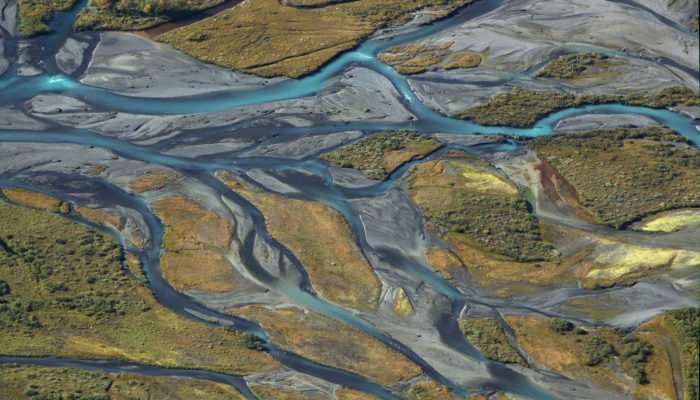
A view of the southern edge of the Ladebakte mountain in the Sarek national park in north Sweden.
At this place the rivers Rahpajaka and Sarvesjaka meet to form the biggest river of the Sarek national park, the Rahpaädno. The rivers are fed by glaciers and carry a lot of rock material which lead to a distinct sedimentation and a fascinating river delta for which the Sarek park laying west of the Kungsleden hiking trail is famous.
As the borders of this picture are not straight (due to lens-correction in GIMP) an edited version has been uploaded.
Description by Jakob Keck, as it first appeared on imaggeo.egu.eu.
Imaggeo is the EGU’s online open access geosciences image repository. All geoscientists (and others) can submit their photographs and videos to this repository and, since it is open access, these images can be used for free by scientists for their presentations or publications, by educators and the general public, and some images can even be used freely for commercial purposes. Photographers also retain full rights of use, as Imaggeo images are licensed and distributed by the EGU under a Creative Commons licence. Submit your photos at http://imaggeo.egu.eu/upload/.

Kizash
Magnificent