Below the warm and tranquil waters of the Caribbean, some 480 km away from Puerto Rico, the North America Plate is being subducted under the Caribbean Plate. This has led to the formation of the Lesser Antilles volcanic arc; the result of the formation of reservoirs of magma as fluids from the down going North America Plate are mixed with the rocks of the overlying Caribbean Plate.
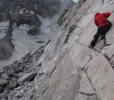
The continued magma generation is expressed violently at the surface on Monserrat Island, which has been the subject of extensive scientific scrutiny since the mid-1990s. This is all because of Soufrier Hills volcano, a Pele’ean type lava dome complex. This means that rather than explosive eruptions taking place, very viscous lava is slowly erupted from the volcano’s vent. The lava is so sticky and gooey that instead of flowing away, down the flanks of the volcano, it accumulates in the vent area and forms a large plug. Lava domes come in a range of shapes and sizes, in the case of Soufrier Hills, it tends to be circular and quite spiky.
Just because the eruptions on this Carbbien Island aren’t generally as spectacular, as for instance at Mt Etna in Italy, they are no less deadly! A common hazard associated with the building up of a dome by the continued accumulation of volcanic material means they can become dangerously unstable and collapse. The volcanic material careers down the flanks of the volcano in the form of pyroclastic density currents (PDCs). The largest such collapse ever observed took place in July 2003 and numerous smaller flows have occurred since. One rather large collapse happened in early 2010, when the dome atop Soufrier Hills had grown to be 1150 m asl (above sea level). After a period of unrest which started in late 2009 and was characterised by seismicity and extrusion of lava from the vent, there was a catastrophic dome collapse in February which reduce the summit height by almost 100m!
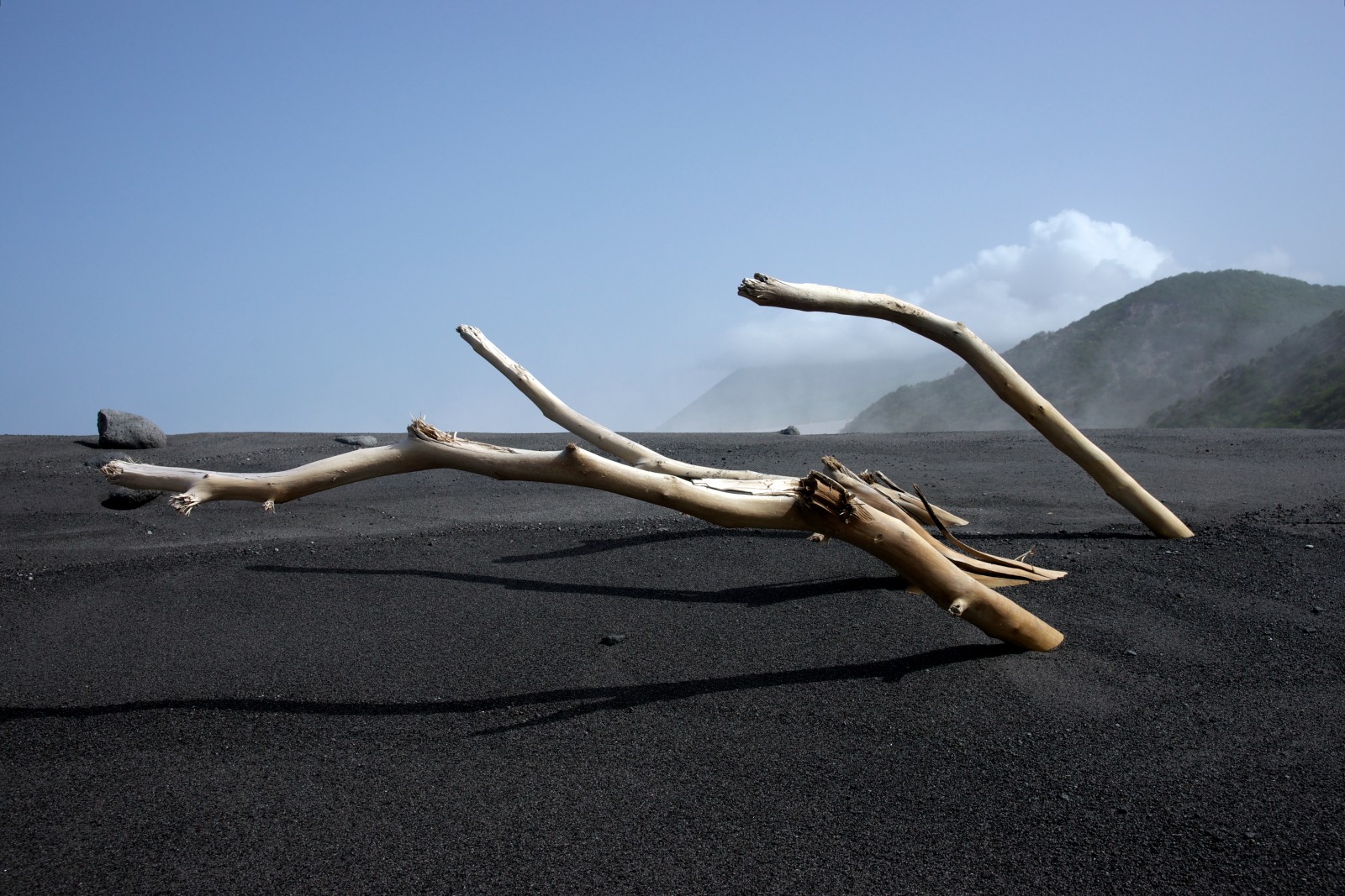
Pyroclastic flow, Montserrat. Credit: Alan Linde (distributed via imaggeo.egu.eu)
“The photo is taken from a spot at the water’s edge (just behind me) that was previously about 200 m out to sea. A PDC pushed the shoreline out by as much as ~600 m,”
says Alan Linde, who took this photograph of the smoking black landscape in April 2010.
Alan and the research team from the Department of Terrestrial Magnetism (DTM, Carnegie Institution for Science) have been involved with studying Soufrier Hills since 2003. By installing a network of very sensitive instruments in small shafts dug into the ground in and around the volcano, known as borehole strainmeters, they can measure changes in the size and volume of the ground as a result of dome collapses and explosive eruptions.
“One of our borehole sites, very close to the coast, was almost destroyed by the hot ash. There is a clear change (from before to after the flow) in the tidal signals recorded by that site because an area of ocean loading has been removed as a result of the ash filling in and moving the coastline. The volcano is behind the small mountains, obscured by cloud.”
Imaggeo is the EGU’s online open access geosciences image repository. All geoscientists (and others) can submit their photographs and videos to this repository and, since it is open access, these images can be used for free by scientists for their presentations or publications, by educators and the general public, and some images can even be used freely for commercial purposes. Photographers also retain full rights of use, as Imaggeo images are licensed and distributed by the EGU under a Creative Commons licence. Submit your photos at http://imaggeo.egu.eu/upload/.