Tapping into commercial datasets
Over the last two years, I have had the opportunity to work on a variety of construction related projects across Alberta, both as a palaeontologist and as geologist. They have included pipeline lays and inspections, bridge and highway remediation, building projects, quarrying and dam construction. Each of the projects has offered the chance to examine brand new exposures of sedimentary bedrock and/or glacial deposits, with many yielding terrific datasets that can readily be studied by researchers.
I believe that both industry and academia are missing a trick in not looking for cooperative ventures. The companies can benefit from having the data explored by experienced scientists, often free of charge, while the academic staff get the chance to work on previously untouched, often unique, geological datasets that range from structural to sedimentological to palaeontological and beyond in character. The examples provided below, all from projects that I have worked on over the last two years, demonstrate the sheer quality and diversity of the available data, while focusing mainly on the sedimentology. I am also including selected data that I collected while preparing a virtual field trip for industry, examining carbon sequestration.
Pipeline Installation
Our first project involved the palaeontological monitoring of trenching for a new pipeline. The trenches were typically around 4 m deep and 6 to 8 m wide, excavated using back hoes. In this area glacial and post glacial sediments overlie bedrock, as in much of Alberta away from the Rocky Mountains. The bedrock is mainly made up of Paskapoo Formation, deposited as terrestrial sediments on an extensive floodplain that dipped very gently down towards the east. Thick, blocky sandstone beds, deposited in river channels, are interbedded with light grey mudstones, the latter laid down on well oxygenated floodplains. I have discussed these deposits in a previous blog, so we will focus on the glacial deposits.
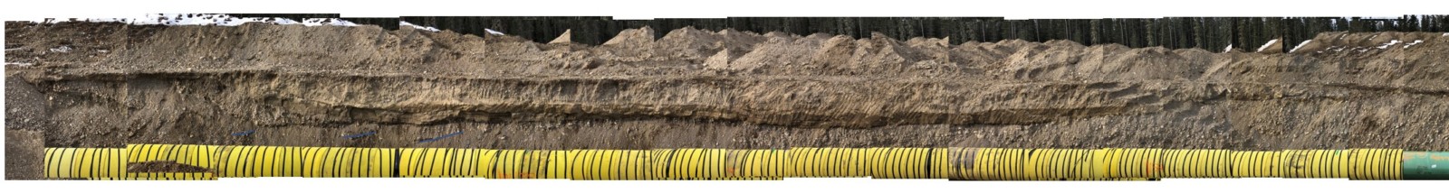

While the ridges comprise bedrock highs, the lows between them are filled with glacial deposits. Presumably the valleys were scoured by slow moving glaciers and then outwash channels flowed through them, depositing gravel and sandstone beds. A photomosaic along a trench allows the chance to map out these channels, picking out the sedimentary structures while enabling their precise dimensions to be measured. The sandier portions preserve root traces and other fossils, as we shall see in a later project.
Potential studies: palaeo-glacio-topography; glacial channel morphology; provenance.
Pipeline Inspection
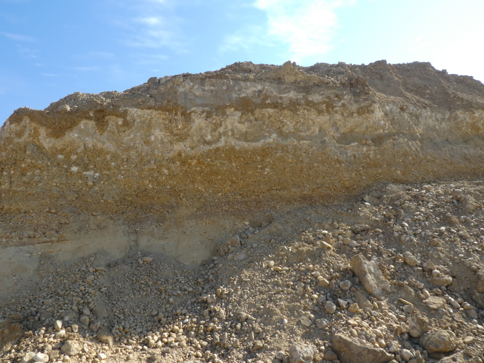
Gas pipelines require regular monitoring, usually undertaken by “pigs”, torpedo-like canisters designed to pass through the pipeline collecting data as they go. When a potential problem is identified, a pipeline integrity dig is undertaken in order to expose a section of pipeline between two welds. This particular dig exposed Campanian (Upper Cretaceous) sandstone beds capped by mudstone. The sandstone beds were deposited by low sinuosity channels, with stacked, trough cross-bedded sandstone beds capped by rippled silty sandstone. What made the outcropping clastics so interesting was the differential cementation. Siderite cements often target organic rich layers, and indeed there are some large logs preserved within the sandstone beds. However the cementation is not contained within particular beds, rather stepping from bed to bed across the limited area of exposure.
View of project area Cemented sandstone layers
Potential study: cementation behaviour in channel sandstone beds.
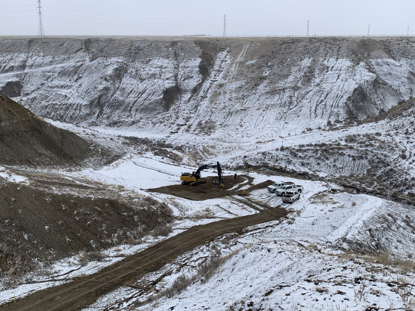
Gravel Pit
The third project was undertaken at a gravel pit exposing inter-glacial deposits. While ostensibly similar to the deposits exposed in the Pipeline Installation above, these sediments are older. The basal deposits are made up of thick, dark grey mudstone beds, capped by a gravel bed. This is in turn overlain by a striking fluvial deposit. Interbedded gravel and sandstone beds pick out inclined heterolithic stratification (IHS), which characterizes heterolithic, meandering channels. The interbeds may indicate seasonal variations in discharge. The channel is around 3 m in thickness, and at least one of the thicker sandstone beds, deposited on a fluvial point bar some 50,000 years ago, features burrows and even a fossil ground squirrel skeleton. Similar fossils have previously been published in the literature, but there is no substitute for finding them yourself.
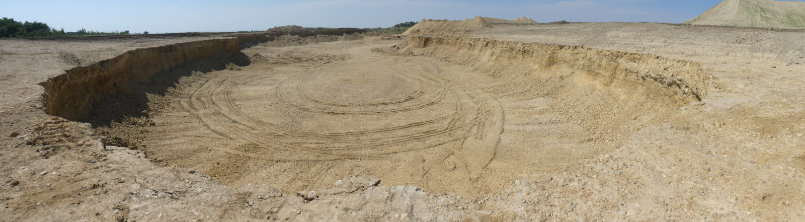
The Gravel Pit.

View of burrows and fossil ground squirrel skeleton
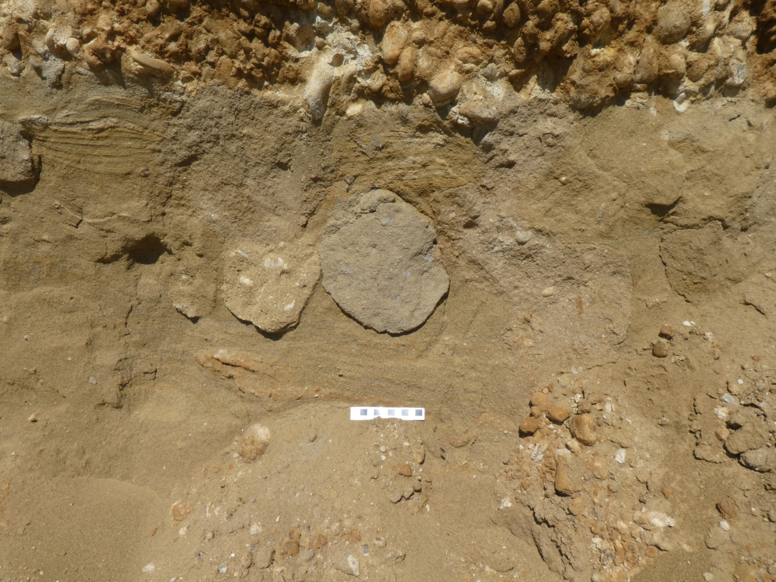
Another aspect of the gravel pit exposures is the glacial overprint. At least three structures in the pit relate directly to glacial processes. There are glacio-lacustrine deposits towards the top of the quarry; there is a potential solution pipe eroding down into the channel deposits; and there is possible ice heave with a bed of very unusual sedimentary structures. These alone would merit further study.
 Contorted sediments with caliche overlie meandering channel deposits with inclined heterolithic stratification.
Potential studies: glacial channel dimensions; ichnology of small mammal burrows.
Seismic Surveys
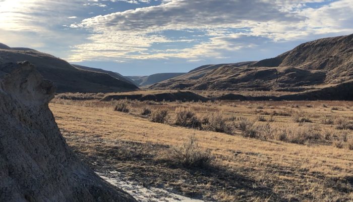
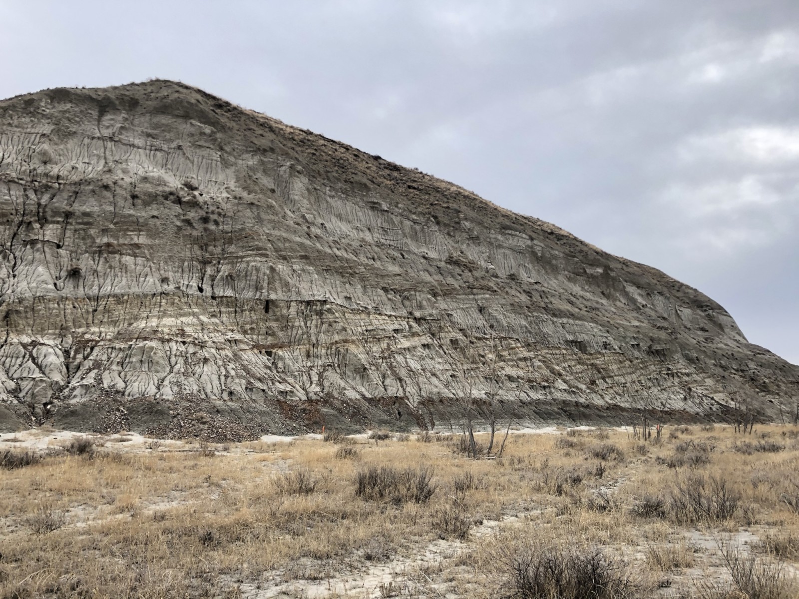
I have been involved in palaeontological monitoring of several seismic surveys. The aim of the monitoring is to visit every planned shot point, where bedrock is exposed, to ensure that the associated drilling will not damage any fossils at surface. In practice this means walking many kilometres through coulees that are sometimes littered with fossils. Nowhere is this truer than in the Princess region, close to Dinosaur Provincial Park, where Campanian age sediments are exposed in the badlands created by erosion within often steep sided coulees, or valleys. These were deposited in a terrestrial setting and, at this location, are often riddled with dinosaur remains.
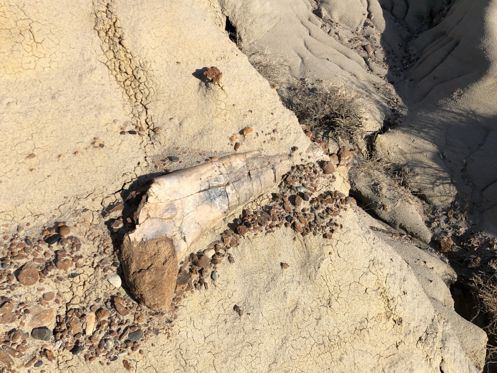
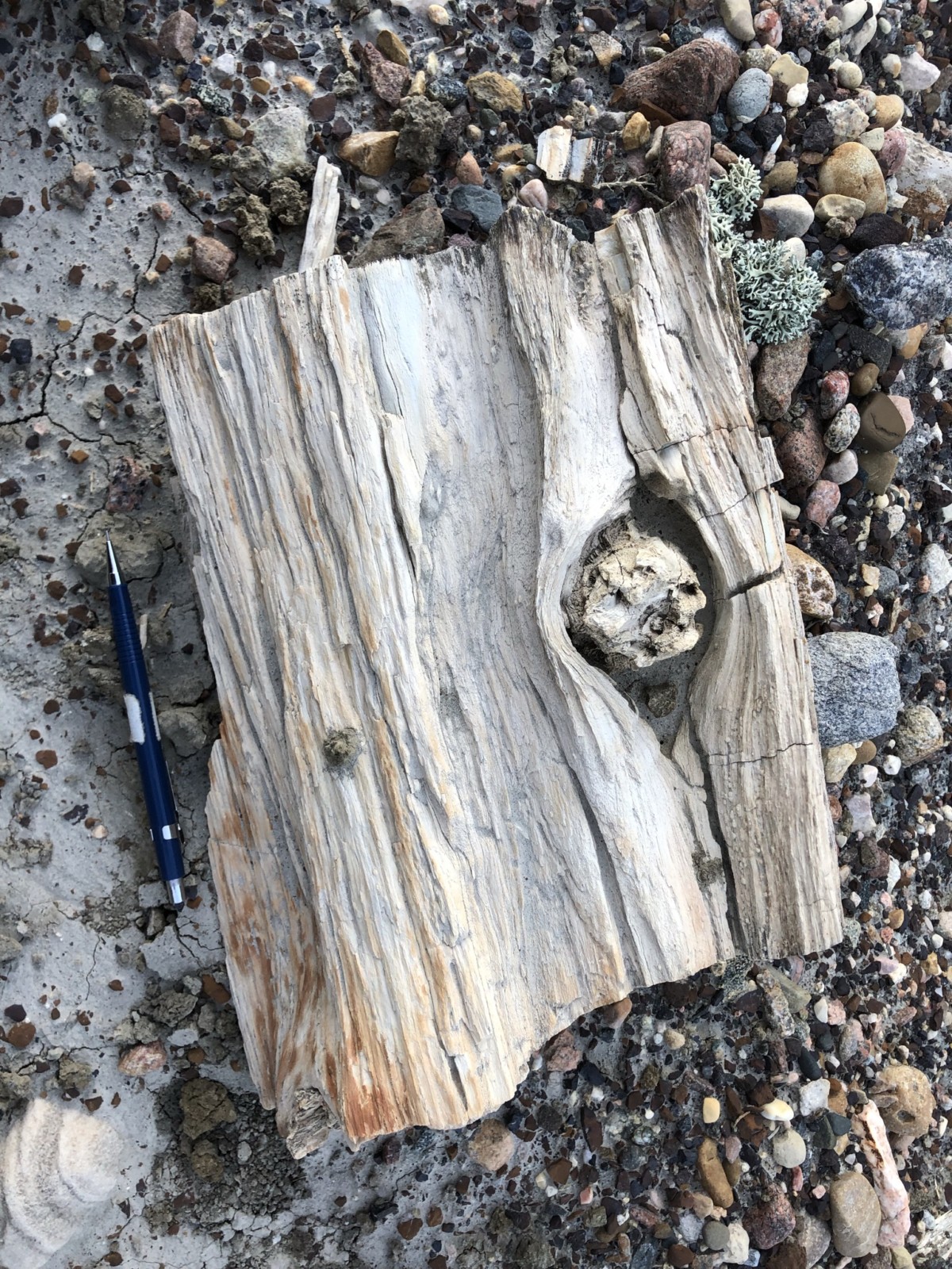
Fossil dinosaur femur, 1 metre long, and fossil wood
A single survey identified tens of significant sites including:
• A variety of channel deposits including isolated channels; stacked channels; trunk channels representing major fluvial systems; crevasse splays and interpreted pond deposits (22 sites)
• Fossil wood including logs and branches (17 sites where wood exceeded 10 cm)
• Dinosaur bones ranging from isolated bones (too common to count) to multiple bones (24 sites); bone beds (3 sites)
• Microvertebrate sites with small fossils including teeth, claws, scale and scutes, usually washed together as channel lags, by floods or on point bars (34 sites)
• Invertebrate and ichnological sites (6 sites)
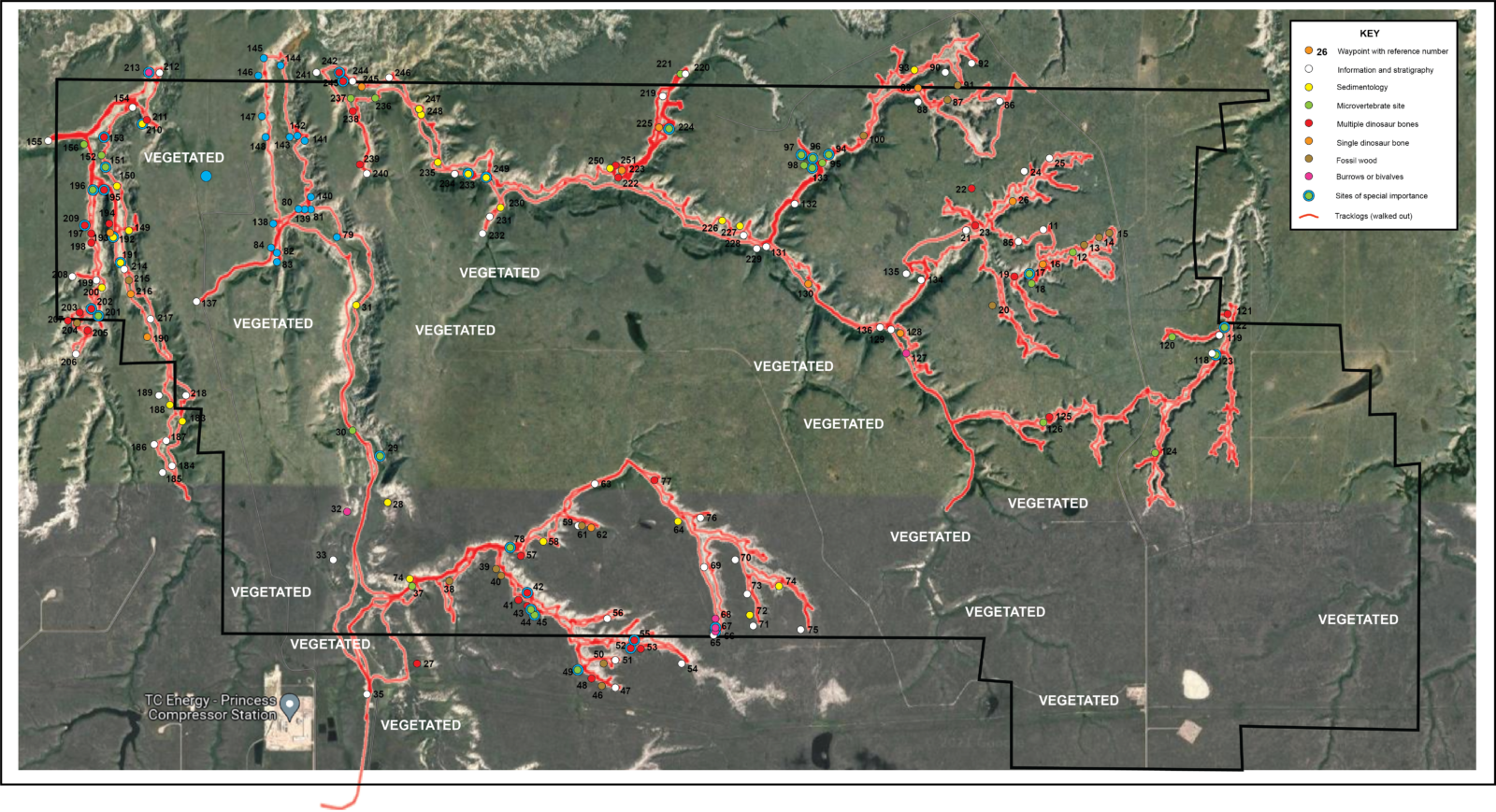 Map of significant sites. The map is around 6 km across.
The ichnological sites were particularly interesting with an oyster bed; a burrowed bed indicating a marine incursion; and some crayfish burrows showing at least semi-annual waterlogged terrain. The bone beds were spectacular, with one in particular clearly deposited in flood conditions extant within a channel sandstone. The bones reach more than a metre in length and are associated with a lag of intraformational, siderite cemented mud clasts.

Bed with casts of unionid bivalves Stunning view of meandering channels incising into mudstones.
Potential studies: relative proportions of different fossil-prone settings (e.g. 10 microvertebrate sites preserved as channel lags and 18 as point bar deposits); mapping out trunk channels from coulee to coulee. These channel deposits may reach 300 m in width and commonly feature large scale lateral accretion surfaces (LAS); bone bed sedimentology; and many more research opportunities.
Dam Construction
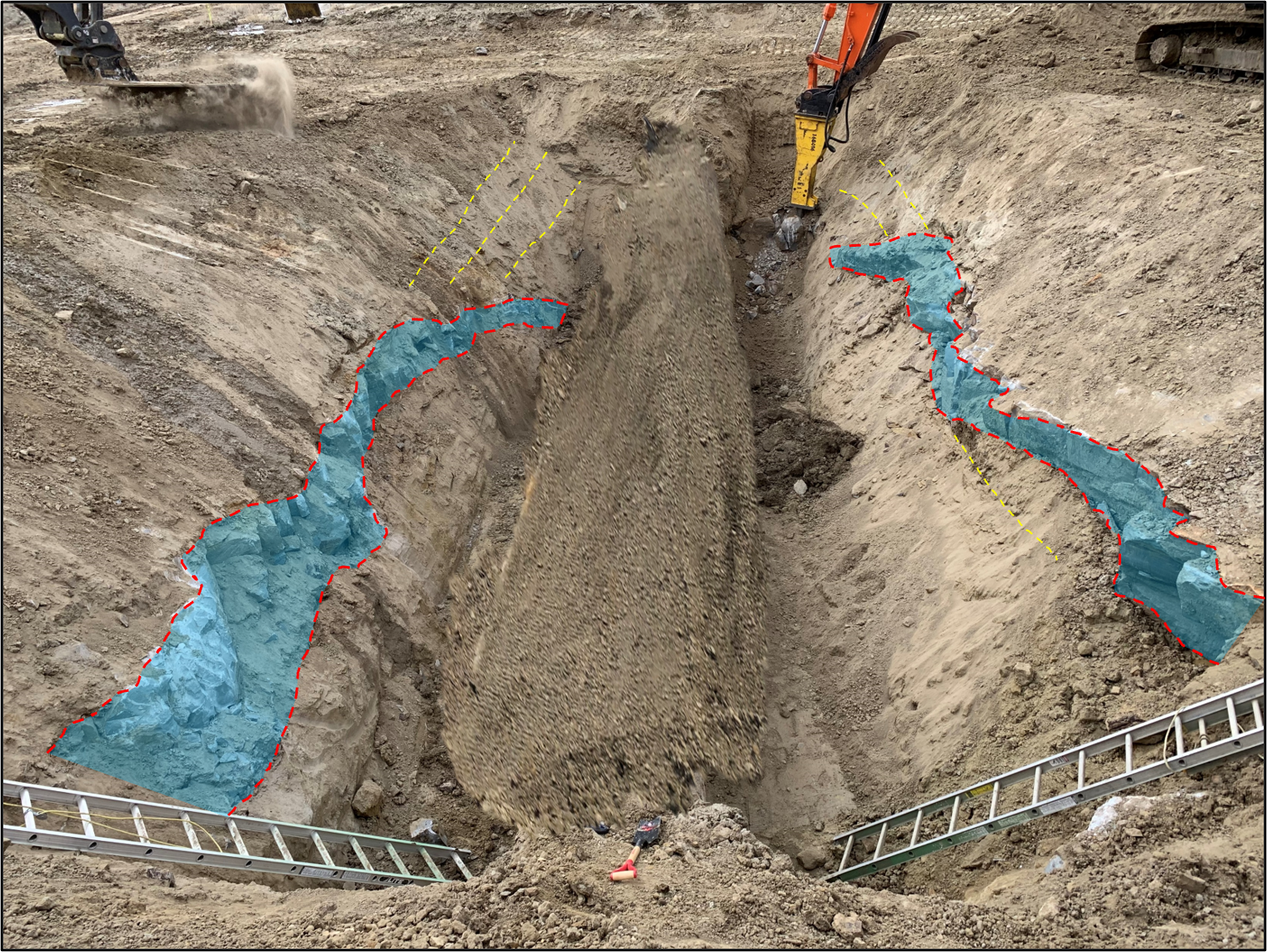
Another project involved building flood defences and included the construction of a spillway, a concrete floored culvert some 20 m across. The bedrock is Upper Cretaceous in age and dominated by fluvial deposits exhibiting lateral accretion surfaces, deposited by point bars in a meandering channel setting. These are interbedded with overbank mudstone beds with plant fossils including a small, rooted tree.
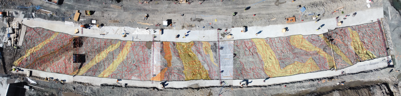
Photomosaic of the spillway with fractures in red
To lay the culvert, the underlying Cretaceous bedrock was scoured flat, using an excavator, and then hydrovac’ed. This process uses a large nozzle with high suction to literally suck up any loose bedrock, leaving a surface free of rock debris. This allowed me to step in and spray paint any fractures before sending up a drone to capture the images with as little distortion as possible. These were then fitted together to form a mosaic of the created pavement, which could be matched to a separate, interpreted photomosaic of the exposures along the sides of the manmade valley in which the spillway sits.
![]()
Photomosaic of succession in valley wall, matching the spillway pavement
Potential studies: fracture orientations and sets; sedimentology of the channel deposits.
Virtual Field Trip
I was asked to put together a virtual field trip examining Carbon Capture and Sequestration (CCS). I visited a variety of outcrops across the southern part of the Province as well as logging several cores. The key requirements are a porous (but not too porous), laterally extensive reservoir; and an impervious caprock, with early Cambrian quartzites providing the best targets.
 I was able to visit the Gog Quartzite, used as an analogue for Shell’s Quest CCS project, to shoot a series of videos showing the main characteristics of this formation. I also logged four cores drilled in the Cambrian Deadwood Formation. The latter included a great core that tagged a few metres of Precambrian basement, with igneous gabbros on display.
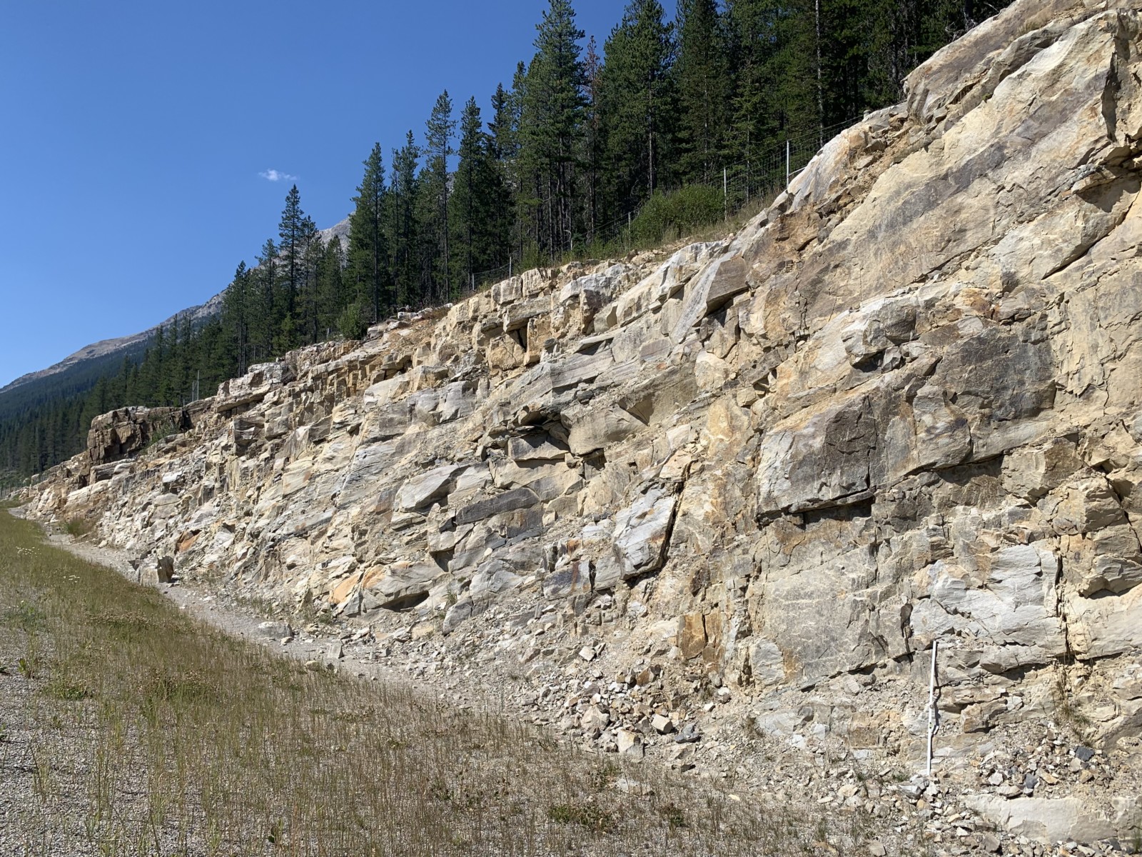
Cambrian Gog Quartzite, Kicking Horse Pass, AB
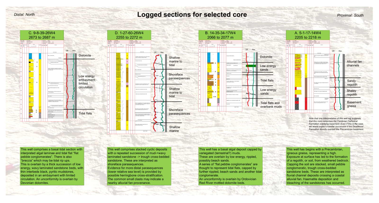

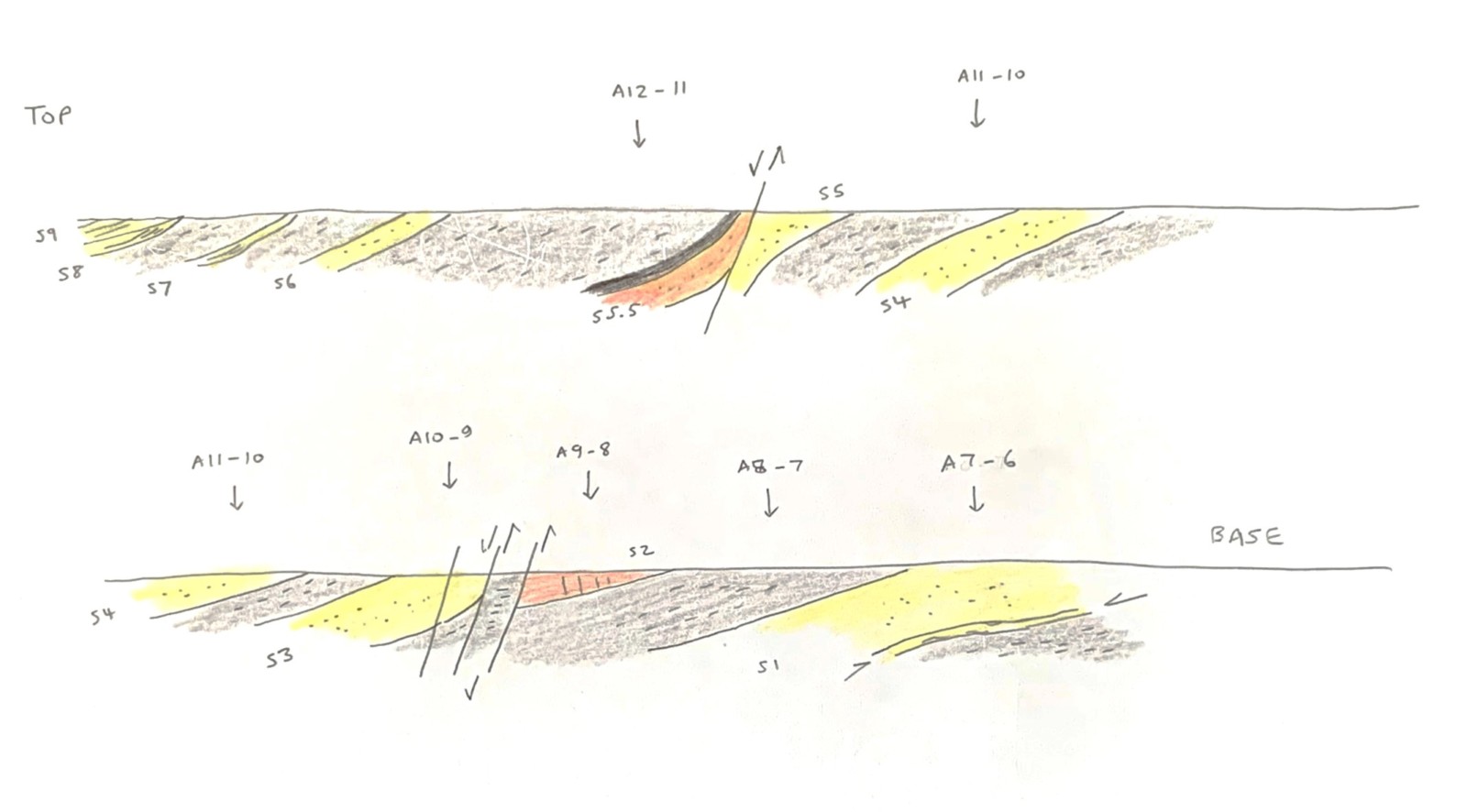
Logged sections and flat pebble conglomerate from the Cambrian Deadwood Formation
Potential studies: Cambrian quartzites; sedimentary structures deposited in plant free hinterland and shallow subsea.
Summary
Overall, I hope that these projects, along with many others, demonstrate the amazing database that is available for study, with the potential to provide significant returns to both the industrial companies who collect the data and the researchers who could utilize and interpret it.