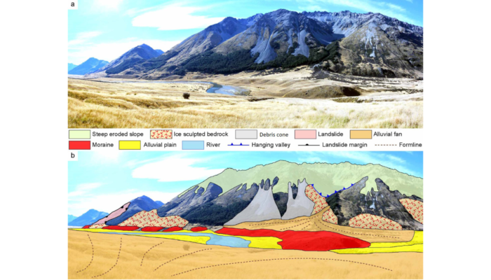
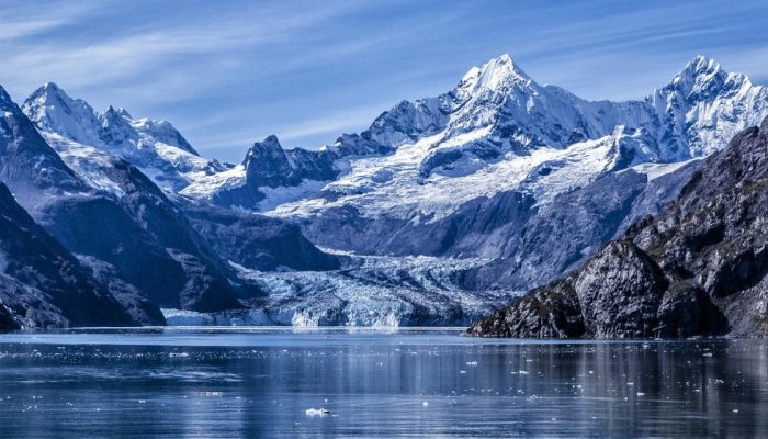
Written by Oliver Strimpel, University of Oxford; edited by Jan and Sabine What is it about rocks that determines whether they create features in the landscape? In the Sierras, why does the west side with its giant cliffs of glacially polished stone look so different from the gentler terrain of the east side despite having the same bedrock? How has the use of cosmogenic radionuclides revolutioni ...[Read More]
The new glacial geomorphological map from New Zealand
Glacial geomorphological mapping comparison in 3D. a – Moraine ridge in the middle section of the Ahuriri River valley with surrounding area. b – Key landscape elements are shown in the accompanying sketch. (Credit: Tielidze et al., 2021). Geomorphological maps are a fundamental tool to represent landforms and understand how different morphological elements and agents shaped a natural ...[Read More]
GSA Penrose Conference: CLAST2019, 4-10 August 2019, Juneau, Alaska
We are happy to announce the GSA Penrose Conference on Climatic controls on continental erosion and sediment transport (CLAST2019), 4-10 August 2019, Juneau, Alaska (USA). Key challenges remain in recognizing and reconciling how climatic and earth surface process mediate erosion independently of solid earth forcing. The relationship amongst climatic, erosional, and transport processes are exceedin ...[Read More]
ECS Events @EGU2018
Finally, the EGU general assembly is starting today. In order to give you some guidance what important events you should definitely not be missing out on, the ECS representatives (Micha Dietze and Annegret Larsen) put together this very nice timetable: