Welcome to In the News: A Geomorphologist’s Perspective! The intent of this series is to explore the geology and geomorphology of places that are currently in the news.
For this first installment, we’ll do a quick tour of how geological processes have laid the groundwork for current fighting over control of the Strait of Hormuz.
The Iran war, and the Strait of Hurmuz, have dominated the news cycle since attacks from the U.S. and Israel began in February. But how did so much come to depend on this one strait?
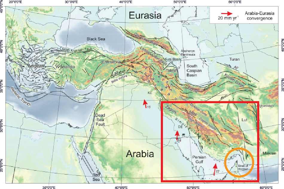
Map and structures of the Arabia-Eurasia collision zone, with Arabia-Eurasia convergence rates from Sella et al. (2002). The red box highlights the Persian Gulf and Zagros mountains; the orange circle highlights the Strait of Hormuz.
The story begins several hundred million years ago in the Paleozoic, when the Arabian and Eurasian continental plates were separated by a shallow sea. During that time, marine sediments were deposited and accumulated, unaware that they would eventually host oil and gas reserves that a future species would war over. Eventually the ancient Tethys ocean opened, and later, around 30 million years ago, the Arabian and Eurasian plates collided, fully subducting the Neo-Tethys Ocean. The collision deformed a wide area of southwest Asia (part of the larger Alpine-Himalayan orogenic belt) including modern Iran, Iraq, Turkey, and the Zagros and Caucasus fold and thrust belts. Pockets of oil and gas within the shallow sea sediments were trapped at the north end of the Arabian plate underneath modern Iran and Iraq. Today, these oil and gas reserves are some of the largest in the world.
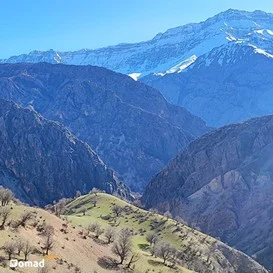
Zagros Mountains from Iran Nomad Tours (https://nomad.tours/adventure-styles/33040/zagros-mountains-history/)
So despite the rift-like appearance, the Persian Gulf is not part of a rift like the Red Sea – it’s a depression within a region dominated by tectonic convergence. The Strait of Hormuz is a promontory caught between the Arabian and Eurasian plates with the Zagros fold and thrust belt to the west and the Makran subduction zone to the east.
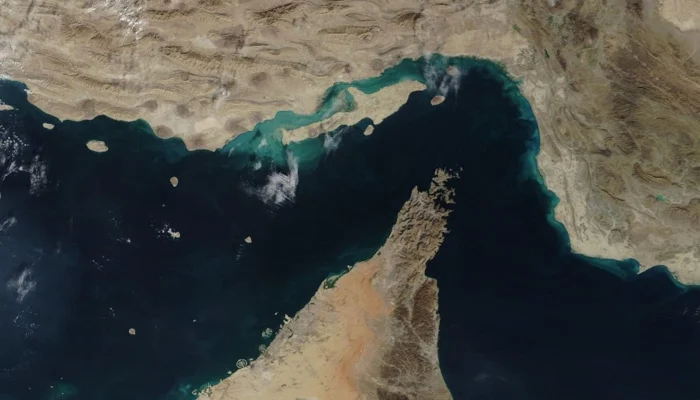
After the last glacial maximum (around 12 thousand years ago), glacial melt filled the Persian Gulf with the water that now facilitates the maritime transportation of oil and gas from the Persian Gulf to global markets. Today, the Strait of Hormuz is less than 40 km wide at its narrowest point carved out by the Musandam Peninsula. It’s the only passageway from the Persian Gulf to the open ocean and a choke point for around one fifth of the world’s oil and gas transportation. The Arabia-Eurasia collision continues today at a north-south rate of ~22 mm/year (Sella et al., 2002), and eventually (in several million years) the Strait of Hormuz will completely close (unless sea level rise beats tectonic rates).
So much of human history and development is shaped by geology – the landscapes that were formed millions of years ago that control our navigation and settlements, the natural resources below our feet that control our lifestyles, and the lithology that collaborates with climate to form soils that will feed us.
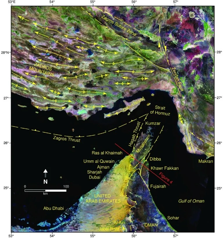
Landsat image of the northern Oman Mountains, Musandam Peninsula, Strait of Hormuz, the southern Zagros Mountains and Arabian Gulf region. Here the arrows are showing major anticline axes in the Zagros, and circular dark-coloured areas are Proterozoic Hormuz salt domes. From Searle et al. (2014).
But humans have a way of thinking they can control nature, including “closing” straits. Since February, passage through the strait has been restricted. Although oil and gas exports receive the most attention, several other global supply chains are also impacted, including helium, pharmaceutical drugs, and fertilizer. Quatar produced more than a third of the world’s helium last year, a key ingredient for semiconductor manufacturing and medical imaging, and fertilizer shortages easily translate to increased food prices. Our reliance on the earth is humbling – shouldn’t this unite us?
References
Searle, M.P., Cherry, A.G., Ali, M.Y. and Cooper, D.J. (2014). Tectonics of the Musandam Peninsula and northern Oman Mountains: From ophiolite obduction to continental collision. GeoArabia, 19(2), pp.135-174.
G.F. Sella, T.H. Dixon, A.L. Mao (2002). REVEL: A model for Recent plate velocities from space geodesy. Journal of Geophysical Research – Solid Earth, 107. DOI
Allen, Mark (2021). “Arabia-Eurasia Collision.” Encyclopedia of Geology, Science Direct. www
Sorkhabi, Rasoul (1 June 2026). “How Did the Hormuz Strait Form?” AAPG Explorer. www
McKeever, Amy (2 April 2026). “Why the Strait of Hormuz is a geological wonder.” National Geographic. www
Buchanan, Naomi (21 March 2026). “It’s not just oil: 3 critical supply chains being upended by the war in Iran”. Business Insider.
Gedeon, Joseph (4 April 2026). “Oil, strait of Hormuz and empty threats: a timeline of Trump’s flip-flopping on the Iran war”. The Guardian. www