Geodesy is fundamental to understanding our dynamic planet. From monitoring sea-level rise and glacier melt to maintaining precise terrestrial reference frames for GNSS and Earth observation, geodesy provides the scientific backbone for many disciplines represented within the EGU and beyond. Despite its importance, geodesy often remains invisible outside the scientific community. Even within geosciences, many people use geodetic products daily without fully realizing the complex infrastructure and science behind them.
To help make geodesy more visible and accessible, the International Association of Geodesy (IAG) and its Global Geodetic Observing System (GGOS) launched the Geodesy Cartoon initiative in 2024. The idea is simple: use cartoons and illustrations to explain geodetic concepts in a creative, understandable, and visually engaging way.
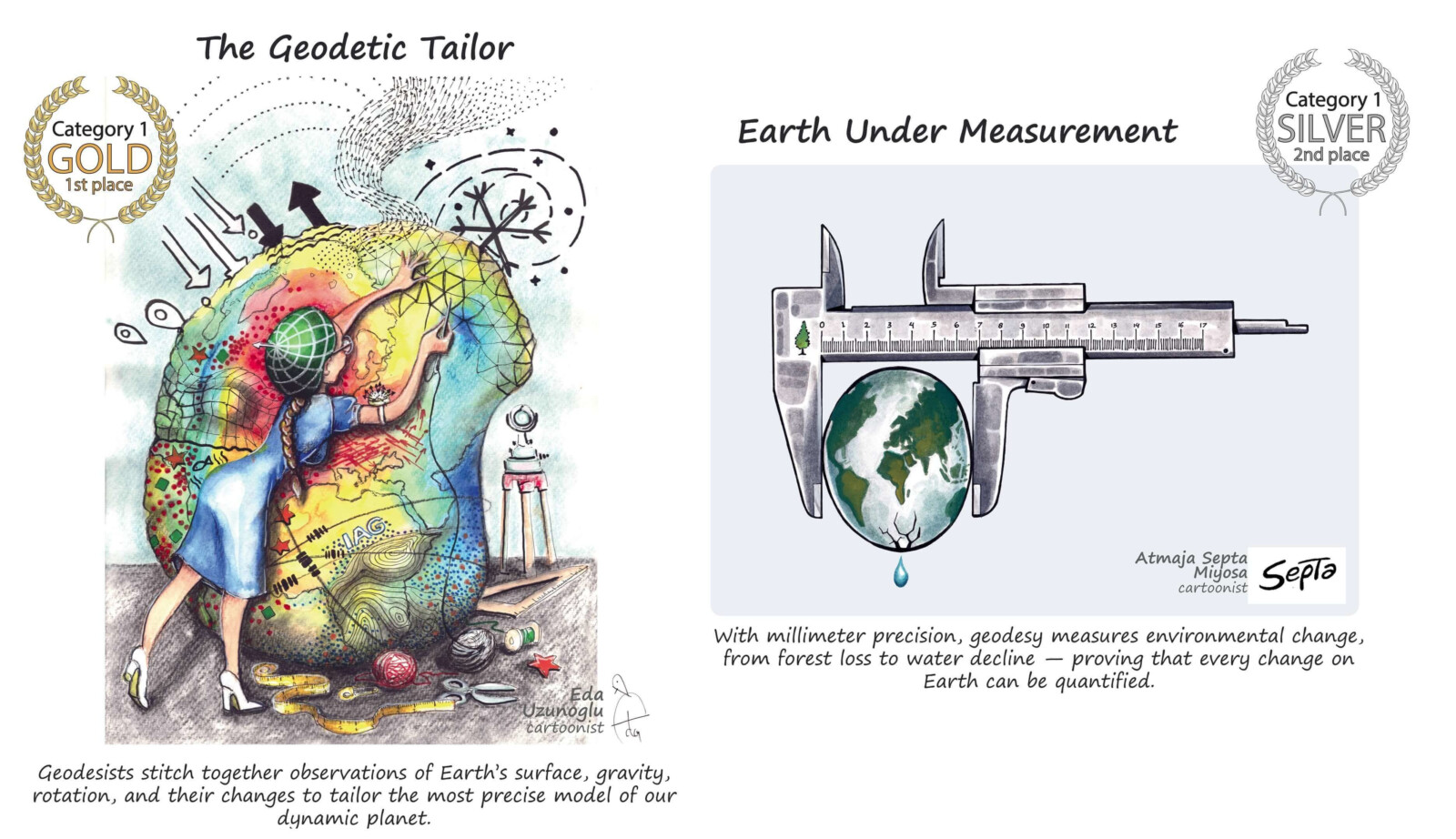
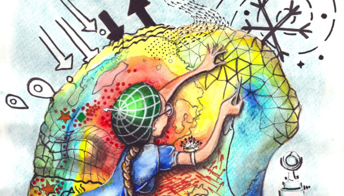
Top cartoons in Category 1 – Explaining Geodesy. Cartoons by Eda Uzunoglu and Atmaja Septa Miyosa, distributed by geodesy.science/cartoon. CC BY.
At first glance, cartoons may seem unusual in a scientific context. However, they can be remarkably effective tools for science communication. Concepts such as reference frames, GNSS positioning, gravity field modelling, VLBI, or satellite geodesy are often difficult to explain to non-specialists. Visual storytelling helps lower the entry barrier and creates intuitive connections between complex scientific methods and their real-world applications.
The cartoons cover a broad spectrum of topics relevant to the geodetic and geospatial community, including:
- GNSS and precise positioning,
- Earth observation and climate monitoring,
- gravity field determination,
- geodetic infrastructure and reference frames,
- surveying and land administration,
- and the role of geodesy in daily life.
Many of the cartoons are particularly useful for lectures, conference presentations, outreach events, teaching activities, and social media communication. They can also help Early Career Scientists communicate their work to broader audiences, an increasingly important skill in interdisciplinary science and public engagement.
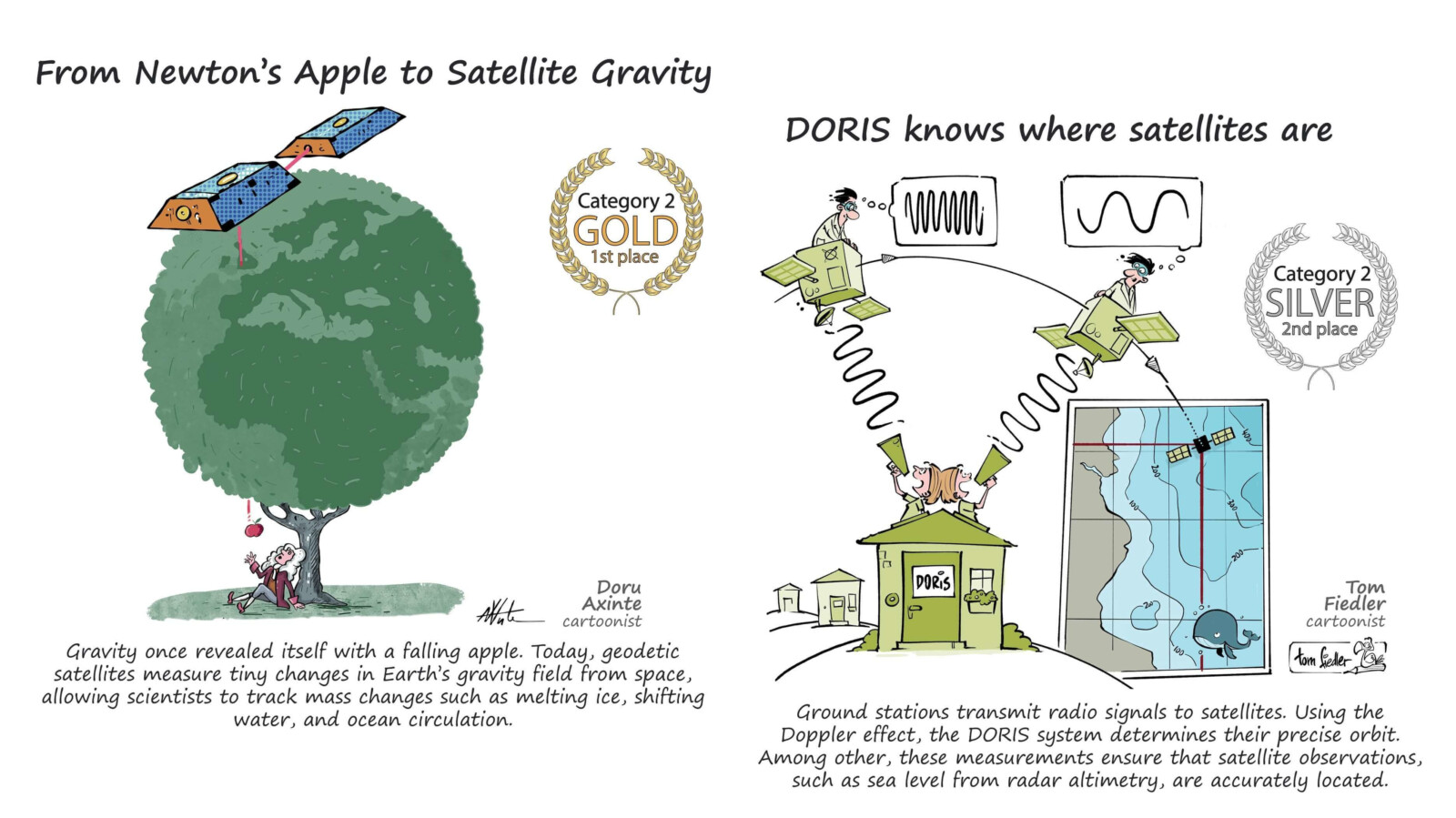
Top cartoons in Category 2 – Observation Techniques. Cartoons by Doru Axinte and Tom Fiedler, distributed by geodesy.science/cartoon. CC BY.
A major milestone for the initiative was the international Geodesy Cartoon Competition, whose winners were announced during the EGU General Assembly 2026 in Vienna. The competition attracted 274 submissions from 119 cartoonists across 46 countries, demonstrating strong international interest in creative geoscience communication. The best cartoons were exhibited at the IAG Geodesy Reception during EGU26 and sparked numerous discussions among scientists about new ways of communicating research and geodetic applications.
One particularly encouraging aspect was the diversity of contributors. Alongside professional scientists, the competition also attracted students, educators, and professional cartoonists, highlighting how science communication can connect communities far beyond traditional academic boundaries.
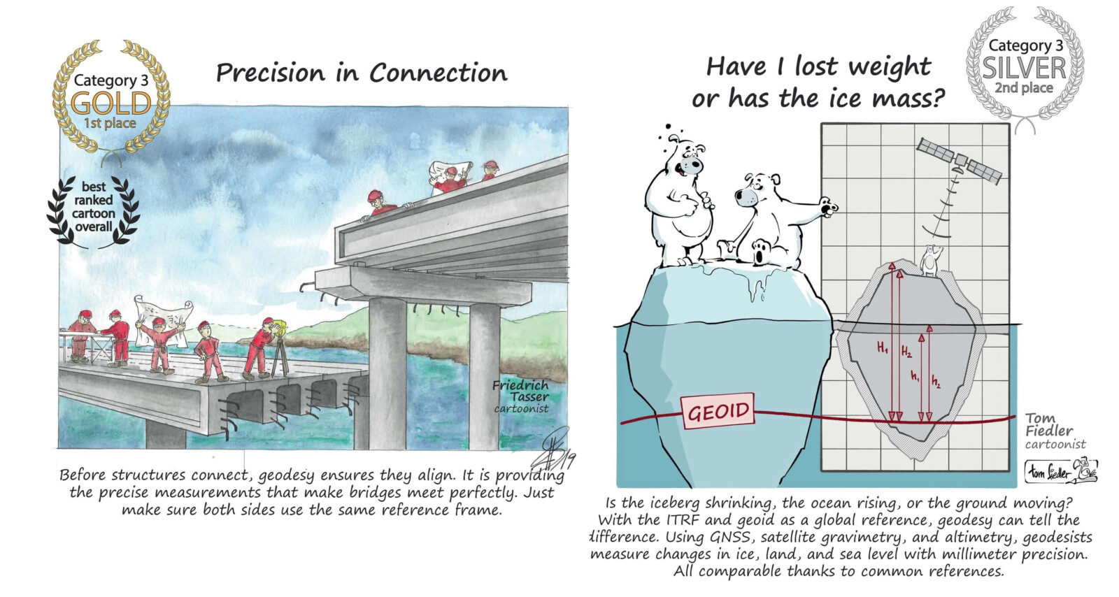
Top cartoons in Category 3 – Geodetic Products. Cartoons by Friedrich Tasser and Tom Fiedler, distributed by geodesy.science/cartoon. CC BY.
For the geodesy community, initiatives like this are about more than outreach alone. They are also about visibility. While disciplines such as meteorology or geology are widely recognized by the public, geodesy often remains unknown despite underpinning positioning, navigation, digital twins, and many Earth observation applications. Strengthening awareness of geodesy is therefore essential not only for education, but also for attracting future students, supporting scientific collaboration, and highlighting the societal relevance of geodetic research.
All cartoons are openly available under a Creative Commons license and can be freely reused for educational and outreach purposes.
Further information: https://geodesy.science/cartoon
– Edited by Leire Retegui-Schiettekatte