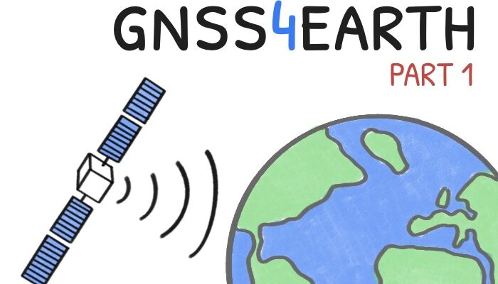
Part 1 – the global case
When you check directions on your smartphone or track your morning run, you’re tapping into a global infrastructure that has revolutionized not just navigation, but our understanding of Earth itself. What began as military technology has evolved into powerful scientific tools that confirm longstanding theories and reveal previously unobservable phenomena.
In this post, we’ll explore how this remarkable technology developed into the Global Navigation Satellite System (GNSS) we know today—an intricate network of satellites and ground stations, completed with control and processing centers, enable crucial scientific applications, with a special highlight on Earth science research (Figure 1). From monitoring continental drift to tracking ice loss and sea-level rise, GNSS has become an essential tool for observing our planet in motion. As we celebrate International GNSS Day on October 23rd, this year’s event holds special significance: it marks 30 years since the start of European satellite navigation programme and 20 years since the launch of the first Galileo satellite — Europe’s contribution to the GNSS constellation and a major milestone in the global effort to enhance our understanding of Earth through satellite navigation.
The global positioning revolution – How did we get here?
GNSS refers to the ensemble of all the available navigation satellite systems. While the American GPS (Global Positioning System) may be most familiar, it’s just one player in the constellation of GNSS orbiting our planet. GPS pioneered civil satellite navigation in the early 1990s and remains the most widely used system, having been constantly upgraded with new generations of satellites offering better features and improved reliability.
Galileo emerged as Europe’s civilian-focused alternative, designed from the outset to provide open, high-quality access for everyday users and demanding scientific research. Its civilian governance promotes transparency and data availability, translating into greater precision and reliability. Beyond this precision, Galileo offers unique features that push the technological limits. For example, while standard open signals provide meter- to decimeter-level positioning accuracy in real time, users can now achieve sub-decimeter accuracy using the Galileo High Accuracy Service (HAS), which has been operational since 2023. HAS is open and requires no paid subscription or internet connection, as correction data is transmitted free of charge directly within the Galileo GNSS signal. This complements existing solutions, such as internet-based correction services, by offering a globally available, standalone correction capability that remains accessible even in areas without network coverage. Another important innovation is the security: the Open Service Navigation Message Authentication (OSNMA) feature adds a digital signature to navigation data, allowing receivers to confirm that signals genuinely originate from Galileo satellites. As users increasingly face risks from signal spoofing, OSNMA provides a vital layer of protection for critical applications like aviation and autonomous systems. These are not the only but some of the most recent established changes; at the same time, ESA has an entire portfolio of activities ensuring innovation and the continuous development of its navigation solutions.
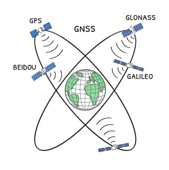
Figure 1: The multi-GNSS constellation. The system comprises satellites from four major players: GPS, Galileo, GLONASS, and BeiDou.
GPS and Galileo are not the only navigation systems. The Russian system, GLONASS, was initially developed almost in parallel with its American counterpart, however, during the late 1990s its capacity declined, and remained limited during the following decade until a global coverage was restored in 2011. BeiDou-2 evolved from China’s regional system to a global one with its BeiDou-3 completion in 2020, uniquely incorporating geostationary satellites for improved services in the Asia region and offering two-way short messaging services valuable for emergency communications. Regional systems like NavIC (India) and QZSS (Japan) further enhance coverage in Asia’s urban canyons. And the race isn’t over yet. In the coming years, South Korea is set to join the club with its own regional navigation system, KPS, further expanding the global landscape of satellite positioning capabilities.
Satellite navigation systems deliver enormous economic value. More than 10% of Europe’s Gross Domestic Product already relies on satellite navigation. The rise of multiple satellite navigation systems reflects each nation’s drive for strategic independence, a pursuit that has, in turn, brought immense benefits to GNSS users worldwide through increased interoperability, innovation, and competition. From a user perspective, this proliferation offers huge practical advantages. Modern GNSS devices can “see” over 40 satellites instead of just 10, dramatically improving positioning in challenging environments like urban canyons or deep valleys (read more about GNSS positioning and satellite coverage in the latest post of the Bits and Bites series). Your smartphone can pinpoint locations even when tall buildings block many satellites, and fitness trackers can keep you on route even when you’re running along a forest trail. For everyday users, the difference is most noticeable in difficult conditions, where devices achieve positioning fixes in seconds rather than minutes. For scientists, however, GNSS systems haven’t just allowed us to follow our jogging paths more precisely — they revolutionized the Earth sciences.
As of 2025, we’ve reached a significant milestone: 30 years of continuous observations from GNSS satellites. This three-decade dataset has become a treasure trove for climate scientists, providing crucial empirical data on Earth’s changing systems.
GNSS for Earth sciences
Scientists have harnessed GNSS signals to create an unprecedented planetary monitoring system. This system relies on establishing a precise description of Earth’s shape, rotation, and gravity field that serves as a stable baseline for detecting both short-term variations and gradual climate-driven changes (Figure 2). The foundation for this work is a vast global network of permanent GNSS stations—hundreds of thousands of ground-based reference antennas equipped with precise, geodetic-quality receivers that continuously track satellite signals. GNSS signals are used to calculate precise, three-dimensional coordinates of every receiver on the Earth’s surface. By supplying precise reference data, these stations have broadened the spectrum of geodetic and Earth-science applications that were once limited to costly, specialized equipment. Maintained by scientific institutions around the world, these essential networks deliver open data to researchers and innovators, powering the next generation of geoscience and positioning technologies. Here, we focus on how GNSS has contributed to Earth monitoring on a global scale. For our next post, we plan to shift gears and underline the even more fascinating regional use cases!
Rotation
The Earth’s rotation constantly fluctuates due to changes in atmospheric pressure, ocean currents, and global mass redistribution. By continuously monitoring changes in the positions of the permanent stations, scientists can detect subtle movements caused by the Earth’s rotation and underlying geophysical processes. The dense network and continuous data collection make GNSS particularly well-suited for monitoring high-frequency, or short-term, changes in the Earth’s rotation, such as those caused by ocean tides. These measurements capture not only the slow, expected movements, but also sudden, dramatic shifts. A classic example is the 2011 Tohoku earthquake, which actually shortened the Earth’s day by 1.8 microseconds and shifted the Earth’s pole by 17 centimeters. That change was instantly and accurately captured by the global GNSS network.
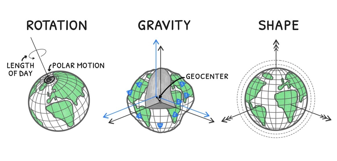
Figure 2: GNSS and Earth’s core properties. GNSS data provides key measurements for the planet’s rotation, gravity field, and shape.
Gravity
The Earth’s gravity field, and how it varies over time, is a fundamental measurement for understanding our planet as a unified system. While we have specialized ‘gravity hunters’ in orbit — satellites like GRACE — GNSS provides a unique and complementary perspective. When huge masses of water or ice shift on Earth (think melting glaciers or the hydrological cycle), that change in mass causes a subtle, elastic deformation of the Earth’s crust too. Such elastic “bounce” is detected as a displacement by a vast network of thousands of GNSS ground receivers. By tracking these movements, scientists can then calculate the amount of displaced mass that caused them, allowing us to map the corresponding changes in Earth’s gravity field.
Speaking of the gravity field and how mass moves, we should also mention the so-called geocenter motion. The geocenter vector is essentially the invisible line connecting two fundamental points: the natural origin of the Earth’s total mass (encompassing the solid Earth, oceans, atmosphere, and cryosphere) and the origin of the geometric Earth as defined by our reference frame. In a recent post, we learned that Earth has more than one center and why that matters. Now, we can explore how to observe this using GNSS. Observing geocenter motion is, in principle, straightforward: we track satellites that orbit around Earth’s true center of mass, using stations fixed to the planet’s surface. Any translation of this ground-based network relative to the satellite orbits reveals the geocenter’s motion. Naturally, the better we model GNSS satellite orbits, the more accurately we can recover the geocenter — a long-standing limitation. Recent advances in GNSS processing, however, are beginning to overcome this challenge and shed new light on Earth’s center-of-mass motion. Another way to estimate the geocenter is to track motion in the global GNSS network. Surface mass changes cause both a small shift of Earth’s center and an elastic deformation of the crust. By modeling both effects together, modern GNSS inversion methods more accurately isolate geocenter motion and its link to mass redistribution.
Shape
Having established that precise monitoring of GNSS station displacements provides an access to the complex phenomena defining the Earth’s shape, let’s focus on the two key use cases that bring us an essential global context. Before the GNSS era, geologists relied on indirect evidence of tectonic movements over vast geological timescales. Today, millimeter-precise measurements provide direct, almost real-time observation of plate tectonics. This work reveals that plate boundaries are not simple faults, but complex deformation zones extending hundreds of kilometers. Dense GNSS networks now map strain accumulation across multiple faults, offering key insights for assessing earthquake risks. Scientists can monitor continental drifts at rates with a millimeter per year accuracy and detect instantaneous crust displacements during large earthquakes.
GNSS has long been essential for tracking the Earth’s shape, but only recently, it has begun to help in measuring the actual size of our planet. For many years, GNSS could not reliably measure the true size of the Earth because we lacked information about phase center calibration. In simple terms, every satellite and ground antenna has a “phase center” — the exact point where the signal is treated as coming from. But that point is not fixed; it shifts slightly as the antenna sends or receives signals from different directions. Without knowing these tiny shifts, measurements can be stretched or compressed, like trying to measure with a ruler that changes length. Only recently have we obtained precise calibration data for satellite antennas and ground receivers. With this information, modern systems like Galileo, BeiDou, or the last generation of GPS satellites, now allow GNSS to finally contribute to defining Earth’s true scale, one of the key parameters of the terrestrial reference frames.
Forget just tracking your sport activities; thanks to the scientific community’s innovations, GNSS has gone big-time — evolving from a simple mapping tool into a cornerstone of complex planetary monitoring systems. The three-decades of data from our navigation satellites now forms the backbone of modern Earth sciences, giving us unprecedented, continuous insight into our planet’s dynamics.
Further reading:
- Teunissen, Peter J. G., and Oliver Montenbruck, eds. 2017. Springer Handbook of Global Navigation Satellite Systems. Springer Handbooks. Springer International Publishing. https://doi.org/10.1007/978-3-319-42928-1
- https://geodesy.science/item/earth-orientation-parameter/
- https://www.earthscope.org/what-is/gps/gps-and-earthquakes/
- Anderson, Don L. 1974. “Earthquakes and the Rotation of the Earth.” Science 186 (4158): 49–50. https://doi.org/10.1126/science.186.4158.49
- Villiger, Arturo, Rolf Dach, Stefan Schaer, et al. 2020. “GNSS Scale Determination Using Calibrated Receiver and Galileo Satellite Antenna Patterns.” Journal of Geodesy 94 (9): 93. https://doi.org/10.1007/s00190-020-01417-0
- Wu, Xiaoping, Jim Ray, and Tonie van Dam. 2012. “Geocenter Motion and Its Geodetic and Geophysical Implications.” Journal of Geodynamics 58 (July): 44–61.
Financing
This post is an action carried out within the project “BIG4 – Benefits of GNSS Integration for Geodesy, Geophysics and Geodynamics”, implemented by Radosław Zajdel and financed by the European Union’s Horizon Europe and the Central Bohemian Region under the Marie Skłodowska-Curie Actions — COFUND, Grant Agreement ID 101081195 (“MERIT”). Views and opinions expressed are solely those of the author and do not necessarily reflect those of the European Union or the Central Bohemian Region. Neither the European Union nor the Central Bohemian Region can be held responsible for them.
– Graphics designed by Jowita Junke
– Edited by Leire Retegui-Schiettekatte and Marius Schlaak