During this year’s EGU General Assembly (GA) we held the first Geodesy 101 Short Course, where we gave an introduction to satellite gravimetry, GNSS processing and geodetic reference frames. We want to thank all of you who attended in-person or virtually, and made the short course a great experience! Please provide us feedback, if you have attended the short course here.
At the GA, we were only able to scratch the surface of each topic, but there are a number of excellent textbooks about the different geodetic sub-disciplines, techniques and datasets which offer a more in-depth view. In this blog post we want to highlight four of them, on which the short-course was partially built on. If you have other recommendations, feel free to post a comment to this blog!
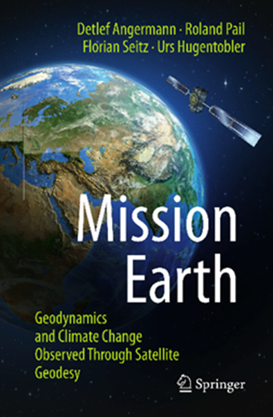
Mission Earth – Geodynamics and Climate Change Observed Through Satellite Geodesy
Mission Earth is aimed at interested nonprofessionals who want to learn more about our fascinating planet, but also at experts in natural sciences. You are taken on an exciting journey through time from the first surveys in ancient times to the satellite era, which is providing us with a global view of our home planet. Using illustrative examples, the authors convey how deeply global positioni ng and navigation with satellites pervade our daily life, and what fundamental contributions geodesy makes to understanding the Earth system and determining the effects of climate change.
How does your cell phone know where you are right now? How is our planet changing due to geodynamic processes and ongoing climate change? How can we measure these changes precisely from space in order to obtain reliable information about the melting of ice sheets or the threat to coastal regions from rising sea levels? This popular science book provides answers to these and many other socially relevant questions.
D. Angermann | R. Pail | F. Seitz | U. Hugentobler
Mission Earth
Geodynamics and Climate Change Observed Through Satellite Geodesy
ISBN 978-3-662-64105-7
DOI 10.1007/978-3-662-64106-4
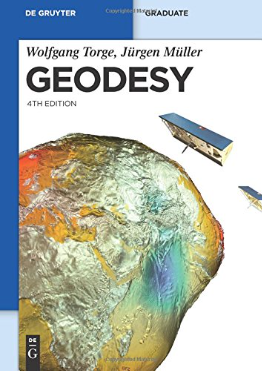
Geodesy
Geodesy is designed as an introductory textbook for graduate students, scientists, and engineers in the fields of geodesy and geophysics. It offers the theoretical background and principles of measurement and evaluation methods. This is complemented by selected examples of instruments to illustrate geodetic work flows and how geodetic data sets are generated.
The book gives an overview of various spaceborne and terrestrial techniques used to determine the geometric shape of the Earth and its changes, variations in Earth rotation, and Earth’s static and time-variable gravity field. It contrasts global and regional applications and describes approaches for cross-validating the different measurement techniques. Finally, it shows how changes in Earth’s geometric and physical shape are connected to other geosciences and where geodetic data can be used to improve the modeling of geophysical processes.
W. Torge | J. Müller
Geodesy
ISBN 978-3110207187
DOI 10.1515/9783110879957
Handbook of Global Navigation Satellite Systems
The Handbook of Global Navigation Satellite Systems offers a complete and rigorous overview of the fundamentals and methods of Global Navigation Satellite Systems (GNSS). It provides an exhaustive, state-of-the-art description of GNSS as a key technology for scientific and societal applications. The book is structured into three major topics: Principles of GNSS, Satellite Navigation Systems, and GNSS Receivers and Antennas. Each part is written by international experts and illustrated with figures and photographs.
 In the first part, the principles of GNSS are presented. This includes the temporal and spatial reference systems used in GNSS processing, the characteristics of GNSS satellite orbits and attitude, the signals transmitted by GNSS satellites and how they are affected by Earth’s atmosphere, and the overview of the atomic clocks as the foundation of highly-precise time transfer and positioning. The second part focuses on the description of all global and regional satellite navigation systems, both operational and under development. This spans GPS, GLONASS, Galileo, BeiDou, QZSS, IRNSS/NAVIC and multiple Satellite Based Augmentation Systems (SBAS). Hardware aspects, such as GNSS receiver and antenna design and characteristics, interference and multipath are treated in the last part.
P. J. G. Teunissen | O. Montenbruck (Eds.)
Handbook of Global Navigation Satellite Systems
ISBN 978-3-030-73172-4
DOI 10.1007/978-3-319-42928-1
Global Geodetic Observing System
The Global Geodetic Observing System (GGOS) has been established by the International Association of Geodesy (IAG) to bring together experts of the three fundamental sub-disciplines of geodesy. These three “pillars” are the determination of Earth’s geometry (topography, bathymetry, ice sheet surface, and sea level), Earth’s orientation in space, and Earth’s gravity field. In a changing climate, precise and consistent long-term monitoring and modeling of these quantities is key to understanding global change. As they are also closely interconnected, collaboration between experts across all geodetic areas is required to fulfill these requirements.
In this book, the goals, history, and achievements of GGOS so far are outlined. Since GGOS monitors our changing planet, a chapter about Earth science requirements for geodesy, also with respect to forecasting capabilities is present. It further describes how geodesy and the GGOS are embedded in today’s society and what the scientific and societal user requirements of GGOS are. Finally, an outlook on future developments of GGOS and recommendations of the authors are given.
H.-P. Plag | M. Pearlman
Global Geodetic Observing System
ISBN: 978-3-642-02687-4
DOI 10.1007/978-3-642-02687-4


A Geomatic Engineer
Thank you for the useful literature summary on Geodesy. I have already read part of Geodesy, but all the others seem so appealing. I think Mission Earth will be my next read.