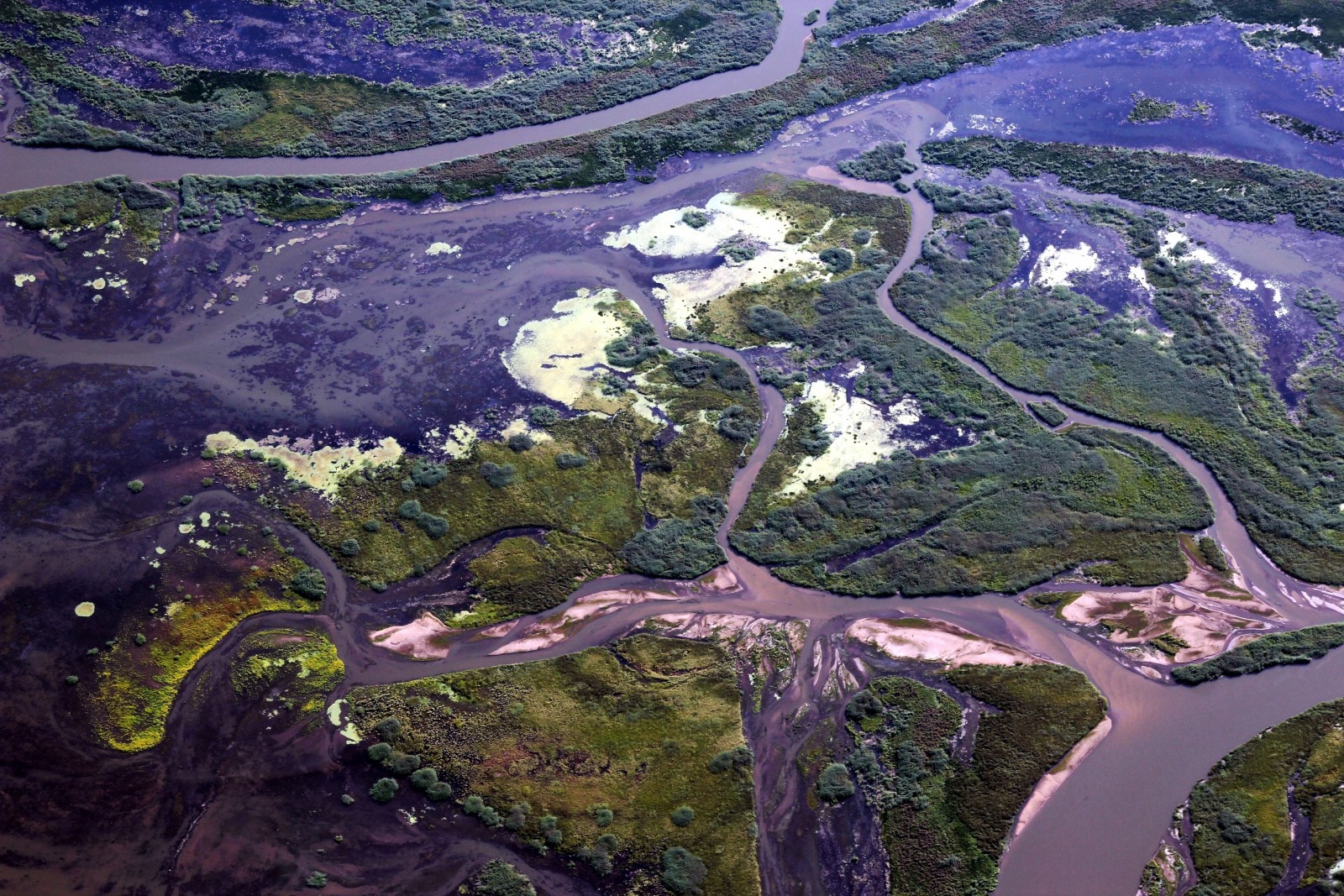
ERE
Energy, Resources and the Environment

ERE matters

Living with water: Water management infrastructure

Irrigation dam Ban Bo Wi, Thailand.Credit:  Sarah Garré (distributed via imaggeo.egu.eu)

Irrigation dam Ban Bo Wi, Thailand.
Credit: Sarah Garré (distributed via imaggeo.egu.eu)

Keeping water out is only half of the battle. Making water available to communities is the other half of the battle. Engineered structures have the ability to do both, dams and dikes can keep flood waters out and they can also divert water to large metropolises and irrigate agricultural lands. But even countries like The Netherlands, which is known for its world class water management engineering, are examining their use of this built infrastructure to make way for ‘green’ infrastructure. Green infrastructure, which can provide more flexible and more cost effective water management strategies while maintaining a larger proportion of natural features, is being investigated for its efficacy in both developed and developing nations. Science, in its second of three debates on water management policies explores the positives and negatives both of gray and green infrastructure in the Policy Forum: Water security: Gray or green?

Kristen MitchellDr. Kristen Mitchell is an experienced geoscientist and marine chemist with specific experience promoting educational outreach and fundraising initiatives in support of science-specific policy and research. She works with policy makers, commercials entities, and universities to educate and inform their communities of the importance of crafting sustainable solutions. She has worked with key players across the world to execute plans and deliver results related to my scientific studies and projects. For more information, you can contact her at drkristenmitchell@gmail.com, or follow her Tweets @dr_kmitchell.

Are you READY for a flood event?

As evidenced by the EU Floods Directive (2007/60/EC), flood management strategies in Europe have undergone a shift in focus in recent years. The goal of flood prevention using structural measures has been replaced by an emphasis on the management of flood risks using non-structural measures. One implication of this is that public authorities alone not only take responsibility for flood management. A broader range of stakeholders, who may personally experience the negative effects of flooding, also take on responsibility for protecting themselves. Therefore, it is vital that information concerning flood risks is conveyed to those who may be affected in order to facilitate the self-protection of citizens. Experience shows that problems persist even where efforts have been made to communicate flood risks.

There is a need for the development of new tools that are able to rapidly disseminate flood-risk information to the general public. To be useful these tools must be able to present information relevant to the location of the user. Moreover, the content and design of the tool need to be adjusted to laypeople’s needs. Dissemination and communication influence both people’s access to and understanding of natural risk information. Such a tool could be a useful aid to effective management of flood risks.

To address this gap, a web-based geographical information system (WebGIS) has been developed through the collaborative efforts of a group of scientists, hazard and risk analysts and managers, GIS analysts, system developers and communication designers.

This tool, called “READY: Risk, Extreme Events, Adaptation, Defend Yourself”, aims to enhance the general public knowledge of flood risk, making citizens more capable of responding appropriately during a flood event. The READY WebGIS has allowed for the visualization and easy querying of a complex hazard and risk database thanks to a high degree of interactivity and easily read maps. In this way, READY has enabled fast exploration of alternative flood scenarios or past calamitous events. Combined also with a system of graphic symbols designed ad hoc for communication of self-protection behaviours, it is believed READY could lead to an increase in citizen participation, informed discussion and consensus building.

The platform has been developed for a site-specific application: the Basilicata region, Italy, has been selected as pilot application area. The goal of the prototype is to raise citizen awareness of flood risks and to build social capacity and enhanced resilience to flood events.

Read the whole paper here: Albano, R., Sole, A., and Adamowski, J.: READY: a web-based geographical information system for enhanced flood resilience through raising awareness in citizens, Nat. Hazards Earth Syst. Sci., 15, 1645-1658, doi:10.5194/nhess-15-1645-2015, 2015.

Example of the recommendations, provided by the READY platform, for behavioural actions in case of alert, intended for selfprotection enhancement.

Example of the recommendations, provided by the READY platform, for behavioural actions in case of alert, intended for selfprotection enhancement.

Call for sessions, General Assembly 2016

The call for sessions for the General Assembly 2016 are now open. We invite you, from now until 18 Sep 2015, to take an active part in organizing the scientific programme of the conference by suggesting new sessions or getting involved with those in the skeleton programme. In particular we would like to encourage Early Career Researchers to get involved.

For more details please see here http://meetingorganizer.copernicus.org/egu2016/provisionalprogramme

If you have questions about the appropriateness of a specific session topic, please contact the Officers for ERE. http://www.egu.eu/ere

We look forward to hearing from you!

Can climate data help to better predict floods?

Can climate data help to better predict floods?

Many studies report that hydrologic regimes are modulated by large-scale modes of climate variability such as the El Niño Southern Oscillation (ENSO) or the North Atlantic Oscillation (NAO). Climate-informed frequency analysis models have therefore been proposed to condition the distribution of hydrologic variables on climate indices. However, standard climate indices may be poor predictors in some regions. Instead of trying to describe climatic cycles using a single parameter, Renard and Lall developed a model using a range of parameters.

You can read the whole paper here: Renard, B., and U. Lall (2014), Regional frequency analysis conditioned on large-scale atmospheric or oceanic fields, Water Resour. Res., 50, 95369554, doi:10.1002/2014WR016277.